Property Record
331 Ne 18Th St, Miami, FL 33132

Property Detail
331 Ne 18Th St
Miami-Miami Beach-Kendall, FL
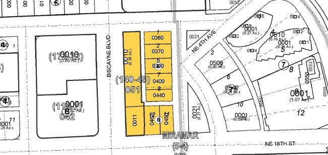
MIRAMAR PB 5-4 LOT 6 BLK 6 AND PROP INT IN & TO COMMON ELEMENTS NOT DEDICATED TO PUBLIC LOT SIZE 53.000 X 10⁵ OR 13892-676 1188 2
01-3231-003-0450
MIAMI/DADE
Commercialacreage
Florida
6600
6
AE The base floodplain where base flood elevations are provided. AE Zones are now used on new format FIRMs instead of A1-A30 Zones.
0.13 AC
2024
Biscayne Corridor
2025
South Florida
981000
NEARBY LISTINGS FOR SALE OR LEASE
DEMOGRAPHICS near 331 Ne 18Th St
1 mile
3 mile
5 mile
2025 Total Population
51,399
293,210
570,235
2030 Population
57,626
320,346
621,825
Pop Growth 2025-2030
+ 12.12%
+ 9.25%
+ 9.05%
Average Age
37
40
41
2025 Total Households
26,215
131,855
247,608
HH Growth 2025-2030
+ 12.30%
+ 9.50%
+ 9.40%
Median Household Inc
$100,326
$71,925
$67,116
Avg Household Size
1.90
2.10
2.20
2025 Avg HH Vehicles
1.00
1.00
1.00
Median Home Value
$667,122
$645,560
$634,000
Median Year Built
2007
1994
1977
Nearby Places
Map Layers
Map Styles
 Street
 Aerial
Layers
 Traffic
 Biking
Places
Listings with unknown addresses are not visible on the map
- Restaurants
- Banks
- Shops
- Fitness
- Groceries
PUBLIC TRANSPORTATION
TRANSIT/SUBWAY
Adrienne Arsht Center (Metromover Omni Loop - Miami-Dade Transit (Metrorail/Metromover))
Drive
Walk
Distance
Adrienne Arsht Center (Metromover Omni Loop - Miami-Dade Transit (Metrorail/Metromover))
1 min
7 min
0.4 mi
School Board (Metromover Omni Loop - Miami-Dade Transit (Metrorail/Metromover))
Drive
Walk
Distance
School Board (Metromover Omni Loop - Miami-Dade Transit (Metrorail/Metromover))
1 min
11 min
0.6 mi
Museum Park Metromover Station (METROMOVER OMNI/BRICKELL OUTER LOOP - Miami-Dade Transit (Metrorail/Metromover))
Drive
Walk
Distance
Museum Park Metromover Station (METROMOVER OMNI/BRICKELL OUTER LOOP - Miami-Dade Transit (Metrorail/Metromover))
3 min
13 min
0.7 mi
Eleventh Street (Metromover Omni Loop - Miami-Dade Transit (Metrorail/Metromover))
Drive
Walk
Distance
Eleventh Street (Metromover Omni Loop - Miami-Dade Transit (Metrorail/Metromover))
2 min
14 min
0.8 mi
Park West (Metromover Omni Loop - Miami-Dade Transit (Metrorail/Metromover))
Drive
Walk
Distance
Park West (Metromover Omni Loop - Miami-Dade Transit (Metrorail/Metromover))
2 min
17 min
0.9 mi
COMMUTER RAIL
Historic Overtown/Lyric Theatre (Metrorail Green Line - Miami-Dade Transit (Metrorail/Metromover))
Drive
Walk
Distance
Historic Overtown/Lyric Theatre (Metrorail Green Line - Miami-Dade Transit (Metrorail/Metromover))
4 min
1.4 mi
Miamicentral Station (Metrorail Transfer - MiamiCentral - Tri-Rail, West Palm Beach - MiamiCentral - Tri-Rail)
Drive
Walk
Distance
Miamicentral Station (Metrorail Transfer - MiamiCentral - Tri-Rail, West Palm Beach - MiamiCentral - Tri-Rail)
4 min
1.5 mi
AIRPORT
Miami International
Drive
Walk
Distance
Miami International
22 min
11.7 mi
Fort Lauderdale/Hollywood International
Drive
Walk
Distance
Fort Lauderdale/Hollywood International
33 min
22.6 mi
Freight Ports
Port of Miami
Drive
Walk
Distance
Port of Miami
8 min
2.8 mi
SALE & LEASE HISTORY
LISTING DATE
SALE/LEASE

Jun 20, 2019
For Sale
Nearby Properties
Address
Land Use
TOTAL SIZE
Lot Size
Zoning
Address
Land Use
TOTAL SIZE
Lot Size
Zoning
1,050,691 SF
0.83 AC
6408
Address
Land Use
TOTAL SIZE
Lot Size
Zoning
4,758,614 SF
810.91 AC
8000
Address
Land Use
TOTAL SIZE
Lot Size
Zoning
955,966 SF
38.91 AC
9600
Address
Land Use
TOTAL SIZE
Lot Size
Zoning
2,559,318 SF
2.21 AC
6407
Address
Land Use
TOTAL SIZE
Lot Size
Zoning
2,039,308 SF
2.46 AC
6401
Address
Land Use
TOTAL SIZE
Lot Size
Zoning
928,000 SF
14.30 AC
8000
Address
Land Use
TOTAL SIZE
Lot Size
Zoning
1,110,657 SF
3.83 AC
6407
Address
Land Use
TOTAL SIZE
Lot Size
Zoning
16.13 AC
6100
Address
Land Use
TOTAL SIZE
Lot Size
Zoning
1,346,294 SF
1.89 AC
6408
Address
Land Use
TOTAL SIZE
Lot Size
Zoning
2,403,353 SF
7.37 AC
6100
Address
Land Use
TOTAL SIZE
Lot Size
Zoning
1,938,271 SF
6.62 AC
6402
Address
Land Use
TOTAL SIZE
Lot Size
Zoning
1,162,113 SF
1.92 AC
6407
Address
Land Use
TOTAL SIZE
Lot Size
Zoning
1,075,124 SF
1.61 AC
6405
Address
Land Use
TOTAL SIZE
Lot Size
Zoning
1,544,491 SF
0.97 AC
6401
Address
Land Use
TOTAL SIZE
Lot Size
Zoning
782,686 SF
0.06 AC
6401
Address
Land Use
TOTAL SIZE
Lot Size
Zoning
1,657,362 SF
1.15 AC
6401
Address
Land Use
TOTAL SIZE
Lot Size
Zoning
1,072,012 SF
1.78 AC
6407
Address
Land Use
TOTAL SIZE
Lot Size
Zoning
244,533 SF
3.53 AC
6600
Address
Land Use
TOTAL SIZE
Lot Size
Zoning
694,863 SF
1.90 AC
6407
Address
Land Use
TOTAL SIZE
Lot Size
Zoning
694,939 SF
1.22 AC
4100
Address
Land Use
TOTAL SIZE
Lot Size
Zoning
656,821 SF
2.06 AC
6407
Address
Land Use
TOTAL SIZE
Lot Size
Zoning
303,989 SF
1.47 AC
6600
Address
Land Use
TOTAL SIZE
Lot Size
Zoning
416,675 SF
6.48 AC
6401
Address
Land Use
TOTAL SIZE
Lot Size
Zoning
256,089 SF
20.35 AC
7600
Address
Land Use
TOTAL SIZE
Lot Size
Zoning
1,004,006 SF
0.92 AC
6401
Address
Land Use
TOTAL SIZE
Lot Size
Zoning
2.50 AC
6407
Address
Land Use
TOTAL SIZE
Lot Size
Zoning
585,775 SF
1.86 AC
6101
Address
Land Use
TOTAL SIZE
Lot Size
Zoning
868,860 SF
2.14 AC
6402
Address
Land Use
TOTAL SIZE
Lot Size
Zoning
491,308 SF
0.14 AC
6401
Address
Land Use
TOTAL SIZE
Lot Size
Zoning
903,993 SF
0.60 AC
6412
The World's #1 Commercial Real Estate Marketplace
Connect with us
© 2026 CoStar Group
The information above has been obtained from sources believed reliable. While we do not doubt its accuracy we have not verified it and make no guarantee, warranty or representation about it. It is your responsibility to independently confirm its accuracy and completeness. Any projections, opinions, assumptions, or estimates used are for example only and do not represent the current or future performance of the property. The value of this transaction to you depends on tax and other factors which should be evaluated by your tax, financial, and legal advisors. You and your advisors should conduct a careful, independent investigation of the property to determine to your satisfaction the suitability of the property for your needs.