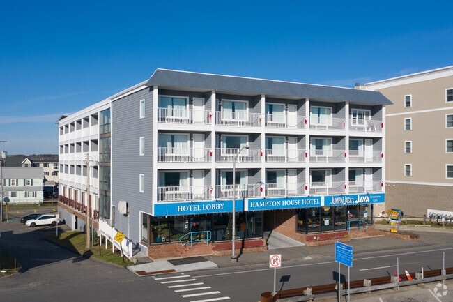
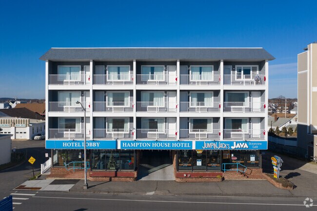
Property Record
331 Ocean Blvd, Hampton, NH 03842

Property Detail
331 Ocean Blvd
Hotel
ROCKINGHAM
BS
New Hampshire
AE The base floodplain where base flood elevations are provided. AE Zones are now used on new format FIRMs instead of A1-A30 Zones.
0.41 AC
2025
Portsmouth
2025
Boston
065009
Boston-Cambridge-Newton, MA-NH
33,771 SF
HMPT-000275-000000-000071
NEARBY LISTINGS FOR SALE OR LEASE
-
-
View all Hampton listings for sale on LoopNet.com
DEMOGRAPHICS near 331 Ocean Blvd
1 mile
3 mile
5 mile
2025 Total Population
4,739
18,734
36,390
2030 Population
5,175
19,674
37,837
Pop Growth 2025-2030
+ 9.20%
+ 5.02%
+ 3.98%
Average Age
52
50
49
2025 Total Households
2,545
8,991
16,553
HH Growth 2025-2030
+ 9.19%
+ 5.25%
+ 4.24%
Median Household Inc
$77,988
$93,754
$96,720
Avg Household Size
1.80
2.00
2.10
2025 Avg HH Vehicles
2.00
2.00
2.00
Median Home Value
$573,018
$636,991
$629,145
Median Year Built
1972
1976
1979
Nearby Places
Map Layers
Map Styles
 Street
 Aerial
Layers
 Traffic
 Biking
Places
Listings with unknown addresses are not visible on the map
- Restaurants
- Banks
- Shops
- Fitness
- Groceries
PUBLIC TRANSPORTATION
AIRPORT
Portsmouth International at Pease
Drive
Walk
Distance
Portsmouth International at Pease
25 min
15.6 mi
Freight Ports
Port of Boston
Drive
Walk
Distance
Port of Boston
71 min
50.3 mi
Nearby Properties
Address
Land Use
TOTAL SIZE
Lot Size
Zoning
Address
Land Use
TOTAL SIZE
Lot Size
Zoning
4,884 SF
40 AC
RB
Address
Land Use
TOTAL SIZE
Lot Size
Zoning
46,328 SF
49.50 AC
RA
Address
Land Use
TOTAL SIZE
Lot Size
Zoning
112,708 SF
40 AC
50
Address
Land Use
TOTAL SIZE
Lot Size
Zoning
116,112 SF
4.52 AC
BS1
Address
Land Use
TOTAL SIZE
Lot Size
Zoning
142,369 SF
8.82 AC
POR
Address
Land Use
TOTAL SIZE
Lot Size
Zoning
79,305 SF
17.18 AC
G
Address
Land Use
TOTAL SIZE
Lot Size
Zoning
850 SF
0.94 AC
BS
Address
Land Use
TOTAL SIZE
Lot Size
Zoning
25,867 SF
9.17 AC
BS
Address
Land Use
TOTAL SIZE
Lot Size
Zoning
577.79 AC
I2
Address
Land Use
TOTAL SIZE
Lot Size
Zoning
70,876 SF
17.38 AC
RA
Address
Land Use
TOTAL SIZE
Lot Size
Zoning
11,338 SF
28.90 AC
I
Address
Land Use
TOTAL SIZE
Lot Size
Zoning
29,408 SF
9.49 AC
RB
Address
Land Use
TOTAL SIZE
Lot Size
Zoning
41,864 SF
7.50 AC
RA
Address
Land Use
TOTAL SIZE
Lot Size
Zoning
47,508 SF
4.94 AC
TC-S
Address
Land Use
TOTAL SIZE
Lot Size
Zoning
57,215 SF
4.40 AC
TOWN C
Address
Land Use
TOTAL SIZE
Lot Size
Zoning
52,319 SF
5.90 AC
POR
Address
Land Use
TOTAL SIZE
Lot Size
Zoning
18,228 SF
4.10 AC
TC-S
Address
Land Use
TOTAL SIZE
Lot Size
Zoning
26,928 SF
25.11 AC
G
Address
Land Use
TOTAL SIZE
Lot Size
Zoning
56,520 SF
6.46 AC
BUSINE
Address
Land Use
TOTAL SIZE
Lot Size
Zoning
5,120 SF
1.30 AC
BS1
Address
Land Use
TOTAL SIZE
Lot Size
Zoning
26,652 SF
23.60 AC
I
Address
Land Use
TOTAL SIZE
Lot Size
Zoning
44,860 SF
5.54 AC
TC-N
Address
Land Use
TOTAL SIZE
Lot Size
Zoning
6,892 SF
5.70 AC
B
Address
Land Use
TOTAL SIZE
Lot Size
Zoning
34,021 SF
0.22 AC
BS
Address
Land Use
TOTAL SIZE
Lot Size
Zoning
41,250 SF
1.67 AC
B/RA
Address
Land Use
TOTAL SIZE
Lot Size
Zoning
13,956 SF
3.36 AC
POR
Address
Land Use
TOTAL SIZE
Lot Size
Zoning
19,840 SF
36 AC
G
Address
Land Use
TOTAL SIZE
Lot Size
Zoning
11,212 SF
0.42 AC
BS1
Address
Land Use
TOTAL SIZE
Lot Size
Zoning
11,904 SF
31.40 AC
I
The World's #1 Commercial Real Estate Marketplace
Connect with us
© 2026 CoStar Group
The information above has been obtained from sources believed reliable. While we do not doubt its accuracy we have not verified it and make no guarantee, warranty or representation about it. It is your responsibility to independently confirm its accuracy and completeness. Any projections, opinions, assumptions, or estimates used are for example only and do not represent the current or future performance of the property. The value of this transaction to you depends on tax and other factors which should be evaluated by your tax, financial, and legal advisors. You and your advisors should conduct a careful, independent investigation of the property to determine to your satisfaction the suitability of the property for your needs.