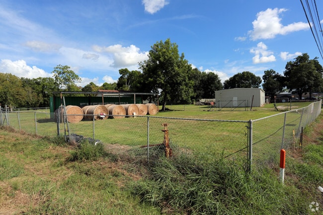
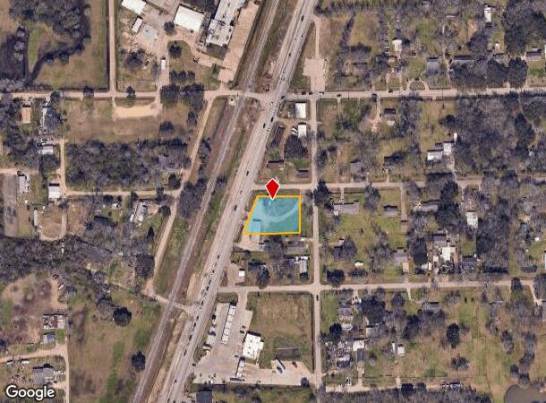
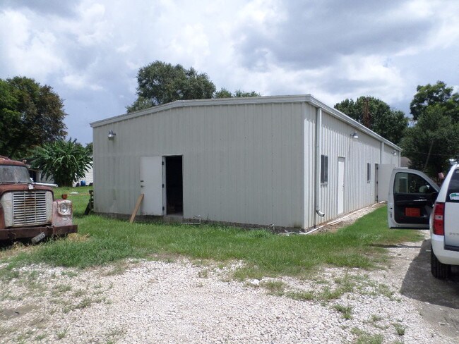
Property Record
3311 Fm 521 Rd, Fresno, TX 77545
NEARBY LISTINGS FOR SALE OR LEASE
Property Detail
3311 Fm 521 Rd
Houston-The Woodlands-Sugar Land, TX
Fresno
3150-00-008-0200-907
FRESNO, BLOCK 8, LOT 2,3,4 & (PT) 5,6
Commercialnec
Fort Bend
X
Texas
48039C0015K
2,3
2024
0.60 AC
2025
E Fort Bend Co/Sugar Land
670700
Houston
2,250 SF
DEMOGRAPHICS near 3311 Fm 521 Rd
1 Mile
3 Mile
5 Mile
2024 Total Population
2,287
70,489
181,771
2029 Population
2,740
82,136
210,222
Pop Growth 2024-2029
+ 19.81%
+ 16.52%
+ 15.65%
Average Age
35
34
35
2024 Total Households
678
21,493
57,720
HH Growth 2024-2029
+ 20.21%
+ 16.87%
+ 15.94%
Median Household Inc
$85,182
$104,653
$90,552
Avg Household Size
3.20
3.20
3.10
2024 Avg HH Vehicles
2.00
2.00
2.00
Median Home Value
$288,016
$293,831
$277,819
Median Year Built
2010
2010
2006
Nearby Places
Map Layers
Map Styles
 Street
 Aerial
- Restaurants
- Banks
- Shops
- Fitness
- Groceries
PUBLIC TRANSPORTATION
AIRPORT
William P Hobby
DRIVE
WALK
Distance
William P Hobby
30 min
16.7 mi
Freight Ports
Port of Houston
DRIVE
WALK
Distance
Port of Houston
35 min
21.3 mi
Nearby Properties
Address
Land Use
TOTAL SIZE
Lot Size
Zoning
Address
Land Use
TOTAL SIZE
Lot Size
Zoning
241,351 SF
60.11 AC
Address
Land Use
TOTAL SIZE
Lot Size
Zoning
344,620 SF
78.14 AC
SY
Address
Land Use
TOTAL SIZE
Lot Size
Zoning
1,764 SF
39.64 AC
ST
Address
Land Use
TOTAL SIZE
Lot Size
Zoning
412,375 SF
22.57 AC
Address
Land Use
TOTAL SIZE
Lot Size
Zoning
117,729 SF
15.41 AC
Address
Land Use
TOTAL SIZE
Lot Size
Zoning
66,060 SF
12.85 AC
0016
Address
Land Use
TOTAL SIZE
Lot Size
Zoning
82,400 SF
10.85 AC
I
Address
Land Use
TOTAL SIZE
Lot Size
Zoning
15.28 AC
0015
Address
Land Use
TOTAL SIZE
Lot Size
Zoning
97,920 SF
11.63 AC
Address
Land Use
TOTAL SIZE
Lot Size
Zoning
85,092 SF
12.95 AC
Address
Land Use
TOTAL SIZE
Lot Size
Zoning
105,790 SF
12.82 AC
X
Address
Land Use
TOTAL SIZE
Lot Size
Zoning
13.85 AC
Address
Land Use
TOTAL SIZE
Lot Size
Zoning
132,938 SF
29 AC
MZY
Address
Land Use
TOTAL SIZE
Lot Size
Zoning
30.17 AC
Address
Land Use
TOTAL SIZE
Lot Size
Zoning
117,467 SF
19.39 AC
Address
Land Use
TOTAL SIZE
Lot Size
Zoning
75,000 SF
7.49 AC
Address
Land Use
TOTAL SIZE
Lot Size
Zoning
125,636 SF
2.25 AC
Address
Land Use
TOTAL SIZE
Lot Size
Zoning
4.30 AC
Address
Land Use
TOTAL SIZE
Lot Size
Zoning
98,957 SF
10.70 AC
Address
Land Use
TOTAL SIZE
Lot Size
Zoning
23,626 SF
3.80 AC
Address
Land Use
TOTAL SIZE
Lot Size
Zoning
136,475 SF
12.48 AC
RSN
Address
Land Use
TOTAL SIZE
Lot Size
Zoning
17,776 SF
4.79 AC
Address
Land Use
TOTAL SIZE
Lot Size
Zoning
17,481 SF
12.54 AC
Address
Land Use
TOTAL SIZE
Lot Size
Zoning
33,225 SF
4.31 AC
Address
Land Use
TOTAL SIZE
Lot Size
Zoning
41,140 SF
4.58 AC
Address
Land Use
TOTAL SIZE
Lot Size
Zoning
Address
Land Use
TOTAL SIZE
Lot Size
Zoning
2.92 AC
Address
Land Use
TOTAL SIZE
Lot Size
Zoning
11,400 SF
2.10 AC
Address
Land Use
TOTAL SIZE
Lot Size
Zoning
68,340 SF
3.74 AC
XS
Address
Land Use
TOTAL SIZE
Lot Size
Zoning
2.31 AC
S
The World's #1 Commercial Real Estate Marketplace
Connect with us
© 2025 CoStar Group
The information above has been obtained from sources believed reliable. While we do not doubt its accuracy we have not verified it and make no guarantee, warranty or representation about it. It is your responsibility to independently confirm its accuracy and completeness. Any projections, opinions, assumptions, or estimates used are for example only and do not represent the current or future performance of the property. The value of this transaction to you depends on tax and other factors which should be evaluated by your tax, financial, and legal advisors. You and your advisors should conduct a careful, independent investigation of the property to determine to your satisfaction the suitability of the property for your needs.