Property Record
3312 Broadway St Ne, Minneapolis, MN 55413


NEARBY LISTINGS FOR SALE OR LEASE
Property Detail
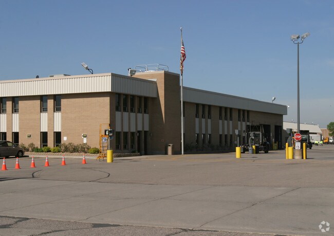
3312 Broadway St Ne
Minneapolis-St. Paul-Bloomington, MN-WI
Mid-City Industrial Center
18-029-23-42-0008
LOT 002 BLOCK 002 T MID-CITY INDUSTRIAL CENTER THAT PART LYING W OF E 66 FT THOF 800117 SQ. FT.
Industrialgeneral
Hennepin
X
Minnesota
27053C0377F
2
2024
18.56 AC
2024
Midway
104002
Minneapolis/St Paul
303,274 SF
DEMOGRAPHICS near 3312 Broadway St Ne
1 Mile
3 Mile
5 Mile
2024 Total Population
7,740
152,463
457,655
2029 Population
7,541
150,180
450,721
Pop Growth 2024-2029
(2.57%)
(1.50%)
(1.52%)
Average Age
33
36
37
2024 Total Households
3,230
68,289
197,251
HH Growth 2024-2029
(2.85%)
(1.45%)
(1.50%)
Median Household Inc
$67,228
$67,800
$65,581
Avg Household Size
2.30
2.00
2.10
2024 Avg HH Vehicles
2.00
1.00
1.00
Median Home Value
$311,848
$338,766
$297,506
Median Year Built
1965
1973
1961
Nearby Places
Map Layers
Map Styles
 Street
 Aerial
- Restaurants
- Banks
- Shops
- Fitness
- Groceries
PUBLIC TRANSPORTATION
COMMUTER RAIL
Target Field Station (Northstar Corridor - Northstar Commuter Rail)
DRIVE
WALK
Distance
Target Field Station (Northstar Corridor - Northstar Commuter Rail)
13 min
4.1 mi
DRIVE
WALK
Distance
16 min
9.6 mi
AIRPORT
Minneapolis-St Paul International/Wold-Chamberlain
DRIVE
WALK
Distance
Minneapolis-St Paul International/Wold-Chamberlain
24 min
12.5 mi
Nearby Properties
Address
Land Use
TOTAL SIZE
Lot Size
Zoning
Address
Land Use
TOTAL SIZE
Lot Size
Zoning
36,300 SF
223.37 AC
Address
Land Use
TOTAL SIZE
Lot Size
Zoning
1,821,999 SF
2.51 AC
B4-2
Address
Land Use
TOTAL SIZE
Lot Size
Zoning
Address
Land Use
TOTAL SIZE
Lot Size
Zoning
1,934,403 SF
1.67 AC
B4-2
Address
Land Use
TOTAL SIZE
Lot Size
Zoning
1,054,492 SF
1.70 AC
B4-1
Address
Land Use
TOTAL SIZE
Lot Size
Zoning
495,632 SF
1.72 AC
C1
Address
Land Use
TOTAL SIZE
Lot Size
Zoning
621,608 SF
1.03 AC
B4-2
Address
Land Use
TOTAL SIZE
Lot Size
Zoning
442,731 SF
0.97 AC
B4S-2
Address
Land Use
TOTAL SIZE
Lot Size
Zoning
695,624 SF
3.67 AC
C2
Address
Land Use
TOTAL SIZE
Lot Size
Zoning
2.67 AC
C3A
Address
Land Use
TOTAL SIZE
Lot Size
Zoning
615,172 SF
1.98 AC
I1
Address
Land Use
TOTAL SIZE
Lot Size
Zoning
37.24 AC
Address
Land Use
TOTAL SIZE
Lot Size
Zoning
577,656 SF
2.92 AC
C3A
Address
Land Use
TOTAL SIZE
Lot Size
Zoning
557,654 SF
3.15 AC
C2
Address
Land Use
TOTAL SIZE
Lot Size
Zoning
478,616 SF
2.28 AC
C2
Address
Land Use
TOTAL SIZE
Lot Size
Zoning
Address
Land Use
TOTAL SIZE
Lot Size
Zoning
513,403 SF
0.73 AC
C2
Address
Land Use
TOTAL SIZE
Lot Size
Zoning
323,404 SF
2.54 AC
B4S-2
Address
Land Use
TOTAL SIZE
Lot Size
Zoning
403,792 SF
2.51 AC
B4N
Address
Land Use
TOTAL SIZE
Lot Size
Zoning
618,841 SF
1.53 AC
B4N
Address
Land Use
TOTAL SIZE
Lot Size
Zoning
618,841 SF
1.54 AC
B4S-2
Address
Land Use
TOTAL SIZE
Lot Size
Zoning
294,047 SF
7.99 AC
Address
Land Use
TOTAL SIZE
Lot Size
Zoning
832,819 SF
0.64 AC
B4-2
Address
Land Use
TOTAL SIZE
Lot Size
Zoning
401,175 SF
0.75 AC
B4N
Address
Land Use
TOTAL SIZE
Lot Size
Zoning
439,615 SF
1.23 AC
B4-2
Address
Land Use
TOTAL SIZE
Lot Size
Zoning
341,894 SF
2.62 AC
R6
Address
Land Use
TOTAL SIZE
Lot Size
Zoning
502,092 SF
1.16 AC
B4N
Address
Land Use
TOTAL SIZE
Lot Size
Zoning
393,881 SF
1.10 AC
B4-1
Address
Land Use
TOTAL SIZE
Lot Size
Zoning
398,356 SF
1.14 AC
B4N
Address
Land Use
TOTAL SIZE
Lot Size
Zoning
142,933 SF
5.57 AC
The World's #1 Commercial Real Estate Marketplace
Connect with us
© 2026 CoStar Group
The information above has been obtained from sources believed reliable. While we do not doubt its accuracy we have not verified it and make no guarantee, warranty or representation about it. It is your responsibility to independently confirm its accuracy and completeness. Any projections, opinions, assumptions, or estimates used are for example only and do not represent the current or future performance of the property. The value of this transaction to you depends on tax and other factors which should be evaluated by your tax, financial, and legal advisors. You and your advisors should conduct a careful, independent investigation of the property to determine to your satisfaction the suitability of the property for your needs.