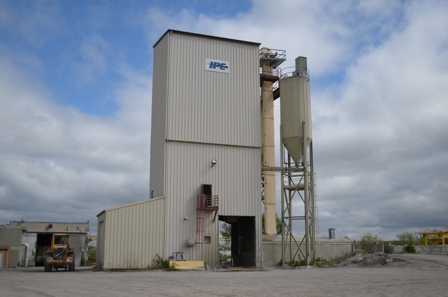
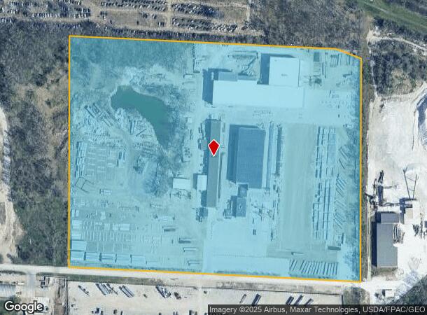
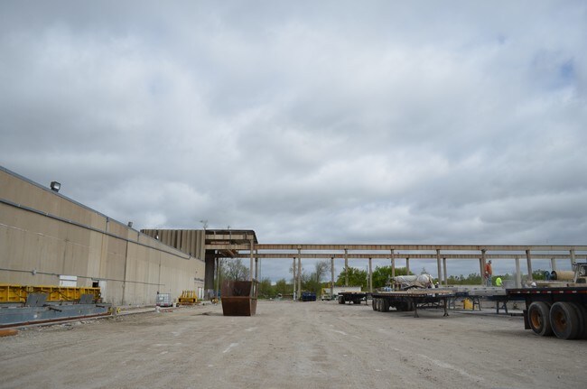
Property Record
3312 E Granger Ave, Des Moines, IA 50317
NEARBY LISTINGS FOR SALE OR LEASE
Property Detail
3312 E Granger Ave
Des Moines
Sec 07-78-23
Des Moines-West Des Moines, IA
E 522F LOT 3 & LOT 4 -EX BEG NE COR THN S 35.74F NW 111.59F E 103.81F TO POB- OP SW FRL 1/4 SEC 7-78-23
050/04224-001-001
Polk
Heavyindustrial
Iowa
0
3,4
2025
27.23 AC
005300
Northeast
123,059 SF
DEMOGRAPHICS near 3312 E Granger Ave
1 Mile
3 Mile
5 Mile
2024 Total Population
1,197
46,560
143,756
2029 Population
1,245
48,336
149,820
Pop Growth 2024-2029
+ 4.01%
+ 3.81%
+ 4.22%
Average Age
36
38
37
2024 Total Households
405
17,487
57,978
HH Growth 2024-2029
+ 3.95%
+ 4.02%
+ 4.53%
Median Household Inc
$53,055
$59,553
$57,738
Avg Household Size
2.80
2.60
2.40
2024 Avg HH Vehicles
2.00
2.00
2.00
Median Home Value
$133,419
$156,014
$158,218
Median Year Built
1947
1973
1971
Nearby Places
Map Layers
Map Styles
 Street
 Aerial
- Restaurants
- Banks
- Shops
- Fitness
- Groceries
PUBLIC TRANSPORTATION
AIRPORT
Des Moines International
DRIVE
WALK
Distance
Des Moines International
21 min
9.6 mi
Freight Ports
Port Milwaukee
DRIVE
WALK
Distance
Port Milwaukee
420 min
371.7 mi
Nearby Properties
Address
Land Use
TOTAL SIZE
Lot Size
Zoning
Address
Land Use
TOTAL SIZE
Lot Size
Zoning
177,094 SF
24.60 AC
Address
Land Use
TOTAL SIZE
Lot Size
Zoning
300,115 SF
2.48 AC
Address
Land Use
TOTAL SIZE
Lot Size
Zoning
475,929 SF
49.86 AC
M2
Address
Land Use
TOTAL SIZE
Lot Size
Zoning
342,000 SF
22.18 AC
Address
Land Use
TOTAL SIZE
Lot Size
Zoning
90,325 SF
5.49 AC
PUD
Address
Land Use
TOTAL SIZE
Lot Size
Zoning
218,593 SF
19.31 AC
M-2
Address
Land Use
TOTAL SIZE
Lot Size
Zoning
95,384 SF
3.23 AC
Address
Land Use
TOTAL SIZE
Lot Size
Zoning
118,080 SF
15.76 AC
Address
Land Use
TOTAL SIZE
Lot Size
Zoning
175,854 SF
22.81 AC
Address
Land Use
TOTAL SIZE
Lot Size
Zoning
1,890,511 SF
39.03 AC
M-2
Address
Land Use
TOTAL SIZE
Lot Size
Zoning
178,415 SF
13.35 AC
R-6
Address
Land Use
TOTAL SIZE
Lot Size
Zoning
155,276 SF
6.66 AC
R-4
Address
Land Use
TOTAL SIZE
Lot Size
Zoning
201,072 SF
26.81 AC
Address
Land Use
TOTAL SIZE
Lot Size
Zoning
38.16 AC
PUD
Address
Land Use
TOTAL SIZE
Lot Size
Zoning
155,640 SF
9.15 AC
R-6
Address
Land Use
TOTAL SIZE
Lot Size
Zoning
138,490 SF
10.01 AC
R-6
Address
Land Use
TOTAL SIZE
Lot Size
Zoning
169,201 SF
13.66 AC
C-4
Address
Land Use
TOTAL SIZE
Lot Size
Zoning
65,079 SF
6.19 AC
R-2
Address
Land Use
TOTAL SIZE
Lot Size
Zoning
55,091 SF
1.40 AC
Address
Land Use
TOTAL SIZE
Lot Size
Zoning
58,366 SF
11.58 AC
Address
Land Use
TOTAL SIZE
Lot Size
Zoning
57,179 SF
1.03 AC
Address
Land Use
TOTAL SIZE
Lot Size
Zoning
89,286 SF
14.49 AC
R1-60
Address
Land Use
TOTAL SIZE
Lot Size
Zoning
31,544 SF
9.38 AC
R1-80
Address
Land Use
TOTAL SIZE
Lot Size
Zoning
111,166 SF
6.42 AC
M-1
Address
Land Use
TOTAL SIZE
Lot Size
Zoning
64,734 SF
4.48 AC
Address
Land Use
TOTAL SIZE
Lot Size
Zoning
99,200 SF
7 AC
I-2
Address
Land Use
TOTAL SIZE
Lot Size
Zoning
44,200 SF
3.41 AC
Address
Land Use
TOTAL SIZE
Lot Size
Zoning
57,475 SF
2.48 AC
PUD
Address
Land Use
TOTAL SIZE
Lot Size
Zoning
107,640 SF
9.57 AC
The World's #1 Commercial Real Estate Marketplace
Connect with us
© 2026 CoStar Group
The information above has been obtained from sources believed reliable. While we do not doubt its accuracy we have not verified it and make no guarantee, warranty or representation about it. It is your responsibility to independently confirm its accuracy and completeness. Any projections, opinions, assumptions, or estimates used are for example only and do not represent the current or future performance of the property. The value of this transaction to you depends on tax and other factors which should be evaluated by your tax, financial, and legal advisors. You and your advisors should conduct a careful, independent investigation of the property to determine to your satisfaction the suitability of the property for your needs.