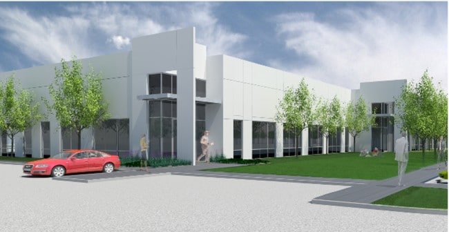
Property Record
2835 Hudson Blvd, The Colony, TX 75056

Current Lease Availabilities
Property Detail
2835 Hudson Blvd
Dallas-Fort Worth-Arlington, TX
PARKS OF AUSTIN RANCH BLK D LOT 1
R740203
DENTON
Apartment
Texas
B and X Area of moderate flood hazard, usually the area between the limits of the 100-year and 500-year floods.
1
2024
4.26 AC
2025
Upper Tollway/West Plano
021655
Dallas/Ft Worth
151,354 SF
NEARBY LISTINGS FOR SALE OR LEASE
DEMOGRAPHICS near 2835 Hudson Blvd
1 mile
3 mile
5 mile
2024 Total Population
10,523
102,138
262,076
2029 Population
12,063
114,600
294,307
Pop Growth 2024-2029
+ 14.63%
+ 12.20%
+ 12.30%
Average Age
37
39
39
2024 Total Households
4,095
40,857
107,288
HH Growth 2024-2029
+ 14.80%
+ 12.53%
+ 12.69%
Median Household Inc
$121,556
$116,048
$109,573
Avg Household Size
2.60
2.50
2.40
2024 Avg HH Vehicles
2.00
2.00
2.00
Median Home Value
$586,906
$480,482
$530,994
Median Year Built
2011
2005
2000
Nearby Places
Map Layers
Map Styles
 Street
 Aerial
Transit
 Traffic
 Biking
Places
Listings with unknown addresses are not visible on the map
- Restaurants
- Banks
- Shops
- Fitness
- Groceries
PUBLIC TRANSPORTATION
COMMUTER RAIL
Hebron Station (A-train - Denton County Transportation Authority)
Drive
Walk
Distance
Hebron Station (A-train - Denton County Transportation Authority)
14 min
8.4 mi
AIRPORT
Dallas-Fort Worth International
Drive
Walk
Distance
Dallas-Fort Worth International
24 min
18.7 mi
Dallas Love Field
Drive
Walk
Distance
Dallas Love Field
30 min
20.6 mi
Freight Ports
Port of Shreveport
Drive
Walk
Distance
Port of Shreveport
233 min
214.0 mi
Nearby Properties
Address
Land Use
TOTAL SIZE
Lot Size
Zoning
Address
Land Use
TOTAL SIZE
Lot Size
Zoning
1,622,342 SF
48.59 AC
Address
Land Use
TOTAL SIZE
Lot Size
Zoning
1,508,248 SF
49.26 AC
CE
Address
Land Use
TOTAL SIZE
Lot Size
Zoning
1,929,059 SF
55.12 AC
CE
Address
Land Use
TOTAL SIZE
Lot Size
Zoning
4,575,402 SF
51.93 AC
Address
Land Use
TOTAL SIZE
Lot Size
Zoning
725,987 SF
34.18 AC
CE
Address
Land Use
TOTAL SIZE
Lot Size
Zoning
542,570 SF
75.67 AC
Address
Land Use
TOTAL SIZE
Lot Size
Zoning
719,177 SF
27.02 AC
O-2
Address
Land Use
TOTAL SIZE
Lot Size
Zoning
526,509 SF
135.02 AC
Address
Land Use
TOTAL SIZE
Lot Size
Zoning
333,321 SF
5.80 AC
CE
Address
Land Use
TOTAL SIZE
Lot Size
Zoning
518,210 SF
38.11 AC
CE
Address
Land Use
TOTAL SIZE
Lot Size
Zoning
526,369 SF
45.84 AC
Address
Land Use
TOTAL SIZE
Lot Size
Zoning
598,569 SF
86.50 AC
Address
Land Use
TOTAL SIZE
Lot Size
Zoning
374,300 SF
6.73 AC
CB-1
Address
Land Use
TOTAL SIZE
Lot Size
Zoning
615,249 SF
16.17 AC
COMM
Address
Land Use
TOTAL SIZE
Lot Size
Zoning
275,457 SF
3.69 AC
CE
Address
Land Use
TOTAL SIZE
Lot Size
Zoning
1,817,951 SF
82 AC
Address
Land Use
TOTAL SIZE
Lot Size
Zoning
337,350 SF
2.32 AC
Address
Land Use
TOTAL SIZE
Lot Size
Zoning
537,274 SF
20.91 AC
Address
Land Use
TOTAL SIZE
Lot Size
Zoning
559,657 SF
30.49 AC
Address
Land Use
TOTAL SIZE
Lot Size
Zoning
554,780 SF
23.81 AC
Address
Land Use
TOTAL SIZE
Lot Size
Zoning
512,903 SF
18 AC
Address
Land Use
TOTAL SIZE
Lot Size
Zoning
500,844 SF
24.36 AC
2B
Address
Land Use
TOTAL SIZE
Lot Size
Zoning
460,403 SF
19.26 AC
Address
Land Use
TOTAL SIZE
Lot Size
Zoning
389,014 SF
20.91 AC
Address
Land Use
TOTAL SIZE
Lot Size
Zoning
479,145 SF
17.08 AC
Address
Land Use
TOTAL SIZE
Lot Size
Zoning
448,915 SF
20.37 AC
Address
Land Use
TOTAL SIZE
Lot Size
Zoning
284,305 SF
9.74 AC
COMM
Address
Land Use
TOTAL SIZE
Lot Size
Zoning
452,164 SF
15.70 AC
2B
Address
Land Use
TOTAL SIZE
Lot Size
Zoning
376,139 SF
3.58 AC
Address
Land Use
TOTAL SIZE
Lot Size
Zoning
419,464 SF
22.05 AC
MF-3
The World's #1 Commercial Real Estate Marketplace
Connect with us
© 2026 CoStar Group
The information above has been obtained from sources believed reliable. While we do not doubt its accuracy we have not verified it and make no guarantee, warranty or representation about it. It is your responsibility to independently confirm its accuracy and completeness. Any projections, opinions, assumptions, or estimates used are for example only and do not represent the current or future performance of the property. The value of this transaction to you depends on tax and other factors which should be evaluated by your tax, financial, and legal advisors. You and your advisors should conduct a careful, independent investigation of the property to determine to your satisfaction the suitability of the property for your needs.