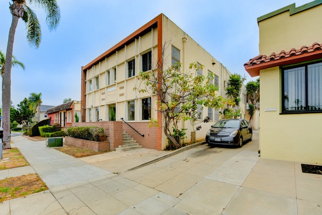
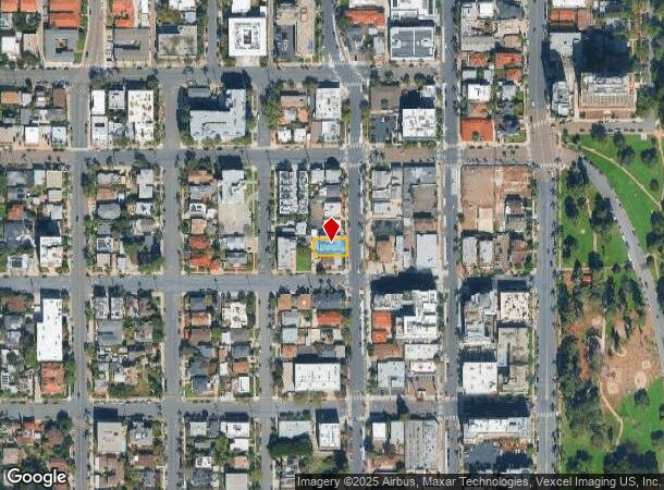
Property Record
3314 4Th Ave, San Diego, CA 92103
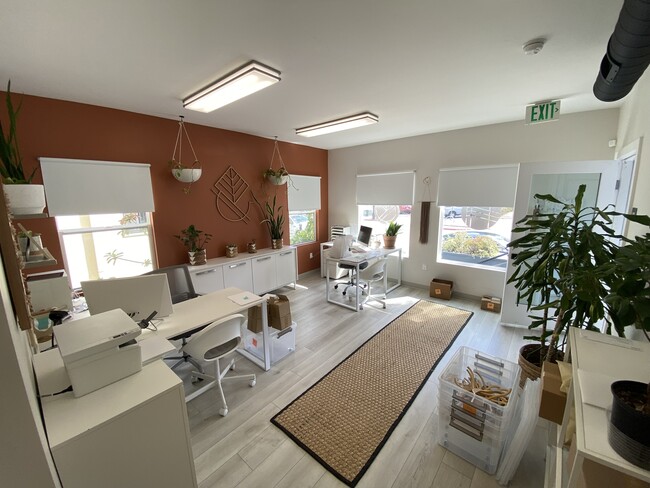
Current Lease Availabilities
NEARBY LISTINGS FOR SALE OR LEASE
Property Detail
3314 4Th Ave
San Diego-Carlsbad, CA
Hortons Add Lockling
452-554-27
BLK 389 LOT H TR DB0013PG522
Retailwithmorethanonenonretailuse
San Diego
X
California
06073C1881H
h
2024
0.12 AC
2025
Uptown West/Park West
006000
San Diego
4,670 SF
DEMOGRAPHICS near 3314 4Th Ave
1 Mile
3 Mile
5 Mile
2024 Total Population
28,892
233,949
526,638
2029 Population
28,913
234,853
526,114
Pop Growth 2024-2029
+ 0.07%
+ 0.39%
(0.10%)
Average Age
44
39
38
2024 Total Households
16,663
114,123
219,593
HH Growth 2024-2029
(0.06%)
+ 0.47%
(0.03%)
Median Household Inc
$89,641
$81,448
$77,905
Avg Household Size
1.70
1.90
2.20
2024 Avg HH Vehicles
1.00
1.00
2.00
Median Home Value
$888,792
$799,494
$795,174
Median Year Built
1972
1980
1974
Nearby Places
- Restaurants
- Banks
- Shops
- Fitness
- Groceries
PUBLIC TRANSPORTATION
COMMUTER RAIL
San Diego (Santa Fe Depot) (Coaster - San Diego North County Transit District (Coaster/Sprinter/Breeze))
DRIVE
WALK
Distance
San Diego (Santa Fe Depot) (Coaster - San Diego North County Transit District (Coaster/Sprinter/Breeze))
4 min
2.1 mi
Old Town Transit Center (Coaster - San Diego North County Transit District (Coaster/Sprinter/Breeze))
DRIVE
WALK
Distance
Old Town Transit Center (Coaster - San Diego North County Transit District (Coaster/Sprinter/Breeze))
7 min
4.0 mi
AIRPORT
San Diego International
DRIVE
WALK
Distance
San Diego International
7 min
3.1 mi
Freight Ports
Port of San Diego
DRIVE
WALK
Distance
Port of San Diego
9 min
4.0 mi
Nearby Properties
Address
Land Use
TOTAL SIZE
Lot Size
Zoning
Address
Land Use
TOTAL SIZE
Lot Size
Zoning
8.75 AC
60
Address
Land Use
TOTAL SIZE
Lot Size
Zoning
10.72 AC
M
Address
Land Use
TOTAL SIZE
Lot Size
Zoning
30,000 SF
62.51 AC
MVPD-MV-CR
Address
Land Use
TOTAL SIZE
Lot Size
Zoning
5.99 AC
C
Address
Land Use
TOTAL SIZE
Lot Size
Zoning
3.24 AC
C
Address
Land Use
TOTAL SIZE
Lot Size
Zoning
0.33 AC
CCPD-NC
Address
Land Use
TOTAL SIZE
Lot Size
Zoning
1.38 AC
CCPD-R
Address
Land Use
TOTAL SIZE
Lot Size
Zoning
11.59 AC
CO-3-1
Address
Land Use
TOTAL SIZE
Lot Size
Zoning
1.25 AC
CCPD-BP
Address
Land Use
TOTAL SIZE
Lot Size
Zoning
12.97 AC
RM-3-7
Address
Land Use
TOTAL SIZE
Lot Size
Zoning
37.33 AC
C
Address
Land Use
TOTAL SIZE
Lot Size
Zoning
9,999 SF
1.18 AC
C
Address
Land Use
TOTAL SIZE
Lot Size
Zoning
107.28 AC
UNZONED
Address
Land Use
TOTAL SIZE
Lot Size
Zoning
17.25 AC
CCPD-BP
Address
Land Use
TOTAL SIZE
Lot Size
Zoning
1.14 AC
CCPD-NC
Address
Land Use
TOTAL SIZE
Lot Size
Zoning
496,552 SF
27.12 AC
M
Address
Land Use
TOTAL SIZE
Lot Size
Zoning
0.21 AC
CCPD-R
Address
Land Use
TOTAL SIZE
Lot Size
Zoning
10,000 SF
0.21 AC
CCPD-NC
Address
Land Use
TOTAL SIZE
Lot Size
Zoning
1.38 AC
CCPD-CORE
Address
Land Use
TOTAL SIZE
Lot Size
Zoning
18.97 AC
C
Address
Land Use
TOTAL SIZE
Lot Size
Zoning
2.53 AC
EMX-1
Address
Land Use
TOTAL SIZE
Lot Size
Zoning
CCPD-ER
Address
Land Use
TOTAL SIZE
Lot Size
Zoning
1.51 AC
CC-3-9
Address
Land Use
TOTAL SIZE
Lot Size
Zoning
0.57 AC
CCPD-NC
Address
Land Use
TOTAL SIZE
Lot Size
Zoning
0.77 AC
CCPD-NC
Address
Land Use
TOTAL SIZE
Lot Size
Zoning
1.38 AC
CCPD-R
Address
Land Use
TOTAL SIZE
Lot Size
Zoning
1.10 AC
GQPD-GASLA
Address
Land Use
TOTAL SIZE
Lot Size
Zoning
RM-4-10
Address
Land Use
TOTAL SIZE
Lot Size
Zoning
6.96 AC
MVPD-MVR-4
Address
Land Use
TOTAL SIZE
Lot Size
Zoning
3.17 AC
U
The World's #1 Commercial Real Estate Marketplace
Connect with us
© 2025 CoStar Group
The information above has been obtained from sources believed reliable. While we do not doubt its accuracy we have not verified it and make no guarantee, warranty or representation about it. It is your responsibility to independently confirm its accuracy and completeness. Any projections, opinions, assumptions, or estimates used are for example only and do not represent the current or future performance of the property. The value of this transaction to you depends on tax and other factors which should be evaluated by your tax, financial, and legal advisors. You and your advisors should conduct a careful, independent investigation of the property to determine to your satisfaction the suitability of the property for your needs.