Property Record
3315 S State Highway 349, Midland, TX 79706


NEARBY LISTINGS FOR SALE OR LEASE
-
-
View all Midland listings for sale on LoopNet.com
Property Detail
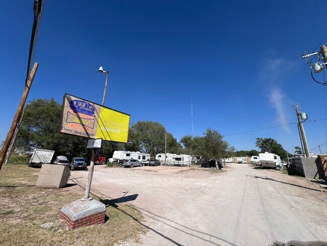
3315 S State Highway 349
Midland, TX
ACRES: 0.590 SW/4 SEC: 11 BLK: 39-T2S
R000005-409
Midland
Realpropertynec
Texas
2025
0.59 AC
2025
Midland & Odessa
010127
Other Market Areas
DEMOGRAPHICS near 3315 S State Highway 349
1 Mile
3 Mile
5 Mile
2024 Total Population
1,665
24,406
81,497
2029 Population
1,669
24,845
82,571
Pop Growth 2024-2029
+ 0.24%
+ 1.80%
+ 1.32%
Average Age
36
34
35
2024 Total Households
560
7,928
28,268
HH Growth 2024-2029
+ 0.36%
+ 2.09%
+ 1.63%
Median Household Inc
$77,778
$52,577
$67,187
Avg Household Size
3.00
2.90
2.80
2024 Avg HH Vehicles
2.00
2.00
2.00
Median Home Value
$270,967
$205,856
$230,404
Median Year Built
1977
1982
1973
Nearby Places
Map Layers
Map Styles
 Street
 Aerial
- Restaurants
- Banks
- Shops
- Fitness
- Groceries
PUBLIC TRANSPORTATION
AIRPORT
Midland International Air And Space Port
DRIVE
WALK
Distance
Midland International Air And Space Port
17 min
12.4 mi
Freight Ports
Calhoun Port
DRIVE
WALK
Distance
Calhoun Port
523 min
471.4 mi
SALE & LEASE HISTORY
LISTING DATE
SALE/LEASE

Nov 26, 2024
For Sale
Nearby Properties
Address
Land Use
TOTAL SIZE
Lot Size
Zoning
Address
Land Use
TOTAL SIZE
Lot Size
Zoning
15,052 SF
4.68 AC
C1
Address
Land Use
TOTAL SIZE
Lot Size
Zoning
245,203 SF
18.40 AC
Address
Land Use
TOTAL SIZE
Lot Size
Zoning
29,645 SF
2.07 AC
C1
Address
Land Use
TOTAL SIZE
Lot Size
Zoning
10,228 SF
15.98 AC
Address
Land Use
TOTAL SIZE
Lot Size
Zoning
8,004 SF
3.58 AC
C1
Address
Land Use
TOTAL SIZE
Lot Size
Zoning
133,056 SF
2.07 AC
C1
Address
Land Use
TOTAL SIZE
Lot Size
Zoning
7,200 SF
2.07 AC
C1
Address
Land Use
TOTAL SIZE
Lot Size
Zoning
46,512 SF
0.96 AC
C1
Address
Land Use
TOTAL SIZE
Lot Size
Zoning
96,390 SF
0.96 AC
C1
Address
Land Use
TOTAL SIZE
Lot Size
Zoning
7,008 SF
0.96 AC
C1
Address
Land Use
TOTAL SIZE
Lot Size
Zoning
41,790 SF
1.50 AC
C1
Address
Land Use
TOTAL SIZE
Lot Size
Zoning
12.91 AC
Address
Land Use
TOTAL SIZE
Lot Size
Zoning
800 SF
75.53 AC
Address
Land Use
TOTAL SIZE
Lot Size
Zoning
276 SF
0.48 AC
C1
Address
Land Use
TOTAL SIZE
Lot Size
Zoning
97,700 SF
10.79 AC
Address
Land Use
TOTAL SIZE
Lot Size
Zoning
26,390 SF
1.01 AC
C1
Address
Land Use
TOTAL SIZE
Lot Size
Zoning
6,510 SF
0.48 AC
C1
Address
Land Use
TOTAL SIZE
Lot Size
Zoning
218,900 SF
0.40 AC
C1
Address
Land Use
TOTAL SIZE
Lot Size
Zoning
1,116 SF
0.56 AC
C1
Address
Land Use
TOTAL SIZE
Lot Size
Zoning
9,650 SF
13 AC
MF1
Address
Land Use
TOTAL SIZE
Lot Size
Zoning
215,322 SF
19.80 AC
PDSC
Address
Land Use
TOTAL SIZE
Lot Size
Zoning
3,399 SF
648 AC
Address
Land Use
TOTAL SIZE
Lot Size
Zoning
103,500 SF
0.20 AC
C1
Address
Land Use
TOTAL SIZE
Lot Size
Zoning
15,068 SF
2.77 AC
LR2
Address
Land Use
TOTAL SIZE
Lot Size
Zoning
720 SF
1.86 AC
Address
Land Use
TOTAL SIZE
Lot Size
Zoning
4,263 SF
8.01 AC
Address
Land Use
TOTAL SIZE
Lot Size
Zoning
17,022 SF
1.60 AC
Address
Land Use
TOTAL SIZE
Lot Size
Zoning
34,204 SF
53.45 AC
Address
Land Use
TOTAL SIZE
Lot Size
Zoning
13,440 SF
53.69 AC
Address
Land Use
TOTAL SIZE
Lot Size
Zoning
4,900 SF
0.72 AC
C1
The World's #1 Commercial Real Estate Marketplace
Connect with us
© 2026 CoStar Group
The information above has been obtained from sources believed reliable. While we do not doubt its accuracy we have not verified it and make no guarantee, warranty or representation about it. It is your responsibility to independently confirm its accuracy and completeness. Any projections, opinions, assumptions, or estimates used are for example only and do not represent the current or future performance of the property. The value of this transaction to you depends on tax and other factors which should be evaluated by your tax, financial, and legal advisors. You and your advisors should conduct a careful, independent investigation of the property to determine to your satisfaction the suitability of the property for your needs.