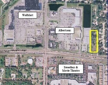
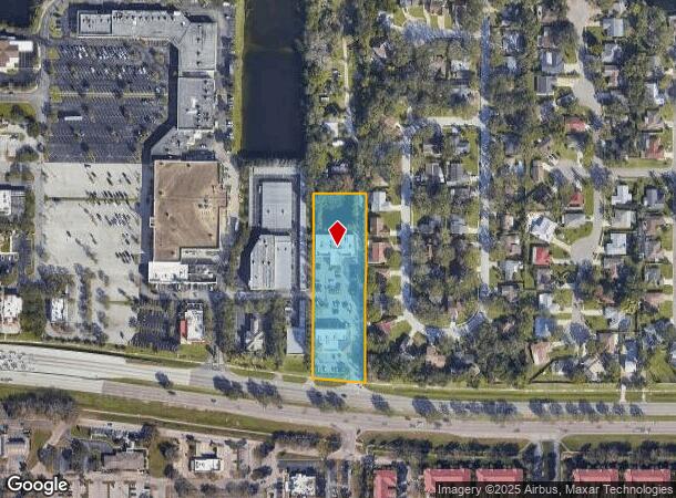
Property Record
3425 University Pky, Sarasota, FL 34243
NEARBY LISTINGS FOR SALE OR LEASE
Property Detail
3425 University Pky
20509-0000-6
THE S1/2 OF THE W 165 FT OF THE W 20 AC OF THE E 45 AC OF THE S1/2 OF THE SE1/4 OF SEC 33, LESS THEREFROM THE N 51 FT OF THE S1/2 OF THE W 165 FT OF THE E 45 AC OF THE S1/2 OF
Commercialnec
Manatee
X
Florida
12115C0044G
2.18 AC
2024
Manatee
2025
Tampa/St Petersburg
000809
North Port-Sarasota-Bradenton, FL
17,599 SF
DEMOGRAPHICS near 3425 University Pky
1 Mile
3 Mile
5 Mile
2024 Total Population
8,220
59,454
171,052
2029 Population
9,497
68,578
197,540
Pop Growth 2024-2029
+ 15.54%
+ 15.35%
+ 15.49%
Average Age
48
49
47
2024 Total Households
3,853
27,614
75,820
HH Growth 2024-2029
+ 14.98%
+ 15.06%
+ 15.19%
Median Household Inc
$74,693
$68,091
$68,657
Avg Household Size
2.10
2.10
2.10
2024 Avg HH Vehicles
2.00
2.00
2.00
Median Home Value
$312,658
$315,831
$318,770
Median Year Built
1991
1989
1988
Nearby Places
Map Layers
Map Styles
 Street
 Aerial
- Restaurants
- Banks
- Shops
- Fitness
- Groceries
PUBLIC TRANSPORTATION
AIRPORT
Sarasota/Bradenton International
DRIVE
WALK
Distance
Sarasota/Bradenton International
10 min
4.9 mi
Freight Ports
Port Manatee
DRIVE
WALK
Distance
Port Manatee
35 min
21.6 mi
Nearby Properties
Address
Land Use
TOTAL SIZE
Lot Size
Zoning
Address
Land Use
TOTAL SIZE
Lot Size
Zoning
1,023,770 SF
76.55 AC
Address
Land Use
TOTAL SIZE
Lot Size
Zoning
434,419 SF
49.04 AC
CG
Address
Land Use
TOTAL SIZE
Lot Size
Zoning
617,341 SF
76.40 AC
PD-MU
Address
Land Use
TOTAL SIZE
Lot Size
Zoning
298,916 SF
36.99 AC
G
Address
Land Use
TOTAL SIZE
Lot Size
Zoning
486,203 SF
40.94 AC
RMF3
Address
Land Use
TOTAL SIZE
Lot Size
Zoning
425,298 SF
25.59 AC
PD-R
Address
Land Use
TOTAL SIZE
Lot Size
Zoning
385,610 SF
32.65 AC
RMF-6 MULT
Address
Land Use
TOTAL SIZE
Lot Size
Zoning
331,241 SF
44.24 AC
Address
Land Use
TOTAL SIZE
Lot Size
Zoning
326,645 SF
17.96 AC
RMF3
Address
Land Use
TOTAL SIZE
Lot Size
Zoning
272,602 SF
28.35 AC
PD-R
Address
Land Use
TOTAL SIZE
Lot Size
Zoning
358,441 SF
31.80 AC
PD-R
Address
Land Use
TOTAL SIZE
Lot Size
Zoning
296,343 SF
26.53 AC
PD-R
Address
Land Use
TOTAL SIZE
Lot Size
Zoning
251,472 SF
11 AC
RSF2
Address
Land Use
TOTAL SIZE
Lot Size
Zoning
264,317 SF
9.55 AC
PD-MU
Address
Land Use
TOTAL SIZE
Lot Size
Zoning
209,091 SF
21.30 AC
RMF3
Address
Land Use
TOTAL SIZE
Lot Size
Zoning
8,796 SF
69.53 AC
RMH
Address
Land Use
TOTAL SIZE
Lot Size
Zoning
235,824 SF
71.44 AC
PD-MU
Address
Land Use
TOTAL SIZE
Lot Size
Zoning
195,271 SF
42.40 AC
GU
Address
Land Use
TOTAL SIZE
Lot Size
Zoning
126,111 SF
38.38 AC
RSF2
Address
Land Use
TOTAL SIZE
Lot Size
Zoning
238,774 SF
15.56 AC
A-1 SUBURB
Address
Land Use
TOTAL SIZE
Lot Size
Zoning
359,950 SF
34.91 AC
LM LIGHT M
Address
Land Use
TOTAL SIZE
Lot Size
Zoning
63,064 SF
33.29 AC
GU
Address
Land Use
TOTAL SIZE
Lot Size
Zoning
179,670 SF
3.51 AC
LM LIGHT M
Address
Land Use
TOTAL SIZE
Lot Size
Zoning
160,328 SF
11.75 AC
RMF-6 MULT
Address
Land Use
TOTAL SIZE
Lot Size
Zoning
5,504 SF
60.92 AC
RMH
Address
Land Use
TOTAL SIZE
Lot Size
Zoning
155,000 SF
23.72 AC
PD-C
Address
Land Use
TOTAL SIZE
Lot Size
Zoning
53,916 SF
6.59 AC
CG
Address
Land Use
TOTAL SIZE
Lot Size
Zoning
123,398 SF
18.50 AC
RMF2
Address
Land Use
TOTAL SIZE
Lot Size
Zoning
114,899 SF
15.63 AC
PD-MU
Address
Land Use
TOTAL SIZE
Lot Size
Zoning
174,118 SF
14.20 AC
CG
The World's #1 Commercial Real Estate Marketplace
Connect with us
© 2025 CoStar Group
The information above has been obtained from sources believed reliable. While we do not doubt its accuracy we have not verified it and make no guarantee, warranty or representation about it. It is your responsibility to independently confirm its accuracy and completeness. Any projections, opinions, assumptions, or estimates used are for example only and do not represent the current or future performance of the property. The value of this transaction to you depends on tax and other factors which should be evaluated by your tax, financial, and legal advisors. You and your advisors should conduct a careful, independent investigation of the property to determine to your satisfaction the suitability of the property for your needs.