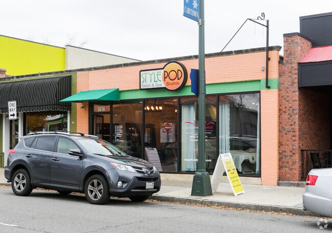
Property Record
3318 W Cary St, Richmond, VA 23221
NEARBY LISTINGS FOR SALE OR LEASE
Property Detail
3318 W Cary St
W000-1511-030
0027.56X0135.00 0000.000
Medicalclinic
Richmond City
X
Virginia
5101290036E
0.09 AC
2025
Near West End
2025
Richmond VA
040800
Richmond, VA
2,943 SF
DEMOGRAPHICS near 3318 W Cary St
1 Mile
3 Mile
5 Mile
2024 Total Population
18,941
110,788
275,723
2029 Population
19,227
114,167
284,051
Pop Growth 2024-2029
+ 1.51%
+ 3.05%
+ 3.02%
Average Age
38
38
38
2024 Total Households
10,329
53,311
124,581
HH Growth 2024-2029
+ 1.34%
+ 3.05%
+ 3.10%
Median Household Inc
$84,599
$64,527
$58,146
Avg Household Size
1.80
1.90
2.10
2024 Avg HH Vehicles
2.00
1.00
2.00
Median Home Value
$478,120
$389,375
$320,353
Median Year Built
1946
1952
1959
Nearby Places
Map Layers
Map Styles
 Street
 Aerial
- Restaurants
- Banks
- Shops
- Fitness
- Groceries
PUBLIC TRANSPORTATION
COMMUTER RAIL
DRIVE
WALK
Distance
8 min
3.9 mi
DRIVE
WALK
Distance
11 min
5.3 mi
AIRPORT
Richmond International
DRIVE
WALK
Distance
Richmond International
23 min
13.9 mi
Freight Ports
Virginia Port Authority - Richmond
DRIVE
WALK
Distance
Virginia Port Authority - Richmond
17 min
9.8 mi
Nearby Properties
Address
Land Use
TOTAL SIZE
Lot Size
Zoning
Address
Land Use
TOTAL SIZE
Lot Size
Zoning
870,159 SF
1.84 AC
B-4 CENTRA
Address
Land Use
TOTAL SIZE
Lot Size
Zoning
450,000 SF
4.35 AC
RP REASEAR
Address
Land Use
TOTAL SIZE
Lot Size
Zoning
640,340 SF
3.79 AC
B-4 CENTRA
Address
Land Use
TOTAL SIZE
Lot Size
Zoning
910,544 SF
3.16 AC
B-4 CENTRA
Address
Land Use
TOTAL SIZE
Lot Size
Zoning
340,000 SF
9.43 AC
B-4 CENTRA
Address
Land Use
TOTAL SIZE
Lot Size
Zoning
272,131 SF
11.22 AC
R-6 SINGLE
Address
Land Use
TOTAL SIZE
Lot Size
Zoning
226,734 SF
3.67 AC
B-3 GENERA
Address
Land Use
TOTAL SIZE
Lot Size
Zoning
1,728 SF
2.99 AC
MULTIPLE Z
Address
Land Use
TOTAL SIZE
Lot Size
Zoning
482,958 SF
2.38 AC
M-1 LIGHT
Address
Land Use
TOTAL SIZE
Lot Size
Zoning
1,185 SF
2.54 AC
M-1 LIGHT
Address
Land Use
TOTAL SIZE
Lot Size
Zoning
317,625 SF
1.81 AC
B-4 CENTRA
Address
Land Use
TOTAL SIZE
Lot Size
Zoning
382,570 SF
2.98 AC
UMUC
Address
Land Use
TOTAL SIZE
Lot Size
Zoning
393,266 SF
1.77 AC
B-4 CENTRA
Address
Land Use
TOTAL SIZE
Lot Size
Zoning
315,000 SF
0.38 AC
B-4 CENTRA
Address
Land Use
TOTAL SIZE
Lot Size
Zoning
14.89 AC
R-53 MULTI
Address
Land Use
TOTAL SIZE
Lot Size
Zoning
111,948 SF
2.64 AC
RP REASEAR
Address
Land Use
TOTAL SIZE
Lot Size
Zoning
185,604 SF
2.30 AC
MULTIPLE Z
Address
Land Use
TOTAL SIZE
Lot Size
Zoning
16.14 AC
MULTIPLE Z
Address
Land Use
TOTAL SIZE
Lot Size
Zoning
111,876 SF
5.90 AC
M-1 LIGHT
Address
Land Use
TOTAL SIZE
Lot Size
Zoning
878,512 SF
8.33 AC
MULTIPLE Z
Address
Land Use
TOTAL SIZE
Lot Size
Zoning
321,552 SF
UMUC
Address
Land Use
TOTAL SIZE
Lot Size
Zoning
2.11 AC
M-1
Address
Land Use
TOTAL SIZE
Lot Size
Zoning
299,820 SF
3.16 AC
M-2 HEAVY
Address
Land Use
TOTAL SIZE
Lot Size
Zoning
182,548 SF
2.25 AC
DCC-DOWNTO
Address
Land Use
TOTAL SIZE
Lot Size
Zoning
80,519 SF
27.21 AC
I INSTITUT
Address
Land Use
TOTAL SIZE
Lot Size
Zoning
416,669 SF
1.80 AC
B-4 CENTRA
Address
Land Use
TOTAL SIZE
Lot Size
Zoning
652,952 SF
2.49 AC
MULTIPLE Z
Address
Land Use
TOTAL SIZE
Lot Size
Zoning
426,000 SF
5.68 AC
RF-2 RIVER
Address
Land Use
TOTAL SIZE
Lot Size
Zoning
319,512 SF
20.33 AC
UMU
Address
Land Use
TOTAL SIZE
Lot Size
Zoning
379,598 SF
11.11 AC
DCC-DOWNTO
The World's #1 Commercial Real Estate Marketplace
Connect with us
© 2025 CoStar Group
The information above has been obtained from sources believed reliable. While we do not doubt its accuracy we have not verified it and make no guarantee, warranty or representation about it. It is your responsibility to independently confirm its accuracy and completeness. Any projections, opinions, assumptions, or estimates used are for example only and do not represent the current or future performance of the property. The value of this transaction to you depends on tax and other factors which should be evaluated by your tax, financial, and legal advisors. You and your advisors should conduct a careful, independent investigation of the property to determine to your satisfaction the suitability of the property for your needs.