Property Record
3319 Mier St, Laredo, TX 78043
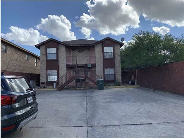


Property Detail
3319 Mier St
213182
LOT 5 BLK 18 MORENO
Multifamilydwelling
Webb
R3
Texas
B and X Area of moderate flood hazard, usually the area between the limits of the 100-year and 500-year floods.
5
2024
0.15 AC
2025
Texas South Area
001001
Other Market Areas
3,390 SF
Laredo, TX
NEARBY LISTINGS FOR SALE OR LEASE
DEMOGRAPHICS near 3319 Mier St
1 mile
3 mile
5 mile
2025 Total Population
16,491
110,945
191,791
2030 Population
16,827
113,194
196,098
Pop Growth 2025-2030
+ 2.04%
+ 2.03%
+ 2.25%
Average Age
35
35
35
2025 Total Households
5,159
33,460
56,931
HH Growth 2025-2030
+ 2.21%
+ 2.17%
+ 2.38%
Median Household Inc
$51,569
$50,872
$53,740
Avg Household Size
3.10
3.20
3.30
2025 Avg HH Vehicles
2.00
2.00
2.00
Median Home Value
$172,664
$175,668
$186,960
Median Year Built
1992
1988
1992
Nearby Places
Map Layers
Map Styles
 Street
 Aerial
Transit
 Traffic
 Biking
Places
Listings with unknown addresses are not visible on the map
- Restaurants
- Banks
- Shops
- Fitness
- Groceries
PUBLIC TRANSPORTATION
AIRPORT
Laredo International
Drive
Walk
Distance
Laredo International
9 min
3.9 mi
SALE & LEASE HISTORY
LISTING DATE
SALE/LEASE

May 25, 2022
For Sale
Nearby Properties
Address
Land Use
TOTAL SIZE
Lot Size
Zoning
Address
Land Use
TOTAL SIZE
Lot Size
Zoning
668,900 SF
38.32 AC
B4
Address
Land Use
TOTAL SIZE
Lot Size
Zoning
497,463 SF
1.77 AC
R1
Address
Land Use
TOTAL SIZE
Lot Size
Zoning
423,977 SF
1.27 AC
R2
Address
Land Use
TOTAL SIZE
Lot Size
Zoning
310,346 SF
87.65 AC
R1A
Address
Land Use
TOTAL SIZE
Lot Size
Zoning
347,773 SF
49.74 AC
R1
Address
Land Use
TOTAL SIZE
Lot Size
Zoning
152.08 AC
M1
Address
Land Use
TOTAL SIZE
Lot Size
Zoning
224,926 SF
21.49 AC
R3
Address
Land Use
TOTAL SIZE
Lot Size
Zoning
165,608 SF
28.50 AC
R2
Address
Land Use
TOTAL SIZE
Lot Size
Zoning
231,146 SF
1.77 AC
R1
Address
Land Use
TOTAL SIZE
Lot Size
Zoning
144,491 SF
3.54 AC
CBD
Address
Land Use
TOTAL SIZE
Lot Size
Zoning
380,420 SF
9.18 AC
B3
Address
Land Use
TOTAL SIZE
Lot Size
Zoning
169,339 SF
28 AC
Address
Land Use
TOTAL SIZE
Lot Size
Zoning
96,991 SF
1.59 AC
CBD
Address
Land Use
TOTAL SIZE
Lot Size
Zoning
192,176 SF
34.94 AC
Address
Land Use
TOTAL SIZE
Lot Size
Zoning
127,364 SF
1.60 AC
CBD
Address
Land Use
TOTAL SIZE
Lot Size
Zoning
157,376 SF
25.86 AC
B3
Address
Land Use
TOTAL SIZE
Lot Size
Zoning
183,795 SF
10.36 AC
R2
Address
Land Use
TOTAL SIZE
Lot Size
Zoning
25,104 SF
1.42 AC
CBD
Address
Land Use
TOTAL SIZE
Lot Size
Zoning
101,734 SF
1.63 AC
B3
Address
Land Use
TOTAL SIZE
Lot Size
Zoning
66,567 SF
3.81 AC
M1
Address
Land Use
TOTAL SIZE
Lot Size
Zoning
10,712 SF
745.84 AC
AG
Address
Land Use
TOTAL SIZE
Lot Size
Zoning
113,687 SF
5.58 AC
R3
Address
Land Use
TOTAL SIZE
Lot Size
Zoning
93,414 SF
8.57 AC
R1
Address
Land Use
TOTAL SIZE
Lot Size
Zoning
107,824 SF
13.38 AC
R1
Address
Land Use
TOTAL SIZE
Lot Size
Zoning
96,665 SF
12.03 AC
R1A
Address
Land Use
TOTAL SIZE
Lot Size
Zoning
102,815 SF
2.23 AC
Address
Land Use
TOTAL SIZE
Lot Size
Zoning
70,980 SF
1.44 AC
CBD
Address
Land Use
TOTAL SIZE
Lot Size
Zoning
97,580 SF
3.89 AC
B1
Address
Land Use
TOTAL SIZE
Lot Size
Zoning
95,769 SF
10 AC
R1
Address
Land Use
TOTAL SIZE
Lot Size
Zoning
79,764 SF
30 AC
R1
The World's #1 Commercial Real Estate Marketplace
Connect with us
© 2026 CoStar Group
The information above has been obtained from sources believed reliable. While we do not doubt its accuracy we have not verified it and make no guarantee, warranty or representation about it. It is your responsibility to independently confirm its accuracy and completeness. Any projections, opinions, assumptions, or estimates used are for example only and do not represent the current or future performance of the property. The value of this transaction to you depends on tax and other factors which should be evaluated by your tax, financial, and legal advisors. You and your advisors should conduct a careful, independent investigation of the property to determine to your satisfaction the suitability of the property for your needs.