Property Record
332 Dover Rd, Chichester, NH 03258
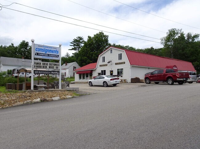


Property Detail
332 Dover Rd
Commercialnec
MERRIMACK
COMM/I
New Hampshire
B and X Area of moderate flood hazard, usually the area between the limits of the 100-year and 500-year floods.
3.48 AC
2025
Concord/New Hampshire North Area
2025
Other Market Areas
033000
Concord, NH
6,074 SF
CHCH-000003-000059
NEARBY LISTINGS FOR SALE OR LEASE
DEMOGRAPHICS near 332 Dover Rd
1 mile
3 mile
5 mile
2025 Total Population
722
4,222
20,090
2030 Population
740
4,330
20,435
Pop Growth 2025-2030
+ 2.49%
+ 2.56%
+ 1.72%
Average Age
44
44
44
2025 Total Households
270
1,637
8,363
HH Growth 2025-2030
+ 2.22%
+ 2.50%
+ 1.65%
Median Household Inc
$132,986
$114,699
$89,137
Avg Household Size
2.70
2.60
2.40
2025 Avg HH Vehicles
3.00
2.00
2.00
Median Home Value
$408,108
$392,016
$357,355
Median Year Built
1989
1989
1983
Nearby Places
Map Layers
Map Styles
 Street
 Aerial
Layers
 Traffic
 Biking
Places
Listings with unknown addresses are not visible on the map
- Restaurants
- Banks
- Shops
- Fitness
- Groceries
PUBLIC TRANSPORTATION
AIRPORT
Manchester Boston Regional
Drive
Walk
Distance
Manchester Boston Regional
45 min
30.1 mi
Portsmouth International at Pease
Drive
Walk
Distance
Portsmouth International at Pease
63 min
37.7 mi
SALE & LEASE HISTORY
LISTING DATE
SALE/LEASE

Nov 09, 2023
For Lease
Nov 02, 2023
For Lease
Nov 01, 2023
For Sale
Jul 25, 2023
For Lease
Jul 11, 2023
For Lease
Aug 15, 2022
For Sale
Nearby Properties
Address
Land Use
TOTAL SIZE
Lot Size
Zoning
Address
Land Use
TOTAL SIZE
Lot Size
Zoning
194,386 SF
33.30 AC
GWP
Address
Land Use
TOTAL SIZE
Lot Size
Zoning
50.19 AC
GWP
Address
Land Use
TOTAL SIZE
Lot Size
Zoning
135,161 SF
36.20 AC
GWP
Address
Land Use
TOTAL SIZE
Lot Size
Zoning
8.58 AC
GWP
Address
Land Use
TOTAL SIZE
Lot Size
Zoning
44,963 SF
16.29 AC
COMM V
Address
Land Use
TOTAL SIZE
Lot Size
Zoning
3.47 AC
GWP
Address
Land Use
TOTAL SIZE
Lot Size
Zoning
49,099 SF
6.31 AC
GWP
Address
Land Use
TOTAL SIZE
Lot Size
Zoning
30,580 SF
5.39 AC
GWP
Address
Land Use
TOTAL SIZE
Lot Size
Zoning
1,520 SF
143.90 AC
C/ICOM
Address
Land Use
TOTAL SIZE
Lot Size
Zoning
27,944 SF
9.11 AC
GWP
Address
Land Use
TOTAL SIZE
Lot Size
Zoning
24,096 SF
2.61 AC
GWP
Address
Land Use
TOTAL SIZE
Lot Size
Zoning
35,230 SF
18.40 AC
C/ICOM
Address
Land Use
TOTAL SIZE
Lot Size
Zoning
19,200 SF
2.87 AC
GWP
Address
Land Use
TOTAL SIZE
Lot Size
Zoning
2.35 AC
GWP
Address
Land Use
TOTAL SIZE
Lot Size
Zoning
11.07 AC
RM
Address
Land Use
TOTAL SIZE
Lot Size
Zoning
2,556 SF
167.37 AC
C-1D
Address
Land Use
TOTAL SIZE
Lot Size
Zoning
19,098 SF
5.06 AC
COMM/I
Address
Land Use
TOTAL SIZE
Lot Size
Zoning
384 SF
41.74 AC
C-1D
Address
Land Use
TOTAL SIZE
Lot Size
Zoning
16,246 SF
3.35 AC
COMM/I
Address
Land Use
TOTAL SIZE
Lot Size
Zoning
31,554 SF
8.11 AC
VILLLA
Address
Land Use
TOTAL SIZE
Lot Size
Zoning
11,985 SF
11.40 AC
RM
Address
Land Use
TOTAL SIZE
Lot Size
Zoning
8,309 SF
1.35 AC
GWP
Address
Land Use
TOTAL SIZE
Lot Size
Zoning
5,012 SF
1.01 AC
GWP
Address
Land Use
TOTAL SIZE
Lot Size
Zoning
17,783 SF
11.10 AC
COMM/I
Address
Land Use
TOTAL SIZE
Lot Size
Zoning
5,116 SF
2.64 AC
GWP
Address
Land Use
TOTAL SIZE
Lot Size
Zoning
75.30 AC
C-1D
Address
Land Use
TOTAL SIZE
Lot Size
Zoning
7,638 SF
12.80 AC
RA
Address
Land Use
TOTAL SIZE
Lot Size
Zoning
8,337 SF
4.16 AC
C/ICOM
Address
Land Use
TOTAL SIZE
Lot Size
Zoning
43.30 AC
RA
Address
Land Use
TOTAL SIZE
Lot Size
Zoning
3,596 SF
2.04 AC
COMM V
The World's #1 Commercial Real Estate Marketplace
Connect with us
© 2026 CoStar Group
The information above has been obtained from sources believed reliable. While we do not doubt its accuracy we have not verified it and make no guarantee, warranty or representation about it. It is your responsibility to independently confirm its accuracy and completeness. Any projections, opinions, assumptions, or estimates used are for example only and do not represent the current or future performance of the property. The value of this transaction to you depends on tax and other factors which should be evaluated by your tax, financial, and legal advisors. You and your advisors should conduct a careful, independent investigation of the property to determine to your satisfaction the suitability of the property for your needs.