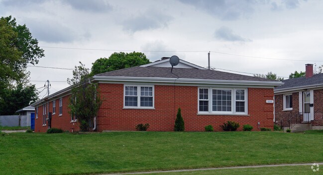
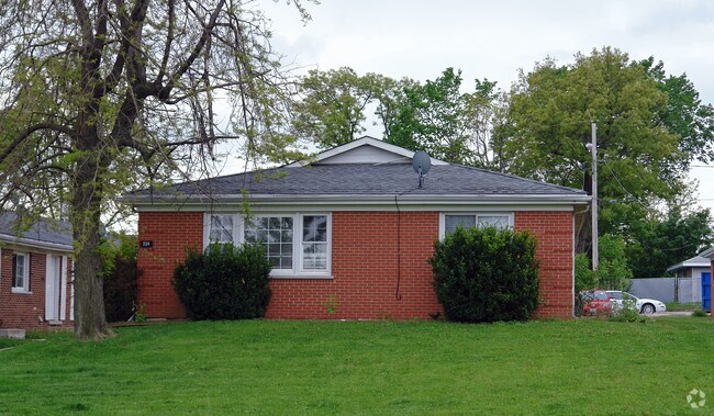
Property Record
332 Short St, Lemont, IL 60439
NEARBY LISTINGS FOR SALE OR LEASE
Property Detail
332 Short St
Chicago-Naperville-Elgin, IL-IN
Lemont Gardens Sub
22-29-225-020-0000
(RESUBDIVISION) OF LT 1-8 INCL IN LEMONT GARDENS SUB OF LTS 13&14 IN COUNTY CLERKS DIVN SEC 29-37-11
Apartment
Cook
X
Illinois
17043C0286J
1-8,1
2023
0.22 AC
2025
Southwest Cook County
824003
Chicago
3,017 SF
DEMOGRAPHICS near 332 Short St
1 Mile
3 Mile
5 Mile
2024 Total Population
10,414
24,148
98,884
2029 Population
10,081
23,523
97,378
Pop Growth 2024-2029
(3.20%)
(2.59%)
(1.52%)
Average Age
43
43
41
2024 Total Households
3,949
8,826
34,996
HH Growth 2024-2029
(3.55%)
(2.83%)
(1.59%)
Median Household Inc
$107,724
$114,593
$95,567
Avg Household Size
2.60
2.70
2.80
2024 Avg HH Vehicles
2.00
2.00
2.00
Median Home Value
$362,805
$400,427
$322,331
Median Year Built
1986
1990
1981
Nearby Places
Map Layers
Map Styles
 Street
 Aerial
- Restaurants
- Banks
- Shops
- Fitness
- Groceries
PUBLIC TRANSPORTATION
COMMUTER RAIL
Lemont Station (Heritage Corridor Line - Northeast Illinois Regional Commuter Railroad (Metra))
DRIVE
WALK
Distance
Lemont Station (Heritage Corridor Line - Northeast Illinois Regional Commuter Railroad (Metra))
2 min
16 min
0.8 mi
Romeoville (Heritage Corridor - Metra)
DRIVE
WALK
Distance
Romeoville (Heritage Corridor - Metra)
10 min
4.9 mi
AIRPORT
Chicago Midway International
DRIVE
WALK
Distance
Chicago Midway International
27 min
18.7 mi
Chicago O'Hare International
DRIVE
WALK
Distance
Chicago O'Hare International
44 min
30.2 mi
Freight Ports
Port Milwaukee
DRIVE
WALK
Distance
Port Milwaukee
125 min
101.9 mi
Nearby Properties
Address
Land Use
TOTAL SIZE
Lot Size
Zoning
Address
Land Use
TOTAL SIZE
Lot Size
Zoning
32.82 AC
Address
Land Use
TOTAL SIZE
Lot Size
Zoning
373,827 SF
21.30 AC
Address
Land Use
TOTAL SIZE
Lot Size
Zoning
759,709 SF
41.75 AC
Address
Land Use
TOTAL SIZE
Lot Size
Zoning
48.48 AC
Address
Land Use
TOTAL SIZE
Lot Size
Zoning
49.91 AC
Address
Land Use
TOTAL SIZE
Lot Size
Zoning
264,310 SF
12.21 AC
I
Address
Land Use
TOTAL SIZE
Lot Size
Zoning
18.82 AC
Address
Land Use
TOTAL SIZE
Lot Size
Zoning
513,805 SF
23.84 AC
Address
Land Use
TOTAL SIZE
Lot Size
Zoning
165.89 AC
Address
Land Use
TOTAL SIZE
Lot Size
Zoning
506,726 SF
28.54 AC
Address
Land Use
TOTAL SIZE
Lot Size
Zoning
500,160 SF
25.07 AC
Address
Land Use
TOTAL SIZE
Lot Size
Zoning
351,257 SF
16.39 AC
I
Address
Land Use
TOTAL SIZE
Lot Size
Zoning
396,546 SF
20.33 AC
I
Address
Land Use
TOTAL SIZE
Lot Size
Zoning
367,990 SF
17.32 AC
I
Address
Land Use
TOTAL SIZE
Lot Size
Zoning
25.79 AC
Address
Land Use
TOTAL SIZE
Lot Size
Zoning
Address
Land Use
TOTAL SIZE
Lot Size
Zoning
263,010 SF
13.56 AC
I
Address
Land Use
TOTAL SIZE
Lot Size
Zoning
356,521 SF
16.32 AC
Address
Land Use
TOTAL SIZE
Lot Size
Zoning
74,782 SF
5.15 AC
Address
Land Use
TOTAL SIZE
Lot Size
Zoning
348,410 SF
18.15 AC
Address
Land Use
TOTAL SIZE
Lot Size
Zoning
357,450 SF
11.65 AC
Address
Land Use
TOTAL SIZE
Lot Size
Zoning
144,312 SF
11.95 AC
I
Address
Land Use
TOTAL SIZE
Lot Size
Zoning
121.17 AC
Address
Land Use
TOTAL SIZE
Lot Size
Zoning
230,668 SF
12.55 AC
I
Address
Land Use
TOTAL SIZE
Lot Size
Zoning
119,270 SF
7 AC
I
Address
Land Use
TOTAL SIZE
Lot Size
Zoning
268,744 SF
12.23 AC
Address
Land Use
TOTAL SIZE
Lot Size
Zoning
274,325 SF
16.32 AC
Address
Land Use
TOTAL SIZE
Lot Size
Zoning
248,971 SF
10.94 AC
I
Address
Land Use
TOTAL SIZE
Lot Size
Zoning
253,622 SF
13.09 AC
Address
Land Use
TOTAL SIZE
Lot Size
Zoning
148,234 SF
7.13 AC
I
The World's #1 Commercial Real Estate Marketplace
Connect with us
© 2026 CoStar Group
The information above has been obtained from sources believed reliable. While we do not doubt its accuracy we have not verified it and make no guarantee, warranty or representation about it. It is your responsibility to independently confirm its accuracy and completeness. Any projections, opinions, assumptions, or estimates used are for example only and do not represent the current or future performance of the property. The value of this transaction to you depends on tax and other factors which should be evaluated by your tax, financial, and legal advisors. You and your advisors should conduct a careful, independent investigation of the property to determine to your satisfaction the suitability of the property for your needs.