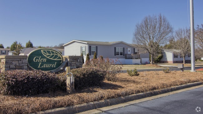
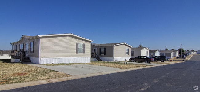
Property Record
3320 Glen Laurel Dr, Concord, NC 28025
NEARBY LISTINGS FOR SALE OR LEASE
Property Detail
3320 Glen Laurel Dr
Charlotte-Concord-Gastonia, NC-SC
H W Miller Estate
5539-13-1354-0000
LOT 4 H W MILLER ESTATE 36-28 29 30
Clubslodgesprofessionalassociations
Cabarrus
X
North Carolina
3710553900K
4
2025
17.88 AC
2025
Outlying Cabarrus County
042201
Charlotte
2,180 SF
DEMOGRAPHICS near 3320 Glen Laurel Dr
1 Mile
3 Mile
5 Mile
2024 Total Population
7,455
41,504
83,980
2029 Population
8,317
46,882
94,626
Pop Growth 2024-2029
+ 11.56%
+ 12.96%
+ 12.68%
Average Age
34
37
38
2024 Total Households
2,465
14,391
30,374
HH Growth 2024-2029
+ 10.10%
+ 11.56%
+ 11.25%
Median Household Inc
$81,830
$72,022
$73,546
Avg Household Size
3.00
2.70
2.70
2024 Avg HH Vehicles
2.00
2.00
2.00
Median Home Value
$235,981
$230,167
$252,955
Median Year Built
2000
1990
1992
Nearby Places
Map Layers
Map Styles
 Street
 Aerial
- Restaurants
- Banks
- Shops
- Fitness
- Groceries
PUBLIC TRANSPORTATION
AIRPORT
Concord-Padgett Regional
DRIVE
WALK
Distance
Concord-Padgett Regional
24 min
14.1 mi
Charlotte/Douglas International
DRIVE
WALK
Distance
Charlotte/Douglas International
44 min
28.2 mi
Nearby Properties
Address
Land Use
TOTAL SIZE
Lot Size
Zoning
Address
Land Use
TOTAL SIZE
Lot Size
Zoning
162,854 SF
2.11 AC
CC
Address
Land Use
TOTAL SIZE
Lot Size
Zoning
103,849 SF
3.03 AC
CC
Address
Land Use
TOTAL SIZE
Lot Size
Zoning
32,872 SF
0.90 AC
CC
Address
Land Use
TOTAL SIZE
Lot Size
Zoning
122,102 SF
4.69 AC
CC
Address
Land Use
TOTAL SIZE
Lot Size
Zoning
173,459 SF
15.03 AC
O-I
Address
Land Use
TOTAL SIZE
Lot Size
Zoning
161,202 SF
2.68 AC
CC
Address
Land Use
TOTAL SIZE
Lot Size
Zoning
15,215 SF
30.18 AC
RM-2
Address
Land Use
TOTAL SIZE
Lot Size
Zoning
6,539 SF
173.17 AC
LI
Address
Land Use
TOTAL SIZE
Lot Size
Zoning
19,673 SF
26.67 AC
RC
Address
Land Use
TOTAL SIZE
Lot Size
Zoning
199,363 SF
53.36 AC
I-1
Address
Land Use
TOTAL SIZE
Lot Size
Zoning
152,554 SF
29.94 AC
O-I
Address
Land Use
TOTAL SIZE
Lot Size
Zoning
94,924 SF
0.39 AC
CC
Address
Land Use
TOTAL SIZE
Lot Size
Zoning
160,412 SF
39.97 AC
O-I
Address
Land Use
TOTAL SIZE
Lot Size
Zoning
76,336 SF
0.55 AC
CC
Address
Land Use
TOTAL SIZE
Lot Size
Zoning
30,170 SF
0.80 AC
CC
Address
Land Use
TOTAL SIZE
Lot Size
Zoning
7,000 SF
72.56 AC
I-2
Address
Land Use
TOTAL SIZE
Lot Size
Zoning
119,676 SF
38.58 AC
C-2
Address
Land Use
TOTAL SIZE
Lot Size
Zoning
8,640 SF
15.51 AC
RC
Address
Land Use
TOTAL SIZE
Lot Size
Zoning
69,251 SF
0.62 AC
CC
Address
Land Use
TOTAL SIZE
Lot Size
Zoning
126,214 SF
93.87 AC
O-I
Address
Land Use
TOTAL SIZE
Lot Size
Zoning
7,584 SF
12.63 AC
RC
Address
Land Use
TOTAL SIZE
Lot Size
Zoning
170,832 SF
1.27 AC
CC
Address
Land Use
TOTAL SIZE
Lot Size
Zoning
29,256 SF
0.17 AC
CC
Address
Land Use
TOTAL SIZE
Lot Size
Zoning
13,410 SF
0.39 AC
CC
Address
Land Use
TOTAL SIZE
Lot Size
Zoning
46,922 SF
24.22 AC
O-I
Address
Land Use
TOTAL SIZE
Lot Size
Zoning
60,343 SF
14.04 AC
I-1
Address
Land Use
TOTAL SIZE
Lot Size
Zoning
12,150 SF
7.23 AC
GI
Address
Land Use
TOTAL SIZE
Lot Size
Zoning
13,627 SF
10.34 AC
C-2
Address
Land Use
TOTAL SIZE
Lot Size
Zoning
30,750 SF
10.08 AC
C-2
Address
Land Use
TOTAL SIZE
Lot Size
Zoning
61,196 SF
16.60 AC
I-2
The World's #1 Commercial Real Estate Marketplace
Connect with us
© 2026 CoStar Group
The information above has been obtained from sources believed reliable. While we do not doubt its accuracy we have not verified it and make no guarantee, warranty or representation about it. It is your responsibility to independently confirm its accuracy and completeness. Any projections, opinions, assumptions, or estimates used are for example only and do not represent the current or future performance of the property. The value of this transaction to you depends on tax and other factors which should be evaluated by your tax, financial, and legal advisors. You and your advisors should conduct a careful, independent investigation of the property to determine to your satisfaction the suitability of the property for your needs.