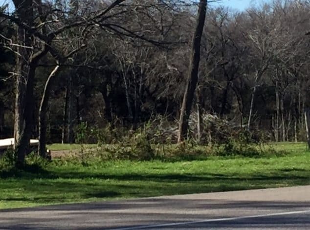
Property Record
3320 Ovilla Rd, Red Oak, TX 75154
NEARBY LISTINGS FOR SALE OR LEASE
Property Detail
3320 Ovilla Rd
Dallas-Fort Worth-Arlington, TX
J Mcnamara
233052
693 J MCNAMARA 12.042 ACRES
Agriculturalland
Ellis
X
Texas
48139C0045G
12.04 AC
2024
Ellis County
2025
Dallas/Ft Worth
060216
DEMOGRAPHICS near 3320 Ovilla Rd
1 Mile
3 Mile
5 Mile
2024 Total Population
2,641
31,925
107,078
2029 Population
3,333
38,177
119,007
Pop Growth 2024-2029
+ 26.20%
+ 19.58%
+ 11.14%
Average Age
41
37
37
2024 Total Households
908
10,467
35,048
HH Growth 2024-2029
+ 26.54%
+ 19.83%
+ 11.30%
Median Household Inc
$114,566
$115,738
$94,366
Avg Household Size
2.90
3.00
3.00
2024 Avg HH Vehicles
3.00
2.00
2.00
Median Home Value
$374,462
$306,256
$260,711
Median Year Built
1997
2005
2000
Nearby Places
Map Layers
Map Styles
 Street
 Aerial
- Restaurants
- Banks
- Shops
- Fitness
- Groceries
PUBLIC TRANSPORTATION
AIRPORT
Dallas Love Field
DRIVE
WALK
Distance
Dallas Love Field
40 min
27.6 mi
Dallas-Fort Worth International
DRIVE
WALK
Distance
Dallas-Fort Worth International
51 min
34.1 mi
Freight Ports
Port of Shreveport
DRIVE
WALK
Distance
Port of Shreveport
226 min
208.7 mi
SALE & LEASE HISTORY
LISTING DATE
SALE/LEASE

Apr 11, 2017
For Sale
Nearby Properties
Address
Land Use
TOTAL SIZE
Lot Size
Zoning
Address
Land Use
TOTAL SIZE
Lot Size
Zoning
330,541 SF
14.85 AC
Address
Land Use
TOTAL SIZE
Lot Size
Zoning
55,213 SF
11.83 AC
Z197
Address
Land Use
TOTAL SIZE
Lot Size
Zoning
90,125 SF
13.82 AC
Address
Land Use
TOTAL SIZE
Lot Size
Zoning
117,564 SF
25.59 AC
Address
Land Use
TOTAL SIZE
Lot Size
Zoning
116,318 SF
14.92 AC
Address
Land Use
TOTAL SIZE
Lot Size
Zoning
148 SF
20.14 AC
Z159
Address
Land Use
TOTAL SIZE
Lot Size
Zoning
151 SF
10.89 AC
Z159
Address
Land Use
TOTAL SIZE
Lot Size
Zoning
79,612 SF
2.67 AC
Address
Land Use
TOTAL SIZE
Lot Size
Zoning
95,200 SF
20.12 AC
Address
Land Use
TOTAL SIZE
Lot Size
Zoning
66,850 SF
14.46 AC
Z197
Address
Land Use
TOTAL SIZE
Lot Size
Zoning
1,288 SF
112.16 AC
Z09
Address
Land Use
TOTAL SIZE
Lot Size
Zoning
4,108 SF
300.81 AC
Address
Land Use
TOTAL SIZE
Lot Size
Zoning
24,485 SF
10 AC
Address
Land Use
TOTAL SIZE
Lot Size
Zoning
69,916 SF
14.88 AC
Address
Land Use
TOTAL SIZE
Lot Size
Zoning
16,500 SF
5.89 AC
Address
Land Use
TOTAL SIZE
Lot Size
Zoning
1,000 SF
99.92 AC
Z362
Address
Land Use
TOTAL SIZE
Lot Size
Zoning
73.85 AC
Z236
Address
Land Use
TOTAL SIZE
Lot Size
Zoning
14,357 SF
25.59 AC
Address
Land Use
TOTAL SIZE
Lot Size
Zoning
60,950 SF
3.87 AC
Z31
Address
Land Use
TOTAL SIZE
Lot Size
Zoning
150 AC
Z369
Address
Land Use
TOTAL SIZE
Lot Size
Zoning
29,465 SF
2.16 AC
Address
Land Use
TOTAL SIZE
Lot Size
Zoning
29,990 SF
6.13 AC
Z29
Address
Land Use
TOTAL SIZE
Lot Size
Zoning
20,867 SF
13.28 AC
Address
Land Use
TOTAL SIZE
Lot Size
Zoning
63.73 AC
Z236
Address
Land Use
TOTAL SIZE
Lot Size
Zoning
12,862 SF
4.99 AC
Address
Land Use
TOTAL SIZE
Lot Size
Zoning
38,600 SF
4.76 AC
Address
Land Use
TOTAL SIZE
Lot Size
Zoning
129.79 AC
Address
Land Use
TOTAL SIZE
Lot Size
Zoning
39,500 SF
1.95 AC
Z137
Address
Land Use
TOTAL SIZE
Lot Size
Zoning
5,740 SF
142.71 AC
Z02
Address
Land Use
TOTAL SIZE
Lot Size
Zoning
7,471 SF
2.73 AC
The World's #1 Commercial Real Estate Marketplace
Connect with us
© 2026 CoStar Group
The information above has been obtained from sources believed reliable. While we do not doubt its accuracy we have not verified it and make no guarantee, warranty or representation about it. It is your responsibility to independently confirm its accuracy and completeness. Any projections, opinions, assumptions, or estimates used are for example only and do not represent the current or future performance of the property. The value of this transaction to you depends on tax and other factors which should be evaluated by your tax, financial, and legal advisors. You and your advisors should conduct a careful, independent investigation of the property to determine to your satisfaction the suitability of the property for your needs.