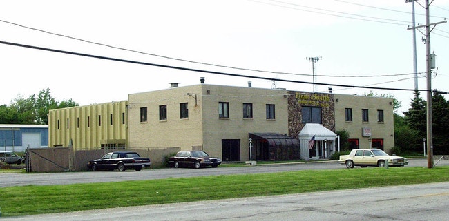
Property Record
3321 S Il Route 31, Crystal Lake, IL 60012


NEARBY LISTINGS FOR SALE OR LEASE
Property Detail
3321 S Il Route 31
14-22-126-023
None
Commercialnec
DOC 2002R0117135 S 300FT E 439.56FT NE1/4 NW1/4 /EX DOC 2024R0022135/
X
McHenry
17111C0220J
Illinois
2023
2.70 AC
2024
McHenry County
870813
Chicago
16,000 SF
Chicago-Naperville-Elgin, IL-IN
DEMOGRAPHICS near 3321 S Il Route 31
1 Mile
3 Mile
5 Mile
2024 Total Population
764
21,885
82,732
2029 Population
785
22,142
83,128
Pop Growth 2024-2029
+ 2.75%
+ 1.17%
+ 0.48%
Average Age
43
42
41
2024 Total Households
340
8,111
31,175
HH Growth 2024-2029
+ 2.06%
+ 1.20%
+ 0.47%
Median Household Inc
$62,500
$105,625
$87,524
Avg Household Size
2.20
2.60
2.60
2024 Avg HH Vehicles
2.00
2.00
2.00
Median Home Value
$346,721
$304,609
$253,684
Median Year Built
1994
1991
1983
Nearby Places
Map Layers
Map Styles
 Street
 Aerial
- Restaurants
- Banks
- Shops
- Fitness
- Groceries
PUBLIC TRANSPORTATION
COMMUTER RAIL
Crystal Lake Station (Union Pacific Northwest Line - Northeast Illinois Regional Commuter Railroad (Metra))
DRIVE
WALK
Distance
Crystal Lake Station (Union Pacific Northwest Line - Northeast Illinois Regional Commuter Railroad (Metra))
10 min
4.2 mi
Pingree Road Station (Union Pacific Northwest Line - Northeast Illinois Regional Commuter Railroad (Metra))
DRIVE
WALK
Distance
Pingree Road Station (Union Pacific Northwest Line - Northeast Illinois Regional Commuter Railroad (Metra))
11 min
4.4 mi
AIRPORT
Chicago O'Hare International
DRIVE
WALK
Distance
Chicago O'Hare International
55 min
38.1 mi
Nearby Properties
Address
Land Use
TOTAL SIZE
Lot Size
Zoning
Address
Land Use
TOTAL SIZE
Lot Size
Zoning
393,554 SF
83.76 AC
Address
Land Use
TOTAL SIZE
Lot Size
Zoning
279,418 SF
12.26 AC
Address
Land Use
TOTAL SIZE
Lot Size
Zoning
376,110 SF
13.46 AC
Address
Land Use
TOTAL SIZE
Lot Size
Zoning
54,986 SF
5.83 AC
Address
Land Use
TOTAL SIZE
Lot Size
Zoning
187,594 SF
6.36 AC
Address
Land Use
TOTAL SIZE
Lot Size
Zoning
47,440 SF
3.59 AC
Address
Land Use
TOTAL SIZE
Lot Size
Zoning
362,936 SF
6.08 AC
Address
Land Use
TOTAL SIZE
Lot Size
Zoning
218,524 SF
12.92 AC
Address
Land Use
TOTAL SIZE
Lot Size
Zoning
236,501 SF
10 AC
Address
Land Use
TOTAL SIZE
Lot Size
Zoning
233,785 SF
15.54 AC
Address
Land Use
TOTAL SIZE
Lot Size
Zoning
217,957 SF
18.53 AC
Address
Land Use
TOTAL SIZE
Lot Size
Zoning
68,880 SF
13.39 AC
Address
Land Use
TOTAL SIZE
Lot Size
Zoning
72,624 SF
2.80 AC
Address
Land Use
TOTAL SIZE
Lot Size
Zoning
43.83 AC
Address
Land Use
TOTAL SIZE
Lot Size
Zoning
83,744 SF
8.06 AC
Address
Land Use
TOTAL SIZE
Lot Size
Zoning
46,824 SF
6.68 AC
Address
Land Use
TOTAL SIZE
Lot Size
Zoning
197,155 SF
3.70 AC
Address
Land Use
TOTAL SIZE
Lot Size
Zoning
94,900 SF
3.84 AC
Address
Land Use
TOTAL SIZE
Lot Size
Zoning
113,904 SF
6.02 AC
Address
Land Use
TOTAL SIZE
Lot Size
Zoning
23,392 SF
2.68 AC
Address
Land Use
TOTAL SIZE
Lot Size
Zoning
50,358 SF
1.54 AC
Address
Land Use
TOTAL SIZE
Lot Size
Zoning
40,515 SF
2.97 AC
Address
Land Use
TOTAL SIZE
Lot Size
Zoning
68,604 SF
4.59 AC
Address
Land Use
TOTAL SIZE
Lot Size
Zoning
84,570 SF
8.60 AC
Address
Land Use
TOTAL SIZE
Lot Size
Zoning
70,136 SF
3.15 AC
Address
Land Use
TOTAL SIZE
Lot Size
Zoning
60,757 SF
3.85 AC
Address
Land Use
TOTAL SIZE
Lot Size
Zoning
50,360 SF
3.46 AC
Address
Land Use
TOTAL SIZE
Lot Size
Zoning
69,072 SF
6.85 AC
Address
Land Use
TOTAL SIZE
Lot Size
Zoning
33,873 SF
3.97 AC
Address
Land Use
TOTAL SIZE
Lot Size
Zoning
23,766 SF
3.86 AC
The World's #1 Commercial Real Estate Marketplace
Connect with us
© 2026 CoStar Group
The information above has been obtained from sources believed reliable. While we do not doubt its accuracy we have not verified it and make no guarantee, warranty or representation about it. It is your responsibility to independently confirm its accuracy and completeness. Any projections, opinions, assumptions, or estimates used are for example only and do not represent the current or future performance of the property. The value of this transaction to you depends on tax and other factors which should be evaluated by your tax, financial, and legal advisors. You and your advisors should conduct a careful, independent investigation of the property to determine to your satisfaction the suitability of the property for your needs.