Property Record
3321 Sw 80Th Ave, Ocala, FL 34481


NEARBY LISTINGS FOR SALE OR LEASE
Property Detail
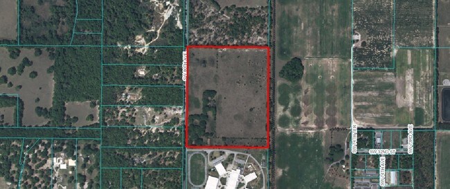
3321 Sw 80Th Ave
Ocala, FL
Brighton Ph 03
23823-000-00
Marion
Sfr
Florida
A
47.50 AC
12083C0492E
Greater Ocala
2,826 SF
Ocala
DEMOGRAPHICS near 3321 Sw 80Th Ave
1 Mile
3 Mile
5 Mile
2024 Total Population
576
9,750
47,571
2029 Population
656
10,991
53,927
Pop Growth 2024-2029
+ 13.89%
+ 12.73%
+ 13.36%
Average Age
50
45
50
2024 Total Households
245
4,180
20,293
HH Growth 2024-2029
+ 14.29%
+ 12.73%
+ 13.51%
Median Household Inc
$68,207
$58,913
$57,339
Avg Household Size
2.30
2.30
2.20
2024 Avg HH Vehicles
2.00
2.00
2.00
Median Home Value
$273,170
$234,860
$228,469
Median Year Built
2001
1997
1998
Nearby Places
Map Layers
Map Styles
 Street
 Aerial
- Restaurants
- Banks
- Shops
- Fitness
- Groceries
SALE & LEASE HISTORY
LISTING DATE
SALE/LEASE

Sep 24, 2016
For Sale
Mar 30, 2017
For Sale
Jan 03, 2017
For Sale
Dec 01, 2016
For Sale
Nearby Properties
Address
Land Use
TOTAL SIZE
Lot Size
Zoning
Address
Land Use
TOTAL SIZE
Lot Size
Zoning
322,193 SF
70.13 AC
INST
Address
Land Use
TOTAL SIZE
Lot Size
Zoning
152,355 SF
973.50 AC
GU
Address
Land Use
TOTAL SIZE
Lot Size
Zoning
91,872 SF
216.43 AC
M1
Address
Land Use
TOTAL SIZE
Lot Size
Zoning
95,496 SF
25.25 AC
R3
Address
Land Use
TOTAL SIZE
Lot Size
Zoning
101,760 SF
9.88 AC
M1
Address
Land Use
TOTAL SIZE
Lot Size
Zoning
14,122 SF
73.47 AC
A1
Address
Land Use
TOTAL SIZE
Lot Size
Zoning
120,571 SF
10.34 AC
M1
Address
Land Use
TOTAL SIZE
Lot Size
Zoning
48,518 SF
84.49 AC
A1
Address
Land Use
TOTAL SIZE
Lot Size
Zoning
100,367 SF
6.40 AC
M1
Address
Land Use
TOTAL SIZE
Lot Size
Zoning
1,766 SF
209.42 AC
M1
Address
Land Use
TOTAL SIZE
Lot Size
Zoning
99,045 SF
7.19 AC
B2
Address
Land Use
TOTAL SIZE
Lot Size
Zoning
99,875 SF
6.12 AC
M1
Address
Land Use
TOTAL SIZE
Lot Size
Zoning
55,950 SF
3.64 AC
M1
Address
Land Use
TOTAL SIZE
Lot Size
Zoning
83,699 SF
58.13 AC
M2
Address
Land Use
TOTAL SIZE
Lot Size
Zoning
31,182 SF
7.07 AC
GU
Address
Land Use
TOTAL SIZE
Lot Size
Zoning
44,975 SF
5.39 AC
M1
Address
Land Use
TOTAL SIZE
Lot Size
Zoning
64,211 SF
4.64 AC
B5
Address
Land Use
TOTAL SIZE
Lot Size
Zoning
3,689 SF
158.80 AC
GU
Address
Land Use
TOTAL SIZE
Lot Size
Zoning
87,539 SF
7.26 AC
M1
Address
Land Use
TOTAL SIZE
Lot Size
Zoning
56,481 SF
4.73 AC
M1
Address
Land Use
TOTAL SIZE
Lot Size
Zoning
24,461 SF
728.42 AC
A1
Address
Land Use
TOTAL SIZE
Lot Size
Zoning
20,194 SF
197.27 AC
PUD
Address
Land Use
TOTAL SIZE
Lot Size
Zoning
129,404 SF
12.63 AC
M1
Address
Land Use
TOTAL SIZE
Lot Size
Zoning
33,900 SF
19.33 AC
R3
Address
Land Use
TOTAL SIZE
Lot Size
Zoning
17,265 SF
1.55 AC
PUD
Address
Land Use
TOTAL SIZE
Lot Size
Zoning
72,485 SF
23.01 AC
GU
Address
Land Use
TOTAL SIZE
Lot Size
Zoning
60,000 SF
7.64 AC
M2
Address
Land Use
TOTAL SIZE
Lot Size
Zoning
11,090 SF
40 AC
GU
Address
Land Use
TOTAL SIZE
Lot Size
Zoning
16,318 SF
11.52 AC
B2
Address
Land Use
TOTAL SIZE
Lot Size
Zoning
21,576 SF
20 AC
M2
The World's #1 Commercial Real Estate Marketplace
Connect with us
© 2025 CoStar Group
The information above has been obtained from sources believed reliable. While we do not doubt its accuracy we have not verified it and make no guarantee, warranty or representation about it. It is your responsibility to independently confirm its accuracy and completeness. Any projections, opinions, assumptions, or estimates used are for example only and do not represent the current or future performance of the property. The value of this transaction to you depends on tax and other factors which should be evaluated by your tax, financial, and legal advisors. You and your advisors should conduct a careful, independent investigation of the property to determine to your satisfaction the suitability of the property for your needs.