Property Record
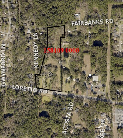
3323 Loretto Rd, Jacksonville, FL 32223


Property Detail
3323 Loretto Rd
158109-0000
08-4S-27E 8.555 PT LOT 13 SEC 8,PT LOT 2 RECD O/R 20944-1716 BEING PARCEL A
Commercialacreage
Duval
PUD
Florida
B and X Area of moderate flood hazard, usually the area between the limits of the 100-year and 500-year floods.
13,2
2025
8.73 AC
2026
Mandarin
016807
Jacksonville (Florida)
6,116 SF
Jacksonville, FL
NEARBY LISTINGS FOR SALE OR LEASE
DEMOGRAPHICS near 3323 Loretto Rd
1 mile
3 mile
5 mile
2025 Total Population
10,114
62,227
123,481
2030 Population
10,624
65,430
132,095
Pop Growth 2025-2030
+ 5.04%
+ 5.15%
+ 6.98%
Average Age
42
43
42
2025 Total Households
4,230
24,798
48,013
HH Growth 2025-2030
+ 5.34%
+ 5.27%
+ 7.02%
Median Household Inc
$81,839
$93,459
$95,267
Avg Household Size
2.40
2.40
2.50
2025 Avg HH Vehicles
2.00
2.00
2.00
Median Home Value
$341,589
$378,163
$390,069
Median Year Built
1986
1987
1989
Nearby Places
Map Layers
Map Styles
 Street
 Aerial
Layers
 Traffic
 Biking
Places
Listings with unknown addresses are not visible on the map
- Restaurants
- Banks
- Shops
- Fitness
- Groceries
PUBLIC TRANSPORTATION
AIRPORT
Jacksonville International
Drive
Walk
Distance
Jacksonville International
47 min
34.8 mi
Freight Ports
Jacksonville Port
Drive
Walk
Distance
Jacksonville Port
33 min
17.8 mi
SALE & LEASE HISTORY
LISTING DATE
SALE/LEASE

Jan 03, 2023
For Sale
Nearby Properties
Address
Land Use
TOTAL SIZE
Lot Size
Zoning
Address
Land Use
TOTAL SIZE
Lot Size
Zoning
438,224 SF
35.14 AC
RMD-D
Address
Land Use
TOTAL SIZE
Lot Size
Zoning
287,406 SF
32.10 AC
CCG-1
Address
Land Use
TOTAL SIZE
Lot Size
Zoning
193,858 SF
8.67 AC
PUD
Address
Land Use
TOTAL SIZE
Lot Size
Zoning
266,087 SF
35.07 AC
RMD-D
Address
Land Use
TOTAL SIZE
Lot Size
Zoning
304,017 SF
20.58 AC
RMD-D
Address
Land Use
TOTAL SIZE
Lot Size
Zoning
291,833 SF
16.91 AC
CRO
Address
Land Use
TOTAL SIZE
Lot Size
Zoning
236,068 SF
18.87 AC
PUD
Address
Land Use
TOTAL SIZE
Lot Size
Zoning
404,315 SF
19.27 AC
RMD-D
Address
Land Use
TOTAL SIZE
Lot Size
Zoning
166,126 SF
17.26 AC
CCG-1
Address
Land Use
TOTAL SIZE
Lot Size
Zoning
273,060 SF
23.70 AC
CCG-1
Address
Land Use
TOTAL SIZE
Lot Size
Zoning
240,240 SF
13.91 AC
PUD
Address
Land Use
TOTAL SIZE
Lot Size
Zoning
148,931 SF
16.93 AC
RMD-D
Address
Land Use
TOTAL SIZE
Lot Size
Zoning
96,065 SF
4.11 AC
PUD
Address
Land Use
TOTAL SIZE
Lot Size
Zoning
177,088 SF
15.02 AC
RMD-D
Address
Land Use
TOTAL SIZE
Lot Size
Zoning
263,796 SF
36.89 AC
PUD
Address
Land Use
TOTAL SIZE
Lot Size
Zoning
330,139 SF
73.17 AC
PBF-1
Address
Land Use
TOTAL SIZE
Lot Size
Zoning
246,534 SF
18.99 AC
RMD-D
Address
Land Use
TOTAL SIZE
Lot Size
Zoning
388,745 SF
49.78 AC
PBF-1
Address
Land Use
TOTAL SIZE
Lot Size
Zoning
321,392 SF
42.84 AC
PUD
Address
Land Use
TOTAL SIZE
Lot Size
Zoning
150,805 SF
26.63 AC
CRO
Address
Land Use
TOTAL SIZE
Lot Size
Zoning
114,215 SF
14.08 AC
PUD
Address
Land Use
TOTAL SIZE
Lot Size
Zoning
217,560 SF
17.08 AC
CCG-1
Address
Land Use
TOTAL SIZE
Lot Size
Zoning
80,974 SF
4.94 AC
CCG-1
Address
Land Use
TOTAL SIZE
Lot Size
Zoning
80,366 SF
10.80 AC
RMD-D
Address
Land Use
TOTAL SIZE
Lot Size
Zoning
170,653 SF
14.56 AC
CRO
Address
Land Use
TOTAL SIZE
Lot Size
Zoning
50,800 SF
2.39 AC
PUD
Address
Land Use
TOTAL SIZE
Lot Size
Zoning
82,518 SF
10.27 AC
PSD
Address
Land Use
TOTAL SIZE
Lot Size
Zoning
118,992 SF
10.14 AC
CRO
Address
Land Use
TOTAL SIZE
Lot Size
Zoning
105,701 SF
8.81 AC
PUD
Address
Land Use
TOTAL SIZE
Lot Size
Zoning
48,821 SF
6.05 AC
OR
The World's #1 Commercial Real Estate Marketplace
Connect with us
© 2026 CoStar Group
The information above has been obtained from sources believed reliable. While we do not doubt its accuracy we have not verified it and make no guarantee, warranty or representation about it. It is your responsibility to independently confirm its accuracy and completeness. Any projections, opinions, assumptions, or estimates used are for example only and do not represent the current or future performance of the property. The value of this transaction to you depends on tax and other factors which should be evaluated by your tax, financial, and legal advisors. You and your advisors should conduct a careful, independent investigation of the property to determine to your satisfaction the suitability of the property for your needs.