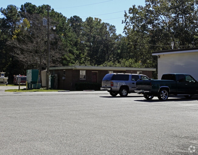
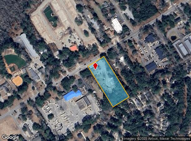
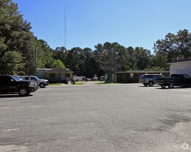
Property Record
3327 Maybank Hwy, Johns Island, SC 29455
NEARBY LISTINGS FOR SALE OR LEASE
Property Detail
3327 Maybank Hwy
Charleston-North Charleston, SC
Whilden
279-00-00-192
SUBDIVISION NAME -WHILDEN DESCRIPTION -LOTS 24 & 25 SECTION F SITE NAME -ST JOHNS FIRE DEPARTMENT
Commercialnec
Charleston
X
South Carolina
45019C0655K
24-25
2025
2.30 AC
2024
West Islands
002107
Charleston/N Charleston
DEMOGRAPHICS near 3327 Maybank Hwy
1 Mile
3 Mile
5 Mile
2024 Total Population
5,284
17,860
35,279
2029 Population
5,679
19,328
37,913
Pop Growth 2024-2029
+ 7.48%
+ 8.22%
+ 7.47%
Average Age
39
40
41
2024 Total Households
2,148
7,303
14,844
HH Growth 2024-2029
+ 7.36%
+ 8.05%
+ 7.23%
Median Household Inc
$94,664
$95,331
$87,330
Avg Household Size
2.40
2.40
2.30
2024 Avg HH Vehicles
2.00
2.00
2.00
Median Home Value
$345,931
$372,118
$378,918
Median Year Built
2008
2010
1996
Nearby Places
Map Layers
Map Styles
 Street
 Aerial
- Restaurants
- Banks
- Shops
- Fitness
- Groceries
PUBLIC TRANSPORTATION
AIRPORT
Charleston AFB/International
DRIVE
WALK
Distance
Charleston AFB/International
37 min
20.7 mi
Freight Ports
Columbus Street Terminal
DRIVE
WALK
Distance
Columbus Street Terminal
19 min
9.9 mi
Nearby Properties
Address
Land Use
TOTAL SIZE
Lot Size
Zoning
Address
Land Use
TOTAL SIZE
Lot Size
Zoning
2,901 SF
4.76 AC
Address
Land Use
TOTAL SIZE
Lot Size
Zoning
55.08 AC
Address
Land Use
TOTAL SIZE
Lot Size
Zoning
34.54 AC
Address
Land Use
TOTAL SIZE
Lot Size
Zoning
10,176 SF
3.02 AC
Address
Land Use
TOTAL SIZE
Lot Size
Zoning
11,625 SF
9.17 AC
Address
Land Use
TOTAL SIZE
Lot Size
Zoning
21,612 SF
14.90 AC
Address
Land Use
TOTAL SIZE
Lot Size
Zoning
9.35 AC
Address
Land Use
TOTAL SIZE
Lot Size
Zoning
960 SF
1.15 AC
Address
Land Use
TOTAL SIZE
Lot Size
Zoning
301.64 AC
Address
Land Use
TOTAL SIZE
Lot Size
Zoning
2,050 SF
3.71 AC
Address
Land Use
TOTAL SIZE
Lot Size
Zoning
2,024 SF
Address
Land Use
TOTAL SIZE
Lot Size
Zoning
950 SF
10.11 AC
Address
Land Use
TOTAL SIZE
Lot Size
Zoning
5,392 SF
2 AC
Address
Land Use
TOTAL SIZE
Lot Size
Zoning
21,612 SF
4 AC
Address
Land Use
TOTAL SIZE
Lot Size
Zoning
2,184 SF
14 AC
Address
Land Use
TOTAL SIZE
Lot Size
Zoning
943 SF
2.81 AC
Address
Land Use
TOTAL SIZE
Lot Size
Zoning
32.40 AC
Address
Land Use
TOTAL SIZE
Lot Size
Zoning
13.71 AC
Address
Land Use
TOTAL SIZE
Lot Size
Zoning
2,815 SF
5.75 AC
Address
Land Use
TOTAL SIZE
Lot Size
Zoning
60,592 SF
9.73 AC
Address
Land Use
TOTAL SIZE
Lot Size
Zoning
Address
Land Use
TOTAL SIZE
Lot Size
Zoning
900 SF
3.23 AC
Address
Land Use
TOTAL SIZE
Lot Size
Zoning
Address
Land Use
TOTAL SIZE
Lot Size
Zoning
Address
Land Use
TOTAL SIZE
Lot Size
Zoning
37,926 SF
7.50 AC
Address
Land Use
TOTAL SIZE
Lot Size
Zoning
Address
Land Use
TOTAL SIZE
Lot Size
Zoning
1,584 SF
2.50 AC
Address
Land Use
TOTAL SIZE
Lot Size
Zoning
13.71 AC
Address
Land Use
TOTAL SIZE
Lot Size
Zoning
Address
Land Use
TOTAL SIZE
Lot Size
Zoning
14.87 AC
The World's #1 Commercial Real Estate Marketplace
Connect with us
© 2025 CoStar Group
The information above has been obtained from sources believed reliable. While we do not doubt its accuracy we have not verified it and make no guarantee, warranty or representation about it. It is your responsibility to independently confirm its accuracy and completeness. Any projections, opinions, assumptions, or estimates used are for example only and do not represent the current or future performance of the property. The value of this transaction to you depends on tax and other factors which should be evaluated by your tax, financial, and legal advisors. You and your advisors should conduct a careful, independent investigation of the property to determine to your satisfaction the suitability of the property for your needs.