Property Record
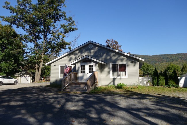
333 Cleverdale Rd, Queensbury, NY 12804


NEARBY LISTINGS FOR SALE OR LEASE
Property Detail
333 Cleverdale Rd
Glens Falls, NY
SANS SOUCI RESTAURANT 124.25'RF 13.-2-2
523400-226-012-0001-043-000-0000
Warren
Restaurantbuilding
New York
2025
43.000
2024
0.27 AC
070701
Warren County
2,232 SF
Albany/Schenectady/Troy
DEMOGRAPHICS near 333 Cleverdale Rd
1 Mile
3 Mile
5 Mile
2024 Total Population
310
1,843
5,220
2029 Population
314
1,894
5,318
Pop Growth 2024-2029
+ 1.29%
+ 2.77%
+ 1.88%
Average Age
55
52
49
2024 Total Households
151
846
2,344
HH Growth 2024-2029
+ 1.32%
+ 2.60%
+ 1.71%
Median Household Inc
$127,678
$106,048
$101,166
Avg Household Size
2.00
2.20
2.20
2024 Avg HH Vehicles
2.00
2.00
2.00
Median Home Value
$485,713
$395,778
$366,082
Median Year Built
1956
1967
1973
Nearby Places
- Restaurants
- Banks
- Shops
- Fitness
- Groceries
SALE & LEASE HISTORY
LISTING DATE
SALE/LEASE

Nov 04, 2016
For Sale
Nearby Properties
Address
Land Use
TOTAL SIZE
Lot Size
Zoning
Address
Land Use
TOTAL SIZE
Lot Size
Zoning
Address
Land Use
TOTAL SIZE
Lot Size
Zoning
5,656 SF
200.20 AC
01 - NOT Z
Address
Land Use
TOTAL SIZE
Lot Size
Zoning
9,643 SF
57.10 AC
RM 1.3
Address
Land Use
TOTAL SIZE
Lot Size
Zoning
5,170 SF
8.74 AC
07
Address
Land Use
TOTAL SIZE
Lot Size
Zoning
11,579 SF
3.30 AC
07 - MIXED
Address
Land Use
TOTAL SIZE
Lot Size
Zoning
9,874 SF
2.60 AC
RCM 1.3
Address
Land Use
TOTAL SIZE
Lot Size
Zoning
442 SF
1.02 AC
WR
Address
Land Use
TOTAL SIZE
Lot Size
Zoning
3,132 SF
1.40 AC
01 - NOT Z
Address
Land Use
TOTAL SIZE
Lot Size
Zoning
8,510 SF
12.25 AC
LC 25
Address
Land Use
TOTAL SIZE
Lot Size
Zoning
4,036 SF
1.30 AC
07 - MIXED
Address
Land Use
TOTAL SIZE
Lot Size
Zoning
1,083 SF
1.10 AC
WR
Address
Land Use
TOTAL SIZE
Lot Size
Zoning
16.14 AC
WR
Address
Land Use
TOTAL SIZE
Lot Size
Zoning
3,005 SF
3.48 AC
RCM 1.3
Address
Land Use
TOTAL SIZE
Lot Size
Zoning
2,133 SF
2.77 AC
RCM 1.3
Address
Land Use
TOTAL SIZE
Lot Size
Zoning
3,916 SF
0.63 AC
01 - NOT Z
Address
Land Use
TOTAL SIZE
Lot Size
Zoning
4,442 SF
1.91 AC
RM 1.3
Address
Land Use
TOTAL SIZE
Lot Size
Zoning
6,960 SF
3.99 AC
WR
Address
Land Use
TOTAL SIZE
Lot Size
Zoning
3,416 SF
1.14 AC
WR
Address
Land Use
TOTAL SIZE
Lot Size
Zoning
3,700 SF
1.40 AC
WR
Address
Land Use
TOTAL SIZE
Lot Size
Zoning
2,988 SF
0.89 AC
WR
Address
Land Use
TOTAL SIZE
Lot Size
Zoning
2,506 SF
1.06 AC
WR
Address
Land Use
TOTAL SIZE
Lot Size
Zoning
4,022 SF
1.06 AC
RM 1.3
Address
Land Use
TOTAL SIZE
Lot Size
Zoning
3,992 SF
2 AC
RCM 1.3
Address
Land Use
TOTAL SIZE
Lot Size
Zoning
1,666 SF
1.02 AC
RM 1.3
Address
Land Use
TOTAL SIZE
Lot Size
Zoning
4,174 SF
1.73 AC
07 - MIXED
Address
Land Use
TOTAL SIZE
Lot Size
Zoning
Address
Land Use
TOTAL SIZE
Lot Size
Zoning
1,660 SF
4.48 AC
RM 1.3
Address
Land Use
TOTAL SIZE
Lot Size
Zoning
1,671 SF
1.84 AC
RM 1.3
Address
Land Use
TOTAL SIZE
Lot Size
Zoning
2,804 SF
2.09 AC
RM 1.3
Address
Land Use
TOTAL SIZE
Lot Size
Zoning
3,906 SF
1.19 AC
07 - MIXED
The World's #1 Commercial Real Estate Marketplace
Connect with us
© 2025 CoStar Group
The information above has been obtained from sources believed reliable. While we do not doubt its accuracy we have not verified it and make no guarantee, warranty or representation about it. It is your responsibility to independently confirm its accuracy and completeness. Any projections, opinions, assumptions, or estimates used are for example only and do not represent the current or future performance of the property. The value of this transaction to you depends on tax and other factors which should be evaluated by your tax, financial, and legal advisors. You and your advisors should conduct a careful, independent investigation of the property to determine to your satisfaction the suitability of the property for your needs.