Property Record
333 E Main St, Ravenna, OH 44266
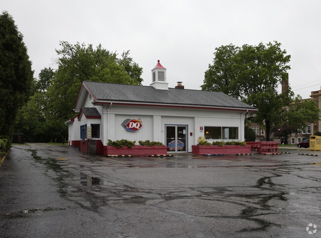


Property Detail
333 E Main St
Akron, OH
TAPPAN 37-38 39 E 1-2 F 173
31-349-04-00-285-000
Portage
Restaurantdrivein
Ohio
B and X Area of moderate flood hazard, usually the area between the limits of the 100-year and 500-year floods.
37-39
2025
0.45 AC
2025
Portage County
600800
Cleveland
1,768 SF
NEARBY LISTINGS FOR SALE OR LEASE
DEMOGRAPHICS near 333 E Main St
1 mile
3 mile
5 mile
2025 Total Population
8,416
22,086
38,973
2030 Population
8,534
22,397
39,547
Pop Growth 2025-2030
+ 1.40%
+ 1.41%
+ 1.47%
Average Age
41
42
41
2025 Total Households
3,920
9,713
16,526
HH Growth 2025-2030
+ 1.33%
+ 1.37%
+ 1.48%
Median Household Inc
$54,077
$57,141
$59,183
Avg Household Size
2.00
2.20
2.20
2025 Avg HH Vehicles
1.00
2.00
2.00
Median Home Value
$147,740
$160,912
$188,417
Median Year Built
1956
1969
1974
Nearby Places
Map Layers
Map Styles
 Street
 Aerial
Layers
 Traffic
 Biking
Places
Listings with unknown addresses are not visible on the map
- Restaurants
- Banks
- Shops
- Fitness
- Groceries
PUBLIC TRANSPORTATION
AIRPORT
Akron-Canton Regional
Drive
Walk
Distance
Akron-Canton Regional
40 min
30.4 mi
Cleveland-Hopkins International
Drive
Walk
Distance
Cleveland-Hopkins International
63 min
44.6 mi
Nearby Properties
Address
Land Use
TOTAL SIZE
Lot Size
Zoning
Address
Land Use
TOTAL SIZE
Lot Size
Zoning
485,791 SF
53.13 AC
Address
Land Use
TOTAL SIZE
Lot Size
Zoning
234,656 SF
23.85 AC
Address
Land Use
TOTAL SIZE
Lot Size
Zoning
161,135 SF
68.79 AC
Address
Land Use
TOTAL SIZE
Lot Size
Zoning
5.75 AC
Address
Land Use
TOTAL SIZE
Lot Size
Zoning
206,254 SF
63.78 AC
Address
Land Use
TOTAL SIZE
Lot Size
Zoning
462,174 SF
33.80 AC
Address
Land Use
TOTAL SIZE
Lot Size
Zoning
350,894 SF
40.36 AC
Address
Land Use
TOTAL SIZE
Lot Size
Zoning
60,343 SF
65.39 AC
Address
Land Use
TOTAL SIZE
Lot Size
Zoning
66,771 SF
6.97 AC
Address
Land Use
TOTAL SIZE
Lot Size
Zoning
33,257 SF
5.57 AC
Address
Land Use
TOTAL SIZE
Lot Size
Zoning
36,912 SF
4.30 AC
Address
Land Use
TOTAL SIZE
Lot Size
Zoning
208,007 SF
14.60 AC
Address
Land Use
TOTAL SIZE
Lot Size
Zoning
138,051 SF
1.96 AC
Address
Land Use
TOTAL SIZE
Lot Size
Zoning
58,213 SF
1.05 AC
Address
Land Use
TOTAL SIZE
Lot Size
Zoning
80,180 SF
0.57 AC
Address
Land Use
TOTAL SIZE
Lot Size
Zoning
47,100 SF
10.77 AC
Address
Land Use
TOTAL SIZE
Lot Size
Zoning
130,941 SF
16.23 AC
Address
Land Use
TOTAL SIZE
Lot Size
Zoning
35,078 SF
7.59 AC
Address
Land Use
TOTAL SIZE
Lot Size
Zoning
97,732 SF
5.20 AC
Address
Land Use
TOTAL SIZE
Lot Size
Zoning
36,652 SF
8.47 AC
Address
Land Use
TOTAL SIZE
Lot Size
Zoning
54,280 SF
5.44 AC
Address
Land Use
TOTAL SIZE
Lot Size
Zoning
166,392 SF
15.10 AC
Address
Land Use
TOTAL SIZE
Lot Size
Zoning
Address
Land Use
TOTAL SIZE
Lot Size
Zoning
80,466 SF
4.42 AC
Address
Land Use
TOTAL SIZE
Lot Size
Zoning
161,000 SF
28.39 AC
Address
Land Use
TOTAL SIZE
Lot Size
Zoning
61,746 SF
12.51 AC
Address
Land Use
TOTAL SIZE
Lot Size
Zoning
69,958 SF
5 AC
Address
Land Use
TOTAL SIZE
Lot Size
Zoning
109,100 SF
12.91 AC
Address
Land Use
TOTAL SIZE
Lot Size
Zoning
69,060 SF
11.88 AC
Address
Land Use
TOTAL SIZE
Lot Size
Zoning
26,531 SF
23.96 AC
The World's #1 Commercial Real Estate Marketplace
Connect with us
© 2026 CoStar Group
The information above has been obtained from sources believed reliable. While we do not doubt its accuracy we have not verified it and make no guarantee, warranty or representation about it. It is your responsibility to independently confirm its accuracy and completeness. Any projections, opinions, assumptions, or estimates used are for example only and do not represent the current or future performance of the property. The value of this transaction to you depends on tax and other factors which should be evaluated by your tax, financial, and legal advisors. You and your advisors should conduct a careful, independent investigation of the property to determine to your satisfaction the suitability of the property for your needs.