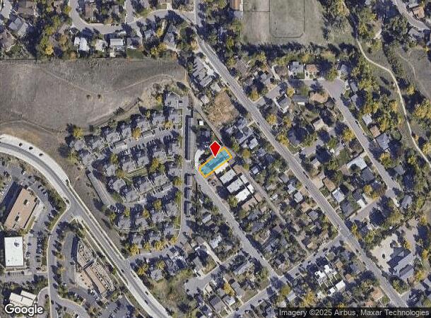
Property Record
333 N Columbine St, Golden, CO 80403

NEARBY LISTINGS FOR SALE OR LEASE
Property Detail
333 N Columbine St
Denver-Aurora-Lakewood, CO
Mckenzie And Martensen Addition
30-281-06-027
SECTION 28 TOWNSHIP 03 RANGE 70 QTR NE SUBDIVISIONCD 509200 SUBDIVISIONNAME MC KENZIE & MARTENSEN ADD TO GOLDEN BLOCK 00A LOT 0004 SIZE: 7000 TRACT VALUE: .161
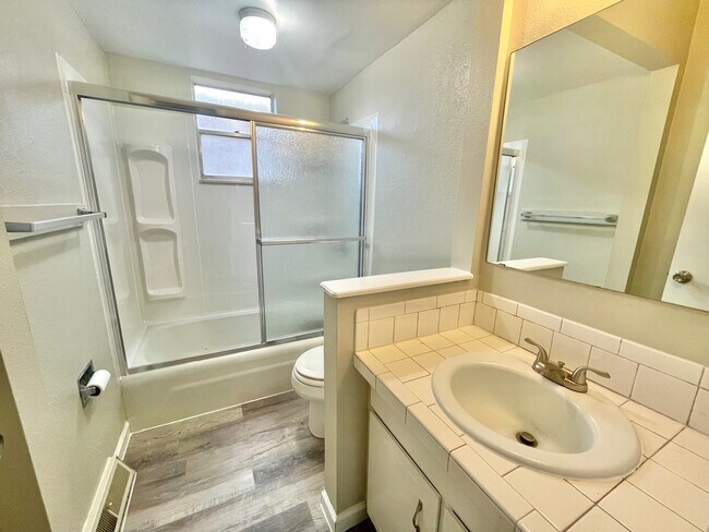
Multifamilydwelling
Jefferson
X
Colorado
08059C0188G
4
2023
0.16 AC
2024
Outer North Jefferson County
009854
Denver
5,460 SF
DEMOGRAPHICS near 333 N Columbine St
1 Mile
3 Mile
5 Mile
2024 Total Population
7,434
21,277
59,261
2029 Population
7,464
21,245
58,809
Pop Growth 2024-2029
+ 0.40%
(0.15%)
(0.76%)
Average Age
41
39
41
2024 Total Households
3,117
7,957
23,253
HH Growth 2024-2029
+ 0.48%
(0.04%)
(0.81%)
Median Household Inc
$94,762
$105,550
$114,450
Avg Household Size
2.30
2.30
2.40
2024 Avg HH Vehicles
2.00
2.00
2.00
Median Home Value
$723,598
$736,415
$718,592
Median Year Built
1990
1985
1988
Nearby Places
Map Layers
Map Styles
 Street
 Aerial
- Restaurants
- Banks
- Shops
- Fitness
- Groceries
PUBLIC TRANSPORTATION
COMMUTER RAIL
Wheat Ridge - Ward Station Track 1 (Union Station to Wheat Ridge Ward Station - Regional Transportation District)
DRIVE
WALK
Distance
Wheat Ridge - Ward Station Track 1 (Union Station to Wheat Ridge Ward Station - Regional Transportation District)
13 min
7.5 mi
Arvada Ridge Station Track 1 (Union Station to Wheat Ridge Ward Station - Regional Transportation District)
DRIVE
WALK
Distance
Arvada Ridge Station Track 1 (Union Station to Wheat Ridge Ward Station - Regional Transportation District)
13 min
8.5 mi
Freight Ports
Tulsa Port Of Catoosa
DRIVE
WALK
Distance
Tulsa Port Of Catoosa
743 min
721.6 mi
SALE & LEASE HISTORY
LISTING DATE
SALE/LEASE

Mar 31, 2023
For Sale
Nearby Properties
Address
Land Use
TOTAL SIZE
Lot Size
Zoning
Address
Land Use
TOTAL SIZE
Lot Size
Zoning
3,357,529 SF
32.87 AC
Address
Land Use
TOTAL SIZE
Lot Size
Zoning
420,482 SF
66.03 AC
Address
Land Use
TOTAL SIZE
Lot Size
Zoning
69,819 SF
1,402.21 AC
R1
Address
Land Use
TOTAL SIZE
Lot Size
Zoning
352,259 SF
17.94 AC
Address
Land Use
TOTAL SIZE
Lot Size
Zoning
589,966 SF
23.48 AC
Address
Land Use
TOTAL SIZE
Lot Size
Zoning
156,531 SF
8.20 AC
Address
Land Use
TOTAL SIZE
Lot Size
Zoning
188,554 SF
33.28 AC
Address
Land Use
TOTAL SIZE
Lot Size
Zoning
353,286 SF
14.49 AC
Address
Land Use
TOTAL SIZE
Lot Size
Zoning
198,147 SF
2.55 AC
Address
Land Use
TOTAL SIZE
Lot Size
Zoning
227,132 SF
11.95 AC
Address
Land Use
TOTAL SIZE
Lot Size
Zoning
1,115,227 SF
84.74 AC
I2
Address
Land Use
TOTAL SIZE
Lot Size
Zoning
192,500 SF
10.97 AC
Address
Land Use
TOTAL SIZE
Lot Size
Zoning
260,325 SF
13.70 AC
Address
Land Use
TOTAL SIZE
Lot Size
Zoning
350,722 SF
73.85 AC
R1
Address
Land Use
TOTAL SIZE
Lot Size
Zoning
454.79 AC
A2
Address
Land Use
TOTAL SIZE
Lot Size
Zoning
391,506 SF
10.02 AC
Address
Land Use
TOTAL SIZE
Lot Size
Zoning
68,773 SF
9.90 AC
Address
Land Use
TOTAL SIZE
Lot Size
Zoning
240,059 SF
58.36 AC
Address
Land Use
TOTAL SIZE
Lot Size
Zoning
190,874 SF
17.36 AC
Address
Land Use
TOTAL SIZE
Lot Size
Zoning
90,663 SF
56.05 AC
Address
Land Use
TOTAL SIZE
Lot Size
Zoning
149,760 SF
8.64 AC
Address
Land Use
TOTAL SIZE
Lot Size
Zoning
64,883 SF
4.74 AC
Address
Land Use
TOTAL SIZE
Lot Size
Zoning
82,432 SF
1.62 AC
Address
Land Use
TOTAL SIZE
Lot Size
Zoning
72,164 SF
8 AC
R2
Address
Land Use
TOTAL SIZE
Lot Size
Zoning
123,448 SF
7.80 AC
Address
Land Use
TOTAL SIZE
Lot Size
Zoning
68,500 SF
5.84 AC
Address
Land Use
TOTAL SIZE
Lot Size
Zoning
173,498 SF
42.86 AC
Address
Land Use
TOTAL SIZE
Lot Size
Zoning
83,450 SF
7.22 AC
Address
Land Use
TOTAL SIZE
Lot Size
Zoning
180,193 SF
4.58 AC
Address
Land Use
TOTAL SIZE
Lot Size
Zoning
64,050 SF
6.07 AC
The World's #1 Commercial Real Estate Marketplace
Connect with us
© 2025 CoStar Group
The information above has been obtained from sources believed reliable. While we do not doubt its accuracy we have not verified it and make no guarantee, warranty or representation about it. It is your responsibility to independently confirm its accuracy and completeness. Any projections, opinions, assumptions, or estimates used are for example only and do not represent the current or future performance of the property. The value of this transaction to you depends on tax and other factors which should be evaluated by your tax, financial, and legal advisors. You and your advisors should conduct a careful, independent investigation of the property to determine to your satisfaction the suitability of the property for your needs.