Property Record
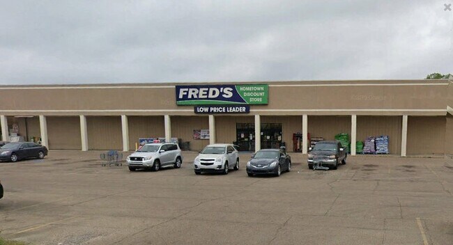
333 N Morrison Blvd, Hammond, LA 70401
Property Detail
333 N Morrison Blvd
01220802
2.038A N23 OF E12 OF NE14 OF NE14 OF SEC 27 T6SR7E HAMMOND B91 P115 B241 P556 B261 P152 B790 P417 B1272 P487 B1595 P177-181-1
Commercialnec
Tangipahoa
A Areas with a 1% annual chance of flooding and a 26% chance of flooding over the life of a 30-year mortgage.
Louisiana
2025
2.04 AC
2025
Louisiana South Area
954104
Other Market Areas
7,200 SF
Hammond, LA
NEARBY LISTINGS FOR SALE OR LEASE
DEMOGRAPHICS near 333 N Morrison Blvd
1 mile
3 mile
5 mile
2025 Total Population
7,024
32,672
64,094
2030 Population
7,331
33,944
66,399
Pop Growth 2025-2030
+ 4.37%
+ 3.89%
+ 3.60%
Average Age
36
36
37
2025 Total Households
2,565
12,563
24,958
HH Growth 2025-2030
+ 4.80%
+ 4.17%
+ 3.81%
Median Household Inc
$37,662
$42,310
$50,906
Avg Household Size
2.30
2.30
2.40
2025 Avg HH Vehicles
2.00
2.00
2.00
Median Home Value
$227,586
$218,970
$228,470
Median Year Built
1986
1988
1994
Nearby Places
Map Layers
Map Styles
 Street
 Aerial
Layers
 Traffic
 Biking
Places
Listings with unknown addresses are not visible on the map
- Restaurants
- Banks
- Shops
- Fitness
- Groceries
PUBLIC TRANSPORTATION
COMMUTER RAIL
Hammond Amtrak Station (City of New Orleans - Amtrak)
Drive
Walk
Distance
Hammond Amtrak Station (City of New Orleans - Amtrak)
3 min
1.9 mi
Freight Ports
Port of Greater Baton Rouge
Drive
Walk
Distance
Port of Greater Baton Rouge
60 min
49.2 mi
SALE & LEASE HISTORY
LISTING DATE
SALE/LEASE

Sep 24, 2020
For Lease
Nearby Properties
Address
Land Use
TOTAL SIZE
Lot Size
Zoning
Address
Land Use
TOTAL SIZE
Lot Size
Zoning
Address
Land Use
TOTAL SIZE
Lot Size
Zoning
1,071,740 SF
67.96 AC
Address
Land Use
TOTAL SIZE
Lot Size
Zoning
1.74 AC
Address
Land Use
TOTAL SIZE
Lot Size
Zoning
154,391 SF
12.30 AC
Address
Land Use
TOTAL SIZE
Lot Size
Zoning
Address
Land Use
TOTAL SIZE
Lot Size
Zoning
170,004 SF
17.06 AC
Address
Land Use
TOTAL SIZE
Lot Size
Zoning
57,600 SF
2.07 AC
Address
Land Use
TOTAL SIZE
Lot Size
Zoning
82,860 SF
11.42 AC
Address
Land Use
TOTAL SIZE
Lot Size
Zoning
0.89 AC
Address
Land Use
TOTAL SIZE
Lot Size
Zoning
24,931 SF
2.67 AC
Address
Land Use
TOTAL SIZE
Lot Size
Zoning
1.56 AC
Address
Land Use
TOTAL SIZE
Lot Size
Zoning
432 SF
14.80 AC
Address
Land Use
TOTAL SIZE
Lot Size
Zoning
127,380 SF
9.70 AC
Address
Land Use
TOTAL SIZE
Lot Size
Zoning
147.07 AC
Address
Land Use
TOTAL SIZE
Lot Size
Zoning
199,026 SF
33 AC
Address
Land Use
TOTAL SIZE
Lot Size
Zoning
73,922 SF
9.99 AC
Address
Land Use
TOTAL SIZE
Lot Size
Zoning
36,000 SF
17.87 AC
Address
Land Use
TOTAL SIZE
Lot Size
Zoning
108,000 SF
9.78 AC
Address
Land Use
TOTAL SIZE
Lot Size
Zoning
22,000 SF
5.56 AC
Address
Land Use
TOTAL SIZE
Lot Size
Zoning
135,524 SF
31.08 AC
Address
Land Use
TOTAL SIZE
Lot Size
Zoning
47,960 SF
9.16 AC
Address
Land Use
TOTAL SIZE
Lot Size
Zoning
96,064 SF
5.03 AC
Address
Land Use
TOTAL SIZE
Lot Size
Zoning
85,430 SF
6.44 AC
Address
Land Use
TOTAL SIZE
Lot Size
Zoning
60,480 SF
7.28 AC
Address
Land Use
TOTAL SIZE
Lot Size
Zoning
20,128 SF
20.77 AC
Address
Land Use
TOTAL SIZE
Lot Size
Zoning
22,507 SF
0.63 AC
Address
Land Use
TOTAL SIZE
Lot Size
Zoning
80,506 SF
13.56 AC
Address
Land Use
TOTAL SIZE
Lot Size
Zoning
43,595 SF
10.17 AC
Address
Land Use
TOTAL SIZE
Lot Size
Zoning
90,605 SF
9.76 AC
Address
Land Use
TOTAL SIZE
Lot Size
Zoning
4,664 SF
8.14 AC
The World's #1 Commercial Real Estate Marketplace
Connect with us
© 2026 CoStar Group
The information above has been obtained from sources believed reliable. While we do not doubt its accuracy we have not verified it and make no guarantee, warranty or representation about it. It is your responsibility to independently confirm its accuracy and completeness. Any projections, opinions, assumptions, or estimates used are for example only and do not represent the current or future performance of the property. The value of this transaction to you depends on tax and other factors which should be evaluated by your tax, financial, and legal advisors. You and your advisors should conduct a careful, independent investigation of the property to determine to your satisfaction the suitability of the property for your needs.