Property Record
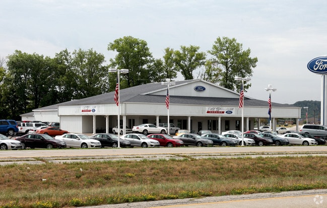
333 Robert Curry Dr, Martinsville, IN 46151


NEARBY LISTINGS FOR SALE OR LEASE
Property Detail
333 Robert Curry Dr
55-13-03-370-001.000-021
S3 T11 R1E PT SW SW 5.246 A
Autorepair
Morgan
A
Indiana
18109C0266F
5.25 AC
2024
Morgan County
2024
Indianapolis
510704
Indianapolis-Carmel-Anderson, IN
17,545 SF
DEMOGRAPHICS near 333 Robert Curry Dr
1 Mile
3 Mile
5 Mile
2024 Total Population
6,176
14,479
21,013
2029 Population
6,278
14,763
21,424
Pop Growth 2024-2029
+ 1.65%
+ 1.96%
+ 1.96%
Average Age
39
41
42
2024 Total Households
2,524
5,904
8,381
HH Growth 2024-2029
+ 1.66%
+ 1.98%
+ 1.94%
Median Household Inc
$50,536
$54,878
$61,998
Avg Household Size
2.30
2.30
2.40
2024 Avg HH Vehicles
2.00
2.00
2.00
Median Home Value
$109,251
$141,821
$178,109
Median Year Built
1963
1966
1972
Nearby Places
Map Layers
Map Styles
 Street
 Aerial
- Restaurants
- Banks
- Shops
- Fitness
- Groceries
PUBLIC TRANSPORTATION
AIRPORT
Indianapolis International
DRIVE
WALK
Distance
Indianapolis International
45 min
26.7 mi
Nearby Properties
Address
Land Use
TOTAL SIZE
Lot Size
Zoning
Address
Land Use
TOTAL SIZE
Lot Size
Zoning
165,182 SF
11.70 AC
Address
Land Use
TOTAL SIZE
Lot Size
Zoning
59,126 SF
6.78 AC
Address
Land Use
TOTAL SIZE
Lot Size
Zoning
35,704 SF
9.26 AC
Address
Land Use
TOTAL SIZE
Lot Size
Zoning
86,173 SF
7.59 AC
Address
Land Use
TOTAL SIZE
Lot Size
Zoning
203,634 SF
26.06 AC
Address
Land Use
TOTAL SIZE
Lot Size
Zoning
16,270 SF
7.10 AC
Address
Land Use
TOTAL SIZE
Lot Size
Zoning
44,380 SF
8 AC
Address
Land Use
TOTAL SIZE
Lot Size
Zoning
20,600 SF
13.83 AC
Address
Land Use
TOTAL SIZE
Lot Size
Zoning
41,364 SF
1.82 AC
Address
Land Use
TOTAL SIZE
Lot Size
Zoning
197,739 SF
16.55 AC
Address
Land Use
TOTAL SIZE
Lot Size
Zoning
Address
Land Use
TOTAL SIZE
Lot Size
Zoning
10,650 SF
5.70 AC
Address
Land Use
TOTAL SIZE
Lot Size
Zoning
14,476 SF
2.13 AC
Address
Land Use
TOTAL SIZE
Lot Size
Zoning
Address
Land Use
TOTAL SIZE
Lot Size
Zoning
30,060 SF
5.85 AC
Address
Land Use
TOTAL SIZE
Lot Size
Zoning
34,309 SF
3.39 AC
Address
Land Use
TOTAL SIZE
Lot Size
Zoning
11,272 SF
3.31 AC
Address
Land Use
TOTAL SIZE
Lot Size
Zoning
13,832 SF
5 AC
Address
Land Use
TOTAL SIZE
Lot Size
Zoning
42,133 SF
1.10 AC
Address
Land Use
TOTAL SIZE
Lot Size
Zoning
25,004 SF
0.67 AC
Address
Land Use
TOTAL SIZE
Lot Size
Zoning
3,672 SF
8.10 AC
Address
Land Use
TOTAL SIZE
Lot Size
Zoning
Address
Land Use
TOTAL SIZE
Lot Size
Zoning
9,603 SF
1.83 AC
Address
Land Use
TOTAL SIZE
Lot Size
Zoning
Address
Land Use
TOTAL SIZE
Lot Size
Zoning
12,119 SF
1.49 AC
Address
Land Use
TOTAL SIZE
Lot Size
Zoning
23,483 SF
6.57 AC
Address
Land Use
TOTAL SIZE
Lot Size
Zoning
12,237 SF
2.79 AC
Address
Land Use
TOTAL SIZE
Lot Size
Zoning
0.87 AC
Address
Land Use
TOTAL SIZE
Lot Size
Zoning
28,700 SF
2.94 AC
The World's #1 Commercial Real Estate Marketplace
Connect with us
© 2026 CoStar Group
The information above has been obtained from sources believed reliable. While we do not doubt its accuracy we have not verified it and make no guarantee, warranty or representation about it. It is your responsibility to independently confirm its accuracy and completeness. Any projections, opinions, assumptions, or estimates used are for example only and do not represent the current or future performance of the property. The value of this transaction to you depends on tax and other factors which should be evaluated by your tax, financial, and legal advisors. You and your advisors should conduct a careful, independent investigation of the property to determine to your satisfaction the suitability of the property for your needs.