Property Record
333 Se 1St Ave, Homestead, FL 33034
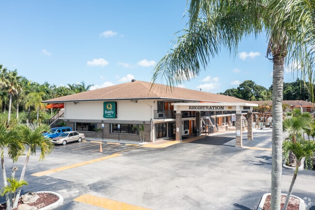
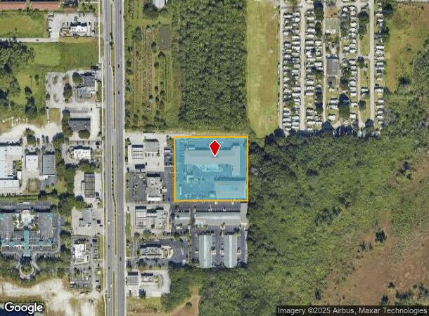
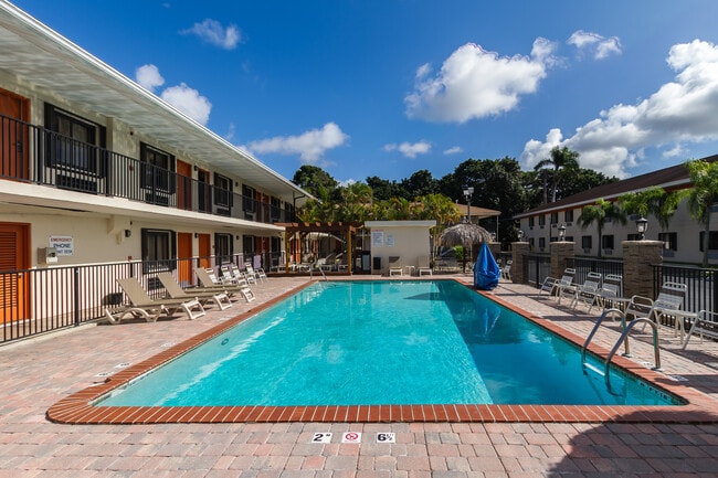
This Property Is For Sale
NEARBY LISTINGS FOR SALE OR LEASE
Property Detail
333 Se 1St Ave
Miami-Miami Beach-Kendall, FL
Miami Land & Dev Co
16-7930-001-0300
30 57 39 3.17 AC MIAMI LAND & DEV CO PB 5-10 N1/4 OF TRS 10 & 11 LESS S127FT OF N152FT OF W240.5FT OF TR 10 & LESS W58FT FOR R/W SR 5 & LESS PORT BEG X OF ELY R/W L OF STATE RO 5 & S/L OF N1/4 OF TR 10 TH N 00 DEG W 150.74FT N89 DEG E248FT S00 DEG E
Motel
Miami/Dade
AE
Florida
12086C0730L
1
2024
3.17 AC
2025
South Dade
011412
South Florida
57,564 SF
DEMOGRAPHICS near 333 Se 1St Ave
1 Mile
3 Mile
5 Mile
2024 Total Population
8,351
78,800
132,046
2029 Population
8,221
77,454
129,449
Pop Growth 2024-2029
(1.56%)
(1.71%)
(1.97%)
Average Age
35
35
36
2024 Total Households
2,630
23,296
38,710
HH Growth 2024-2029
(1.90%)
(2.17%)
(2.42%)
Median Household Inc
$48,600
$47,641
$53,817
Avg Household Size
3.10
3.10
3.20
2024 Avg HH Vehicles
2.00
2.00
2.00
Median Home Value
$223,786
$266,081
$307,366
Median Year Built
1999
1996
1996
Nearby Places
- Restaurants
- Banks
- Shops
- Fitness
- Groceries
PUBLIC TRANSPORTATION
AIRPORT
Miami International
DRIVE
WALK
Distance
Miami International
45 min
32.2 mi
Freight Ports
Port of Miami
DRIVE
WALK
Distance
Port of Miami
54 min
39.3 mi
Nearby Properties
Address
Land Use
TOTAL SIZE
Lot Size
Zoning
Address
Land Use
TOTAL SIZE
Lot Size
Zoning
149,022 SF
34.85 AC
9300
Address
Land Use
TOTAL SIZE
Lot Size
Zoning
216,282 SF
20.04 AC
6300
Address
Land Use
TOTAL SIZE
Lot Size
Zoning
183,244 SF
4 AC
6500
Address
Land Use
TOTAL SIZE
Lot Size
Zoning
304,629 SF
36.34 AC
0100
Address
Land Use
TOTAL SIZE
Lot Size
Zoning
252,526 SF
29.86 AC
6000
Address
Land Use
TOTAL SIZE
Lot Size
Zoning
333,636 SF
77.26 AC
8900
Address
Land Use
TOTAL SIZE
Lot Size
Zoning
169,474 SF
5.76 AC
6300
Address
Land Use
TOTAL SIZE
Lot Size
Zoning
278,375 SF
20.15 AC
7000
Address
Land Use
TOTAL SIZE
Lot Size
Zoning
213,133 SF
138.20 AC
9300
Address
Land Use
TOTAL SIZE
Lot Size
Zoning
208,951 SF
20 AC
6300
Address
Land Use
TOTAL SIZE
Lot Size
Zoning
282,264 SF
52.46 AC
8900
Address
Land Use
TOTAL SIZE
Lot Size
Zoning
409,347 SF
33.88 AC
3000
Address
Land Use
TOTAL SIZE
Lot Size
Zoning
322,425 SF
16.40 AC
5700
Address
Land Use
TOTAL SIZE
Lot Size
Zoning
203,528 SF
3.73 AC
6000
Address
Land Use
TOTAL SIZE
Lot Size
Zoning
234,124 SF
23.35 AC
6000
Address
Land Use
TOTAL SIZE
Lot Size
Zoning
374,632 SF
23.28 AC
3000
Address
Land Use
TOTAL SIZE
Lot Size
Zoning
172,811 SF
22.02 AC
9300
Address
Land Use
TOTAL SIZE
Lot Size
Zoning
24.37 AC
6600
Address
Land Use
TOTAL SIZE
Lot Size
Zoning
96,971 SF
3.08 AC
6500
Address
Land Use
TOTAL SIZE
Lot Size
Zoning
146,483 SF
20 AC
8900
Address
Land Use
TOTAL SIZE
Lot Size
Zoning
165,761 SF
6.72 AC
6300
Address
Land Use
TOTAL SIZE
Lot Size
Zoning
431,236 SF
2.74 AC
9450
Address
Land Use
TOTAL SIZE
Lot Size
Zoning
84,500 SF
2.90 AC
7000
Address
Land Use
TOTAL SIZE
Lot Size
Zoning
177,485 SF
14.71 AC
6300
Address
Land Use
TOTAL SIZE
Lot Size
Zoning
122,076 SF
4.87 AC
9300
Address
Land Use
TOTAL SIZE
Lot Size
Zoning
102,707 SF
3.63 AC
9200
Address
Land Use
TOTAL SIZE
Lot Size
Zoning
126,637 SF
9.70 AC
6500
Address
Land Use
TOTAL SIZE
Lot Size
Zoning
49.95 AC
9300
The World's #1 Commercial Real Estate Marketplace
Connect with us
© 2025 CoStar Group
The information above has been obtained from sources believed reliable. While we do not doubt its accuracy we have not verified it and make no guarantee, warranty or representation about it. It is your responsibility to independently confirm its accuracy and completeness. Any projections, opinions, assumptions, or estimates used are for example only and do not represent the current or future performance of the property. The value of this transaction to you depends on tax and other factors which should be evaluated by your tax, financial, and legal advisors. You and your advisors should conduct a careful, independent investigation of the property to determine to your satisfaction the suitability of the property for your needs.