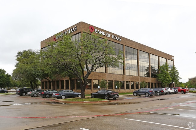
Property Record
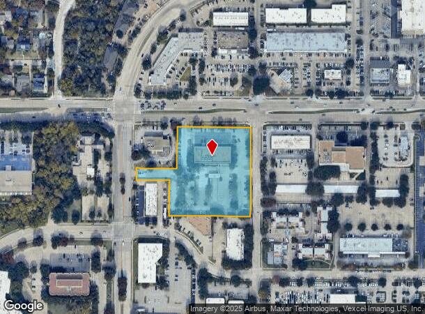
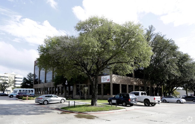
333 W Campbell Rd, Richardson, TX 75080
NEARBY LISTINGS FOR SALE OR LEASE
Property Detail
333 W Campbell Rd
42028620000000000
Canyon Creek Bank Rep
Officebuilding
CANYON CREEK BANK REP ACS 3.768 VOL92121/1317 DD061792 CO-DALLAS 0286200000000 34202862000
X
Dallas
48085C0505K
Texas
2024
3.77 AC
2025
Richardson
019211
Dallas/Ft Worth
47,813 SF
Dallas-Fort Worth-Arlington, TX
DEMOGRAPHICS near 333 W Campbell Rd
1 Mile
3 Mile
5 Mile
2024 Total Population
10,170
116,959
388,367
2029 Population
10,421
125,227
416,659
Pop Growth 2024-2029
+ 2.47%
+ 7.07%
+ 7.28%
Average Age
38
38
38
2024 Total Households
4,576
46,884
151,745
HH Growth 2024-2029
+ 2.78%
+ 8.54%
+ 8.01%
Median Household Inc
$86,620
$81,479
$69,331
Avg Household Size
2.10
2.30
2.40
2024 Avg HH Vehicles
2.00
2.00
2.00
Median Home Value
$436,769
$340,650
$331,948
Median Year Built
1989
1982
1981
Nearby Places
Map Layers
Map Styles
 Street
 Aerial
- Restaurants
- Banks
- Shops
- Fitness
- Groceries
PUBLIC TRANSPORTATION
AIRPORT
Dallas Love Field
DRIVE
WALK
Distance
Dallas Love Field
24 min
16.8 mi
Dallas-Fort Worth International
DRIVE
WALK
Distance
Dallas-Fort Worth International
32 min
25.7 mi
SALE & LEASE HISTORY
LISTING DATE
SALE/LEASE

Sep 25, 2016
For Lease
Nearby Properties
Address
Land Use
TOTAL SIZE
Lot Size
Zoning
Address
Land Use
TOTAL SIZE
Lot Size
Zoning
1,049,441 SF
Address
Land Use
TOTAL SIZE
Lot Size
Zoning
1,283,376 SF
11.62 AC
Address
Land Use
TOTAL SIZE
Lot Size
Zoning
1,050,550 SF
18.24 AC
Address
Land Use
TOTAL SIZE
Lot Size
Zoning
1,614,550 SF
77.76 AC
SFR
Address
Land Use
TOTAL SIZE
Lot Size
Zoning
641,243 SF
20.67 AC
Z109
Address
Land Use
TOTAL SIZE
Lot Size
Zoning
766,245 SF
49.94 AC
COMM
Address
Land Use
TOTAL SIZE
Lot Size
Zoning
567,715 SF
4.75 AC
LC/PD-A
Address
Land Use
TOTAL SIZE
Lot Size
Zoning
1,105,509 SF
92.46 AC
A
Address
Land Use
TOTAL SIZE
Lot Size
Zoning
686,032 SF
9 AC
R2000
Address
Land Use
TOTAL SIZE
Lot Size
Zoning
369,694 SF
Address
Land Use
TOTAL SIZE
Lot Size
Zoning
384,538 SF
2.63 AC
LI-1
Address
Land Use
TOTAL SIZE
Lot Size
Zoning
490,285 SF
29.66 AC
LC/PD-A
Address
Land Use
TOTAL SIZE
Lot Size
Zoning
445,071 SF
107.94 AC
2493-A TO-
Address
Land Use
TOTAL SIZE
Lot Size
Zoning
595,150 SF
17.20 AC
MF-H
Address
Land Use
TOTAL SIZE
Lot Size
Zoning
487,093 SF
6.28 AC
MF-E
Address
Land Use
TOTAL SIZE
Lot Size
Zoning
394,287 SF
14.96 AC
Address
Land Use
TOTAL SIZE
Lot Size
Zoning
507,693 SF
32.50 AC
MFL
Address
Land Use
TOTAL SIZE
Lot Size
Zoning
520,713 SF
8.03 AC
Address
Land Use
TOTAL SIZE
Lot Size
Zoning
393,416 SF
Address
Land Use
TOTAL SIZE
Lot Size
Zoning
377,152 SF
3.91 AC
O-S
Address
Land Use
TOTAL SIZE
Lot Size
Zoning
428,956 SF
18.76 AC
Z291
Address
Land Use
TOTAL SIZE
Lot Size
Zoning
509,566 SF
34.05 AC
PD
Address
Land Use
TOTAL SIZE
Lot Size
Zoning
289,093 SF
8.87 AC
R/O-2
Address
Land Use
TOTAL SIZE
Lot Size
Zoning
284,830 SF
2.98 AC
Address
Land Use
TOTAL SIZE
Lot Size
Zoning
386,448 SF
Address
Land Use
TOTAL SIZE
Lot Size
Zoning
324,000 SF
6.67 AC
O-S
Address
Land Use
TOTAL SIZE
Lot Size
Zoning
129,810 SF
14.93 AC
Z236
Address
Land Use
TOTAL SIZE
Lot Size
Zoning
421,532 SF
4.29 AC
Address
Land Use
TOTAL SIZE
Lot Size
Zoning
795,714 SF
5.36 AC
Z109
The World's #1 Commercial Real Estate Marketplace
Connect with us
© 2025 CoStar Group
The information above has been obtained from sources believed reliable. While we do not doubt its accuracy we have not verified it and make no guarantee, warranty or representation about it. It is your responsibility to independently confirm its accuracy and completeness. Any projections, opinions, assumptions, or estimates used are for example only and do not represent the current or future performance of the property. The value of this transaction to you depends on tax and other factors which should be evaluated by your tax, financial, and legal advisors. You and your advisors should conduct a careful, independent investigation of the property to determine to your satisfaction the suitability of the property for your needs.