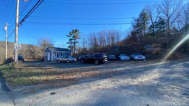
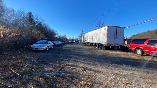
Property Record
333 Warwick Tpke, Hewitt, NJ 07421

Property Detail
333 Warwick Tpke
New York-Jersey City-White Plains, NY-NJ
Passaic
15-02802-0000-00003
New Jersey
Vehiclerentalsvehiclesales
3
B and X Area of moderate flood hazard, usually the area between the limits of the 100-year and 500-year floods.
2.70 AC
2024
Upper Suburban Passaic
2025
Northern New Jersey
256801
NEARBY LISTINGS FOR SALE OR LEASE
DEMOGRAPHICS near 333 Warwick Tpke
1 mile
3 mile
5 mile
2025 Total Population
1,814
12,098
28,711
2030 Population
1,934
12,816
30,039
Pop Growth 2025-2030
+ 6.62%
+ 5.93%
+ 4.63%
Average Age
44
45
45
2025 Total Households
719
4,845
11,198
HH Growth 2025-2030
+ 6.54%
+ 5.86%
+ 4.74%
Median Household Inc
$116,121
$118,052
$114,490
Avg Household Size
2.50
2.40
2.50
2025 Avg HH Vehicles
2.00
2.00
2.00
Median Home Value
$383,423
$386,531
$381,769
Median Year Built
1970
1973
1973
Nearby Places
Map Layers
Map Styles
 Street
 Aerial
Layers
 Traffic
 Biking
Places
Listings with unknown addresses are not visible on the map
- Restaurants
- Banks
- Shops
- Fitness
- Groceries
PUBLIC TRANSPORTATION
AIRPORT
New York Stewart International
Drive
Walk
Distance
New York Stewart International
60 min
35.4 mi
Westchester County
Drive
Walk
Distance
Westchester County
70 min
46.9 mi
Newark Liberty International
Drive
Walk
Distance
Newark Liberty International
62 min
48.4 mi
Freight Ports
Maher Terminal
Drive
Walk
Distance
Maher Terminal
69 min
48.3 mi
SALE & LEASE HISTORY
LISTING DATE
SALE/LEASE

Nov 10, 2022
For Lease
Nearby Properties
Address
Land Use
TOTAL SIZE
Lot Size
Zoning
Address
Land Use
TOTAL SIZE
Lot Size
Zoning
Address
Land Use
TOTAL SIZE
Lot Size
Zoning
1,980.99 AC
Address
Land Use
TOTAL SIZE
Lot Size
Zoning
12.50 AC
Address
Land Use
TOTAL SIZE
Lot Size
Zoning
1,486.31 AC
Address
Land Use
TOTAL SIZE
Lot Size
Zoning
1,854.80 AC
Address
Land Use
TOTAL SIZE
Lot Size
Zoning
Address
Land Use
TOTAL SIZE
Lot Size
Zoning
2,056 SF
2,729.93 AC
Address
Land Use
TOTAL SIZE
Lot Size
Zoning
Address
Land Use
TOTAL SIZE
Lot Size
Zoning
Address
Land Use
TOTAL SIZE
Lot Size
Zoning
1,344 SF
36.33 AC
Address
Land Use
TOTAL SIZE
Lot Size
Zoning
15 AC
Address
Land Use
TOTAL SIZE
Lot Size
Zoning
Address
Land Use
TOTAL SIZE
Lot Size
Zoning
Address
Land Use
TOTAL SIZE
Lot Size
Zoning
Address
Land Use
TOTAL SIZE
Lot Size
Zoning
276.91 AC
Address
Land Use
TOTAL SIZE
Lot Size
Zoning
Address
Land Use
TOTAL SIZE
Lot Size
Zoning
220.45 AC
Address
Land Use
TOTAL SIZE
Lot Size
Zoning
225.80 AC
Address
Land Use
TOTAL SIZE
Lot Size
Zoning
6.60 AC
Address
Land Use
TOTAL SIZE
Lot Size
Zoning
1,301 SF
1.51 AC
Address
Land Use
TOTAL SIZE
Lot Size
Zoning
Address
Land Use
TOTAL SIZE
Lot Size
Zoning
Address
Land Use
TOTAL SIZE
Lot Size
Zoning
Address
Land Use
TOTAL SIZE
Lot Size
Zoning
25,485 SF
10.23 AC
Address
Land Use
TOTAL SIZE
Lot Size
Zoning
3.25 AC
Address
Land Use
TOTAL SIZE
Lot Size
Zoning
Address
Land Use
TOTAL SIZE
Lot Size
Zoning
1.66 AC
Address
Land Use
TOTAL SIZE
Lot Size
Zoning
17,400 SF
6.04 AC
LI
Address
Land Use
TOTAL SIZE
Lot Size
Zoning
1,812 SF
219.25 AC
LI
Address
Land Use
TOTAL SIZE
Lot Size
Zoning
The World's #1 Commercial Real Estate Marketplace
Connect with us
© 2026 CoStar Group
The information above has been obtained from sources believed reliable. While we do not doubt its accuracy we have not verified it and make no guarantee, warranty or representation about it. It is your responsibility to independently confirm its accuracy and completeness. Any projections, opinions, assumptions, or estimates used are for example only and do not represent the current or future performance of the property. The value of this transaction to you depends on tax and other factors which should be evaluated by your tax, financial, and legal advisors. You and your advisors should conduct a careful, independent investigation of the property to determine to your satisfaction the suitability of the property for your needs.