Property Record
3330 Highway 155, Locust Grove, GA 30248

NEARBY LISTINGS FOR SALE OR LEASE
-
-
View all Locust Grove listings for sale on LoopNet.com
Property Detail
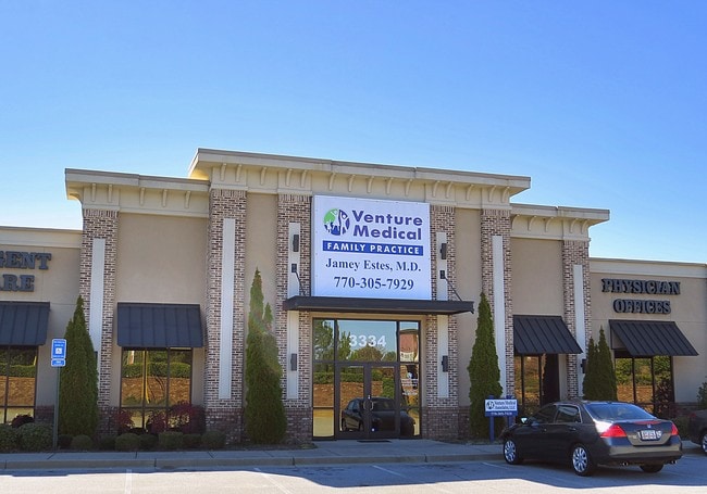
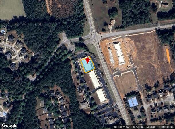
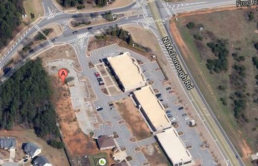
3330 Highway 155
Atlanta-Sandy Springs-Roswell, GA
Town Cntr@Heron B Co
0080-01-024-005
COMMERCIAL CONDOS
Officebuilding
Henry
X
Georgia
13255C0085E
174
2025
0.40 AC
2025
South Clayton/Henry Cnty
070411
Atlanta
10,733 SF
DEMOGRAPHICS near 3330 Highway 155
1 mile
3 mile
5 mile
2024 Total Population
2,855
10,811
40,250
2029 Population
3,130
11,847
44,188
Pop Growth 2024-2029
+ 9.63%
+ 9.58%
+ 9.78%
Average Age
38
39
39
2024 Total Households
877
3,606
14,248
HH Growth 2024-2029
+ 9.58%
+ 9.57%
+ 9.71%
Median Household Inc
$98,244
$90,178
$78,632
Avg Household Size
3.10
3.00
2.80
2024 Avg HH Vehicles
2.00
2.00
2.00
Median Home Value
$311,675
$274,154
$237,757
Median Year Built
2004
2004
2005
Nearby Places
Map Layers
Map Styles
 Street
 Aerial
Transit
 Traffic
 Biking
Places
Listings with unknown addresses are not visible on the map
- Restaurants
- Banks
- Shops
- Fitness
- Groceries
PUBLIC TRANSPORTATION
AIRPORT
Hartsfield - Jackson Atlanta International
Drive
Walk
Distance
Hartsfield - Jackson Atlanta International
40 min
30.0 mi
SALE & LEASE HISTORY
LISTING DATE
SALE/LEASE

Sep 24, 2016
For Sale
Sep 12, 2019
For Sale
Feb 15, 2017
For Lease
Feb 15, 2017
For Sale
Nearby Properties
Address
Land Use
TOTAL SIZE
Lot Size
Zoning
Address
Land Use
TOTAL SIZE
Lot Size
Zoning
1,010,600 SF
78.40 AC
M1
Address
Land Use
TOTAL SIZE
Lot Size
Zoning
1,126,973 SF
88.82 AC
M1
Address
Land Use
TOTAL SIZE
Lot Size
Zoning
1,038,514 SF
141.54 AC
M1
Address
Land Use
TOTAL SIZE
Lot Size
Zoning
4,307,236 SF
66.85 AC
M1
Address
Land Use
TOTAL SIZE
Lot Size
Zoning
7,005,327 SF
56.89 AC
M1
Address
Land Use
TOTAL SIZE
Lot Size
Zoning
427,200 SF
67.92 AC
PD
Address
Land Use
TOTAL SIZE
Lot Size
Zoning
3,060,922 SF
27.99 AC
M1
Address
Land Use
TOTAL SIZE
Lot Size
Zoning
1,352,289 SF
25.38 AC
M1
Address
Land Use
TOTAL SIZE
Lot Size
Zoning
40,728 SF
39.42 AC
Address
Land Use
TOTAL SIZE
Lot Size
Zoning
614,100 SF
22.72 AC
M1
Address
Land Use
TOTAL SIZE
Lot Size
Zoning
166,447 SF
66.49 AC
Address
Land Use
TOTAL SIZE
Lot Size
Zoning
6,720 SF
1,081.34 AC
Address
Land Use
TOTAL SIZE
Lot Size
Zoning
155,664 SF
13.35 AC
C
Address
Land Use
TOTAL SIZE
Lot Size
Zoning
131,498 SF
86 AC
RA
Address
Land Use
TOTAL SIZE
Lot Size
Zoning
181,392 SF
20.01 AC
M1
Address
Land Use
TOTAL SIZE
Lot Size
Zoning
82,789 SF
2.85 AC
C3
Address
Land Use
TOTAL SIZE
Lot Size
Zoning
928 SF
94.14 AC
C3
Address
Land Use
TOTAL SIZE
Lot Size
Zoning
40,105 SF
4.33 AC
C3
Address
Land Use
TOTAL SIZE
Lot Size
Zoning
102,552 SF
14.64 AC
Address
Land Use
TOTAL SIZE
Lot Size
Zoning
684,314 SF
76.70 AC
Address
Land Use
TOTAL SIZE
Lot Size
Zoning
65,436 SF
2.55 AC
Address
Land Use
TOTAL SIZE
Lot Size
Zoning
39,393 SF
1.22 AC
Address
Land Use
TOTAL SIZE
Lot Size
Zoning
50.13 AC
Address
Land Use
TOTAL SIZE
Lot Size
Zoning
33,582 SF
3.92 AC
C3
Address
Land Use
TOTAL SIZE
Lot Size
Zoning
928 SF
31.25 AC
C2
Address
Land Use
TOTAL SIZE
Lot Size
Zoning
58,230 SF
3 AC
M1
The World's #1 Commercial Real Estate Marketplace
Connect with us
© 2026 CoStar Group
The information above has been obtained from sources believed reliable. While we do not doubt its accuracy we have not verified it and make no guarantee, warranty or representation about it. It is your responsibility to independently confirm its accuracy and completeness. Any projections, opinions, assumptions, or estimates used are for example only and do not represent the current or future performance of the property. The value of this transaction to you depends on tax and other factors which should be evaluated by your tax, financial, and legal advisors. You and your advisors should conduct a careful, independent investigation of the property to determine to your satisfaction the suitability of the property for your needs.