Property Record
3333 Beverly Rd, Hoffman Estates, IL 60179
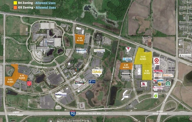

This Property Is For Sale
Property Detail
3333 Beverly Rd
Chicago-Naperville-Elgin, IL-IN
Cook
01-32-201-008-0000
Illinois
Vacantlandnec
1a
B and X Area of moderate flood hazard, usually the area between the limits of the 100-year and 500-year floods.
3.85 AC
2023
Schaumburg Area
2025
Chicago
804204
NEARBY LISTINGS FOR SALE OR LEASE
DEMOGRAPHICS near 3333 Beverly Rd
1 mile
3 mile
5 mile
2025 Total Population
593
23,785
162,374
2030 Population
596
23,908
163,207
Pop Growth 2025-2030
+ 0.51%
+ 0.52%
+ 0.51%
Average Age
43
41
39
2025 Total Households
185
7,949
55,023
HH Growth 2025-2030
0.00%
+ 0.40%
+ 0.41%
Median Household Inc
$176,351
$120,514
$90,560
Avg Household Size
3.20
2.90
2.80
2025 Avg HH Vehicles
2.00
2.00
2.00
Median Home Value
$488,157
$381,685
$275,013
Median Year Built
1997
1993
1977
Nearby Places
Map Layers
Map Styles
 Street
 Aerial
Transit
 Traffic
 Biking
Places
Listings with unknown addresses are not visible on the map
- Restaurants
- Banks
- Shops
- Fitness
- Groceries
PUBLIC TRANSPORTATION
COMMUTER RAIL
Elgin Station (Milwaukee District West Line - Northeast Illinois Regional Commuter Railroad (Metra))
Drive
Walk
Distance
Elgin Station (Milwaukee District West Line - Northeast Illinois Regional Commuter Railroad (Metra))
12 min
6.6 mi
National Street Station (Milwaukee District West Line - Northeast Illinois Regional Commuter Railroad (Metra))
Drive
Walk
Distance
National Street Station (Milwaukee District West Line - Northeast Illinois Regional Commuter Railroad (Metra))
14 min
7.3 mi
AIRPORT
Chicago O'Hare International
Drive
Walk
Distance
Chicago O'Hare International
29 min
22.9 mi
Freight Ports
Port Milwaukee
Drive
Walk
Distance
Port Milwaukee
104 min
78.1 mi
Nearby Properties
Address
Land Use
TOTAL SIZE
Lot Size
Zoning
Address
Land Use
TOTAL SIZE
Lot Size
Zoning
51,091 SF
3.52 AC
Address
Land Use
TOTAL SIZE
Lot Size
Zoning
258,989 SF
27.84 AC
Address
Land Use
TOTAL SIZE
Lot Size
Zoning
Address
Land Use
TOTAL SIZE
Lot Size
Zoning
Address
Land Use
TOTAL SIZE
Lot Size
Zoning
71,725 SF
49.30 AC
Address
Land Use
TOTAL SIZE
Lot Size
Zoning
Address
Land Use
TOTAL SIZE
Lot Size
Zoning
154,483 SF
10 AC
Address
Land Use
TOTAL SIZE
Lot Size
Zoning
Address
Land Use
TOTAL SIZE
Lot Size
Zoning
201,539 SF
15.66 AC
Address
Land Use
TOTAL SIZE
Lot Size
Zoning
Address
Land Use
TOTAL SIZE
Lot Size
Zoning
227,125 SF
2.79 AC
Address
Land Use
TOTAL SIZE
Lot Size
Zoning
120,075 SF
10.70 AC
Address
Land Use
TOTAL SIZE
Lot Size
Zoning
1.30 AC
Address
Land Use
TOTAL SIZE
Lot Size
Zoning
Address
Land Use
TOTAL SIZE
Lot Size
Zoning
23.97 AC
Address
Land Use
TOTAL SIZE
Lot Size
Zoning
1.36 AC
Address
Land Use
TOTAL SIZE
Lot Size
Zoning
7,200 SF
16.86 AC
Address
Land Use
TOTAL SIZE
Lot Size
Zoning
2,415,708 SF
124.06 AC
Address
Land Use
TOTAL SIZE
Lot Size
Zoning
123,875 SF
10.91 AC
Address
Land Use
TOTAL SIZE
Lot Size
Zoning
102,643 SF
10.54 AC
Address
Land Use
TOTAL SIZE
Lot Size
Zoning
110,400 SF
5 AC
Address
Land Use
TOTAL SIZE
Lot Size
Zoning
109,316 SF
4.73 AC
Address
Land Use
TOTAL SIZE
Lot Size
Zoning
44.10 AC
Address
Land Use
TOTAL SIZE
Lot Size
Zoning
90,640 SF
18.99 AC
Address
Land Use
TOTAL SIZE
Lot Size
Zoning
1,352 SF
1.27 AC
Address
Land Use
TOTAL SIZE
Lot Size
Zoning
69,221 SF
3.22 AC
Address
Land Use
TOTAL SIZE
Lot Size
Zoning
49,476 SF
4.70 AC
Address
Land Use
TOTAL SIZE
Lot Size
Zoning
109,180 SF
11.91 AC
Address
Land Use
TOTAL SIZE
Lot Size
Zoning
The World's #1 Commercial Real Estate Marketplace
Connect with us
© 2026 CoStar Group
The information above has been obtained from sources believed reliable. While we do not doubt its accuracy we have not verified it and make no guarantee, warranty or representation about it. It is your responsibility to independently confirm its accuracy and completeness. Any projections, opinions, assumptions, or estimates used are for example only and do not represent the current or future performance of the property. The value of this transaction to you depends on tax and other factors which should be evaluated by your tax, financial, and legal advisors. You and your advisors should conduct a careful, independent investigation of the property to determine to your satisfaction the suitability of the property for your needs.