Property Record
3333 S Council Rd, Oklahoma City, OK 73179


NEARBY LISTINGS FOR SALE OR LEASE
Property Detail
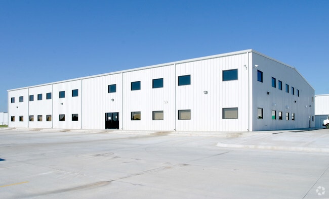
3333 S Council Rd
141931040
Unpltd Pt Sec 18 11N 4W
Heavyindustrial
UNPLTD PT SEC 18 11N 4W 000 000 PT NE4 SEC 18 11N 4W BEG 806.8FT S NE/C NE4 TH W1343.92FT S1841.34FT E683.92FT N660FT E660FT N1178.2FT TO BEG EX E50FT TO CITY & EX BEG 896.45FT S OF NE/C NE4 TH S1088.61FT W660FT S660FT W184.16FT NE258.78FT NWLY331.99
X
Oklahoma
40027C0025J
Oklahoma
2023
33.30 AC
2024
Southwest
108604
Oklahoma City
305,154 SF
Oklahoma City, OK
DEMOGRAPHICS near 3333 S Council Rd
1 Mile
3 Mile
5 Mile
2024 Total Population
3,298
28,697
112,635
2029 Population
3,569
33,109
127,100
Pop Growth 2024-2029
+ 8.22%
+ 15.37%
+ 12.84%
Average Age
37
36
36
2024 Total Households
1,251
9,833
41,457
HH Growth 2024-2029
+ 7.59%
+ 15.45%
+ 12.91%
Median Household Inc
$76,002
$79,894
$58,453
Avg Household Size
2.60
2.80
2.60
2024 Avg HH Vehicles
2.00
2.00
2.00
Median Home Value
$173,502
$191,803
$169,075
Median Year Built
1998
2002
1985
Nearby Places
Map Layers
Map Styles
 Street
 Aerial
- Restaurants
- Banks
- Shops
- Fitness
- Groceries
PUBLIC TRANSPORTATION
AIRPORT
Will Rogers World
DRIVE
WALK
Distance
Will Rogers World
17 min
6.8 mi
Freight Ports
Tulsa Port Of Catoosa
DRIVE
WALK
Distance
Tulsa Port Of Catoosa
148 min
133.4 mi
Nearby Properties
Address
Land Use
TOTAL SIZE
Lot Size
Zoning
Address
Land Use
TOTAL SIZE
Lot Size
Zoning
1,976,300 SF
217.95 AC
I-2
Address
Land Use
TOTAL SIZE
Lot Size
Zoning
1,953,545 SF
111.96 AC
PUD
Address
Land Use
TOTAL SIZE
Lot Size
Zoning
1,563,794 SF
127.94 AC
PUD
Address
Land Use
TOTAL SIZE
Lot Size
Zoning
388,082 SF
34.03 AC
I-2
Address
Land Use
TOTAL SIZE
Lot Size
Zoning
52,170 SF
14.24 AC
Address
Land Use
TOTAL SIZE
Lot Size
Zoning
2,141,947 SF
98.48 AC
I-2
Address
Land Use
TOTAL SIZE
Lot Size
Zoning
653,359 SF
142.11 AC
I-2
Address
Land Use
TOTAL SIZE
Lot Size
Zoning
1,013,603 SF
66.29 AC
PUD
Address
Land Use
TOTAL SIZE
Lot Size
Zoning
460,564 SF
27.08 AC
Address
Land Use
TOTAL SIZE
Lot Size
Zoning
647,520 SF
28.23 AC
PUD
Address
Land Use
TOTAL SIZE
Lot Size
Zoning
136,387 SF
17.63 AC
Address
Land Use
TOTAL SIZE
Lot Size
Zoning
784,972 SF
68.99 AC
I-2
Address
Land Use
TOTAL SIZE
Lot Size
Zoning
40,625 SF
30.82 AC
Address
Land Use
TOTAL SIZE
Lot Size
Zoning
1,194,497 SF
89.98 AC
I-2
Address
Land Use
TOTAL SIZE
Lot Size
Zoning
300,000 SF
123.06 AC
R-1
Address
Land Use
TOTAL SIZE
Lot Size
Zoning
720,640 SF
52.69 AC
PUD
Address
Land Use
TOTAL SIZE
Lot Size
Zoning
211,626 SF
12.67 AC
PUD
Address
Land Use
TOTAL SIZE
Lot Size
Zoning
279,224 SF
18.75 AC
PUD
Address
Land Use
TOTAL SIZE
Lot Size
Zoning
192,771 SF
11.20 AC
I-3
Address
Land Use
TOTAL SIZE
Lot Size
Zoning
143,450 SF
21.45 AC
Address
Land Use
TOTAL SIZE
Lot Size
Zoning
538,787 SF
34.39 AC
I-2
Address
Land Use
TOTAL SIZE
Lot Size
Zoning
215,392 SF
63.71 AC
I-2
Address
Land Use
TOTAL SIZE
Lot Size
Zoning
9,928 SF
2.25 AC
Address
Land Use
TOTAL SIZE
Lot Size
Zoning
9.28 AC
I-2
Address
Land Use
TOTAL SIZE
Lot Size
Zoning
615,435 SF
35.60 AC
I-3
Address
Land Use
TOTAL SIZE
Lot Size
Zoning
256,500 SF
19.46 AC
I-3
Address
Land Use
TOTAL SIZE
Lot Size
Zoning
257,100 SF
33.19 AC
I-2
Address
Land Use
TOTAL SIZE
Lot Size
Zoning
223,600 SF
25.57 AC
I-2
Address
Land Use
TOTAL SIZE
Lot Size
Zoning
124,208 SF
21.48 AC
I-2
The World's #1 Commercial Real Estate Marketplace
Connect with us
© 2026 CoStar Group
The information above has been obtained from sources believed reliable. While we do not doubt its accuracy we have not verified it and make no guarantee, warranty or representation about it. It is your responsibility to independently confirm its accuracy and completeness. Any projections, opinions, assumptions, or estimates used are for example only and do not represent the current or future performance of the property. The value of this transaction to you depends on tax and other factors which should be evaluated by your tax, financial, and legal advisors. You and your advisors should conduct a careful, independent investigation of the property to determine to your satisfaction the suitability of the property for your needs.