Property Record
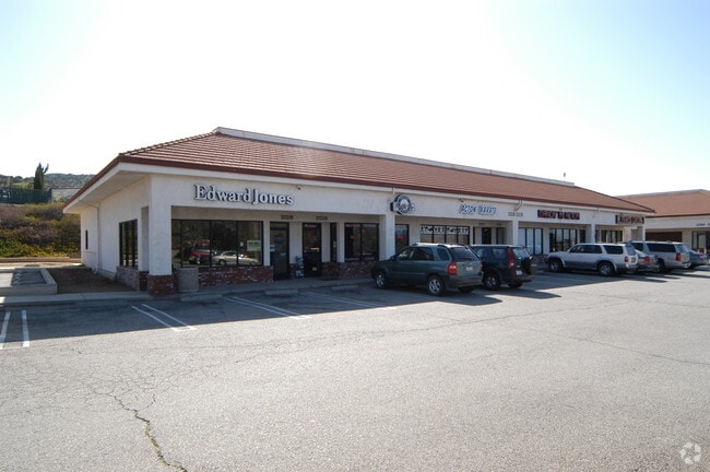
33332 Santiago Rd, Acton, CA 93510


Property Detail
33332 Santiago Rd
3057-019-003
TR=46813 LOT 3
Storemultistory
Los Angeles
LCA11*
California
B and X Area of moderate flood hazard, usually the area between the limits of the 100-year and 500-year floods.
3
2025
1.19 AC
2025
Antelope Valley
910804
Los Angeles
14,893 SF
Los Angeles-Long Beach-Glendale, CA
NEARBY LISTINGS FOR SALE OR LEASE
DEMOGRAPHICS near 33332 Santiago Rd
1 mile
3 mile
5 mile
2025 Total Population
1,763
5,709
10,469
2030 Population
1,749
5,673
10,510
Pop Growth 2025-2030
(0.79%)
(0.63%)
+ 0.39%
Average Age
46
45
44
2025 Total Households
632
2,050
3,556
HH Growth 2025-2030
(1.11%)
(0.83%)
+ 0.08%
Median Household Inc
$112,155
$112,615
$119,054
Avg Household Size
2.70
2.70
2.90
2025 Avg HH Vehicles
3.00
3.00
3.00
Median Home Value
$763,688
$760,581
$749,374
Median Year Built
1986
1985
1986
Nearby Places
Map Layers
Map Styles
 Street
 Aerial
Layers
 Traffic
 Biking
Places
Listings with unknown addresses are not visible on the map
- Restaurants
- Banks
- Shops
- Fitness
- Groceries
PUBLIC TRANSPORTATION
COMMUTER RAIL
Vincent Grade/Acton (Antelope Valley Line - Southern California Regional Rail Authority (Metrolink))
Drive
Walk
Distance
Vincent Grade/Acton (Antelope Valley Line - Southern California Regional Rail Authority (Metrolink))
6 min
3.0 mi
AIRPORT
Bob Hope
Drive
Walk
Distance
Bob Hope
46 min
39.6 mi
Freight Ports
Port of Long Beach
Drive
Walk
Distance
Port of Long Beach
89 min
76.0 mi
Nearby Properties
Address
Land Use
TOTAL SIZE
Lot Size
Zoning
Address
Land Use
TOTAL SIZE
Lot Size
Zoning
134,189 SF
11.43 AC
LCM1
Address
Land Use
TOTAL SIZE
Lot Size
Zoning
342,675 SF
9.09 AC
LCC4-R3*
Address
Land Use
TOTAL SIZE
Lot Size
Zoning
8.71 AC
LCC3DP*
Address
Land Use
TOTAL SIZE
Lot Size
Zoning
35,880 SF
2.89 AC
LCC4
Address
Land Use
TOTAL SIZE
Lot Size
Zoning
39,654 SF
2.28 AC
C4
Address
Land Use
TOTAL SIZE
Lot Size
Zoning
4.22 AC
LCC3DP*
Address
Land Use
TOTAL SIZE
Lot Size
Zoning
5,010 SF
0.74 AC
LCC4*
Address
Land Use
TOTAL SIZE
Lot Size
Zoning
14,000 SF
3.12 AC
LCC3DP*
Address
Land Use
TOTAL SIZE
Lot Size
Zoning
3,216 SF
0.52 AC
LCC3DP*
Address
Land Use
TOTAL SIZE
Lot Size
Zoning
2,497 SF
2.01 AC
LCC2*
Address
Land Use
TOTAL SIZE
Lot Size
Zoning
17,108 SF
1.80 AC
LCC4-A1100
Address
Land Use
TOTAL SIZE
Lot Size
Zoning
600 SF
1.92 AC
LCC4*
Address
Land Use
TOTAL SIZE
Lot Size
Zoning
7,500 SF
0.65 AC
LCC4*
Address
Land Use
TOTAL SIZE
Lot Size
Zoning
2,808 SF
0.73 AC
LCC4-A1100
Address
Land Use
TOTAL SIZE
Lot Size
Zoning
4.64 AC
LCC2*
Address
Land Use
TOTAL SIZE
Lot Size
Zoning
7,500 SF
0.67 AC
LCC-RU
Address
Land Use
TOTAL SIZE
Lot Size
Zoning
2,628 SF
37.90 AC
LCA2 5
Address
Land Use
TOTAL SIZE
Lot Size
Zoning
1,375 SF
0.68 AC
LCC4-A1100
Address
Land Use
TOTAL SIZE
Lot Size
Zoning
2.47 AC
LCC2*
Address
Land Use
TOTAL SIZE
Lot Size
Zoning
22,014 SF
1.70 AC
LCA11*
Address
Land Use
TOTAL SIZE
Lot Size
Zoning
9,518 SF
0.67 AC
LCC4*
Address
Land Use
TOTAL SIZE
Lot Size
Zoning
7,095 SF
0.65 AC
LCC-RU-DP
Address
Land Use
TOTAL SIZE
Lot Size
Zoning
1.81 AC
LCC4*
Address
Land Use
TOTAL SIZE
Lot Size
Zoning
2.90 AC
LCM1*
Address
Land Use
TOTAL SIZE
Lot Size
Zoning
7,379 SF
1.01 AC
LCA11*
Address
Land Use
TOTAL SIZE
Lot Size
Zoning
7.08 AC
LCM1*
Address
Land Use
TOTAL SIZE
Lot Size
Zoning
4,749 SF
3.21 AC
LCC4*
Address
Land Use
TOTAL SIZE
Lot Size
Zoning
1,583 SF
6.79 AC
LCC4-R3*
Address
Land Use
TOTAL SIZE
Lot Size
Zoning
74.75 AC
LCR16000*
The World's #1 Commercial Real Estate Marketplace
Connect with us
© 2026 CoStar Group
The information above has been obtained from sources believed reliable. While we do not doubt its accuracy we have not verified it and make no guarantee, warranty or representation about it. It is your responsibility to independently confirm its accuracy and completeness. Any projections, opinions, assumptions, or estimates used are for example only and do not represent the current or future performance of the property. The value of this transaction to you depends on tax and other factors which should be evaluated by your tax, financial, and legal advisors. You and your advisors should conduct a careful, independent investigation of the property to determine to your satisfaction the suitability of the property for your needs.