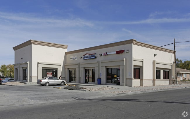
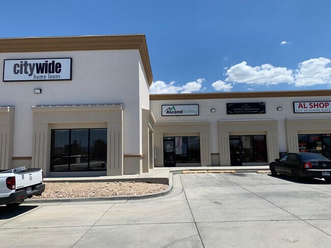
Property Record
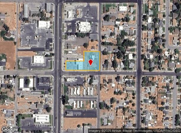
33/34 E 500 N, Tooele, UT 84074
NEARBY LISTINGS FOR SALE OR LEASE
Property Detail
33/34 E 500 N
02-047-0-0001
BEG AT THE SW COR OF BLK 28, PLAT A, TCS, TC; AND RUN TH N 90.75 FT ALG THE E LI OF MAIN ST; TH E 181.5 FT; TH N 99.0 FT; TH
Commercialnec
Tooele
X
Utah
49045C1645C
1.05 AC
2025
Tooele County
2025
Salt Lake City
130900
Salt Lake City-Murray, UT
5,149 SF
DEMOGRAPHICS near 33/34 E 500 N
1 Mile
3 Mile
5 Mile
2024 Total Population
15,159
42,225
44,993
2029 Population
18,942
52,823
56,304
Pop Growth 2024-2029
+ 24.96%
+ 25.10%
+ 25.14%
Average Age
34
34
34
2024 Total Households
5,155
13,554
14,251
HH Growth 2024-2029
+ 25.39%
+ 25.50%
+ 25.54%
Median Household Inc
$69,855
$86,965
$88,737
Avg Household Size
2.90
3.10
3.10
2024 Avg HH Vehicles
2.00
3.00
3.00
Median Home Value
$252,123
$291,206
$300,077
Median Year Built
1992
1995
1996
Nearby Places
Map Layers
Map Styles
 Street
 Aerial
- Restaurants
- Banks
- Shops
- Fitness
- Groceries
PUBLIC TRANSPORTATION
AIRPORT
Salt Lake City International
DRIVE
WALK
Distance
Salt Lake City International
37 min
29.7 mi
Freight Ports
Port of Stockton
DRIVE
WALK
Distance
Port of Stockton
704 min
686.6 mi
SALE & LEASE HISTORY
LISTING DATE
SALE/LEASE

Jul 28, 2021
For Lease
Jul 24, 2018
For Lease
Feb 01, 2017
For Lease
Nearby Properties
Address
Land Use
TOTAL SIZE
Lot Size
Zoning
Address
Land Use
TOTAL SIZE
Lot Size
Zoning
205,900 SF
107.47 AC
Address
Land Use
TOTAL SIZE
Lot Size
Zoning
8.47 AC
Address
Land Use
TOTAL SIZE
Lot Size
Zoning
610,536 SF
48.93 AC
Address
Land Use
TOTAL SIZE
Lot Size
Zoning
263,948 SF
47.90 AC
Address
Land Use
TOTAL SIZE
Lot Size
Zoning
8.32 AC
Address
Land Use
TOTAL SIZE
Lot Size
Zoning
339,571 SF
35.61 AC
Address
Land Use
TOTAL SIZE
Lot Size
Zoning
166,140 SF
7 AC
Address
Land Use
TOTAL SIZE
Lot Size
Zoning
30,144 SF
6 AC
Address
Land Use
TOTAL SIZE
Lot Size
Zoning
90,340 SF
41.76 AC
Address
Land Use
TOTAL SIZE
Lot Size
Zoning
14,400 SF
5.48 AC
Address
Land Use
TOTAL SIZE
Lot Size
Zoning
3,188 SF
7.64 AC
Address
Land Use
TOTAL SIZE
Lot Size
Zoning
59,286 SF
4.84 AC
Address
Land Use
TOTAL SIZE
Lot Size
Zoning
54,648 SF
4.53 AC
Address
Land Use
TOTAL SIZE
Lot Size
Zoning
140,412 SF
10.38 AC
Address
Land Use
TOTAL SIZE
Lot Size
Zoning
86,615 SF
8.87 AC
Address
Land Use
TOTAL SIZE
Lot Size
Zoning
5.34 AC
Address
Land Use
TOTAL SIZE
Lot Size
Zoning
191,115 SF
18.09 AC
Address
Land Use
TOTAL SIZE
Lot Size
Zoning
3.50 AC
Address
Land Use
TOTAL SIZE
Lot Size
Zoning
114,155 SF
20 AC
Address
Land Use
TOTAL SIZE
Lot Size
Zoning
55,381 SF
4.68 AC
Address
Land Use
TOTAL SIZE
Lot Size
Zoning
59,960 SF
16.45 AC
Address
Land Use
TOTAL SIZE
Lot Size
Zoning
191,148 SF
11.08 AC
Address
Land Use
TOTAL SIZE
Lot Size
Zoning
60,127 SF
1.67 AC
Address
Land Use
TOTAL SIZE
Lot Size
Zoning
104,851 SF
11.36 AC
Address
Land Use
TOTAL SIZE
Lot Size
Zoning
53,151 SF
1.18 AC
Address
Land Use
TOTAL SIZE
Lot Size
Zoning
27,277 SF
4.50 AC
Address
Land Use
TOTAL SIZE
Lot Size
Zoning
2,540 SF
2.25 AC
Address
Land Use
TOTAL SIZE
Lot Size
Zoning
24,550 SF
0.86 AC
The World's #1 Commercial Real Estate Marketplace
Connect with us
© 2026 CoStar Group
The information above has been obtained from sources believed reliable. While we do not doubt its accuracy we have not verified it and make no guarantee, warranty or representation about it. It is your responsibility to independently confirm its accuracy and completeness. Any projections, opinions, assumptions, or estimates used are for example only and do not represent the current or future performance of the property. The value of this transaction to you depends on tax and other factors which should be evaluated by your tax, financial, and legal advisors. You and your advisors should conduct a careful, independent investigation of the property to determine to your satisfaction the suitability of the property for your needs.