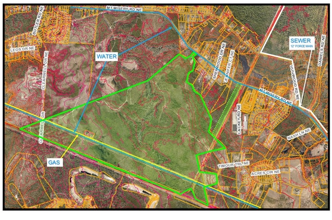
Property Record
3339 Mt Misery Rd Ne, Leland, NC 28451
NEARBY LISTINGS FOR SALE OR LEASE
Property Detail
3339 Mt Misery Rd Ne
Myrtle Beach-Conway-North Myrtle Beach, SC-NC
Hugo Neu Corp
0160000102
TR-2&3 & PRCL A&B 750.80 AC PL 28/550
Vacantlandnec
Brunswick
X
North Carolina
3720226000L
750.80 AC
2024
Leland
2025
Wilmington
020102
DEMOGRAPHICS near 3339 Mt Misery Rd Ne
1 Mile
3 Mile
5 Mile
2024 Total Population
362
7,709
15,024
2029 Population
461
9,940
19,361
Pop Growth 2024-2029
+ 27.35%
+ 28.94%
+ 28.87%
Average Age
42
44
43
2024 Total Households
146
3,140
6,005
HH Growth 2024-2029
+ 26.71%
+ 28.82%
+ 28.76%
Median Household Inc
$61,103
$64,326
$61,060
Avg Household Size
2.40
2.40
2.40
2024 Avg HH Vehicles
2.00
2.00
2.00
Median Home Value
$230,769
$267,794
$226,081
Median Year Built
2004
2008
2005
Nearby Places
Map Layers
Map Styles
 Street
 Aerial
- Restaurants
- Banks
- Shops
- Fitness
- Groceries
PUBLIC TRANSPORTATION
AIRPORT
Wilmington International
DRIVE
WALK
Distance
Wilmington International
28 min
16.8 mi
Freight Ports
Port of Wilmington
DRIVE
WALK
Distance
Port of Wilmington
26 min
15.1 mi
SALE & LEASE HISTORY
LISTING DATE
SALE/LEASE

Mar 01, 2023
For Sale
Nearby Properties
Address
Land Use
TOTAL SIZE
Lot Size
Zoning
Address
Land Use
TOTAL SIZE
Lot Size
Zoning
127,256 SF
7 AC
CLD
Address
Land Use
TOTAL SIZE
Lot Size
Zoning
17,364 SF
200 AC
RR
Address
Land Use
TOTAL SIZE
Lot Size
Zoning
10,154 SF
24.38 AC
IG
Address
Land Use
TOTAL SIZE
Lot Size
Zoning
50,639 SF
5.49 AC
CI
Address
Land Use
TOTAL SIZE
Lot Size
Zoning
5,256 SF
23.74 AC
R60
Address
Land Use
TOTAL SIZE
Lot Size
Zoning
45,170 SF
10.70 AC
IG
Address
Land Use
TOTAL SIZE
Lot Size
Zoning
201,200 SF
89.45 AC
IG
Address
Land Use
TOTAL SIZE
Lot Size
Zoning
102,028 SF
7.31 AC
IG
Address
Land Use
TOTAL SIZE
Lot Size
Zoning
505,480 SF
29.02 AC
CI
Address
Land Use
TOTAL SIZE
Lot Size
Zoning
30,096 SF
2.75 AC
IG
Address
Land Use
TOTAL SIZE
Lot Size
Zoning
104,252 SF
7.20 AC
IG
Address
Land Use
TOTAL SIZE
Lot Size
Zoning
176,515 SF
18.65 AC
IG
Address
Land Use
TOTAL SIZE
Lot Size
Zoning
2,904 SF
16.98 AC
C2
Address
Land Use
TOTAL SIZE
Lot Size
Zoning
6,306 SF
13.07 AC
R60
Address
Land Use
TOTAL SIZE
Lot Size
Zoning
77,226 SF
7.71 AC
IG
Address
Land Use
TOTAL SIZE
Lot Size
Zoning
131.90 AC
IG
Address
Land Use
TOTAL SIZE
Lot Size
Zoning
31,250 SF
175.80 AC
RR
Address
Land Use
TOTAL SIZE
Lot Size
Zoning
145.64 AC
IG
Address
Land Use
TOTAL SIZE
Lot Size
Zoning
18,200 SF
3.33 AC
IG
Address
Land Use
TOTAL SIZE
Lot Size
Zoning
62,740 SF
6.91 AC
IG
Address
Land Use
TOTAL SIZE
Lot Size
Zoning
7,184 SF
12.81 AC
IG
Address
Land Use
TOTAL SIZE
Lot Size
Zoning
46,664 SF
5.06 AC
IG
Address
Land Use
TOTAL SIZE
Lot Size
Zoning
52,998 SF
7.86 AC
IG
Address
Land Use
TOTAL SIZE
Lot Size
Zoning
20,000 SF
23.50 AC
IG
Address
Land Use
TOTAL SIZE
Lot Size
Zoning
54,090 SF
6.11 AC
IG
Address
Land Use
TOTAL SIZE
Lot Size
Zoning
58,820 SF
6.30 AC
IG
Address
Land Use
TOTAL SIZE
Lot Size
Zoning
6,553 SF
2.63 AC
CLD
Address
Land Use
TOTAL SIZE
Lot Size
Zoning
42,479 SF
3.50 AC
IG
Address
Land Use
TOTAL SIZE
Lot Size
Zoning
15,359 SF
22.55 AC
SBR6
The World's #1 Commercial Real Estate Marketplace
Connect with us
© 2026 CoStar Group
The information above has been obtained from sources believed reliable. While we do not doubt its accuracy we have not verified it and make no guarantee, warranty or representation about it. It is your responsibility to independently confirm its accuracy and completeness. Any projections, opinions, assumptions, or estimates used are for example only and do not represent the current or future performance of the property. The value of this transaction to you depends on tax and other factors which should be evaluated by your tax, financial, and legal advisors. You and your advisors should conduct a careful, independent investigation of the property to determine to your satisfaction the suitability of the property for your needs.