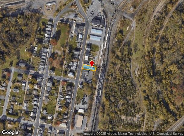
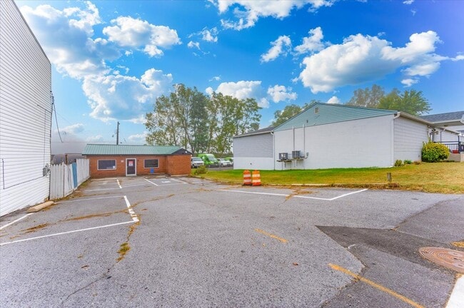
Property Record
334 S Burhans Blvd, Hagerstown, MD 21740
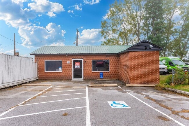
This Property Is For Sale
NEARBY LISTINGS FOR SALE OR LEASE
Property Detail
334 S Burhans Blvd
Hagerstown-Martinsburg, MD-WV
West End Dev Co Sec 18
03-017893
LOT 10 SEC 18 40X130 334 S BURHANS BLVD
Laundromat
Washington
X
Maryland
24043C0138D
10
2024
0.12 AC
2025
Washington County
000900
Washington, DC
1,012 SF
DEMOGRAPHICS near 334 S Burhans Blvd
1 Mile
3 Mile
5 Mile
2024 Total Population
18,088
62,808
98,862
2029 Population
18,413
63,743
100,205
Pop Growth 2024-2029
+ 1.80%
+ 1.49%
+ 1.36%
Average Age
38
40
40
2024 Total Households
7,466
25,648
39,371
HH Growth 2024-2029
+ 1.71%
+ 1.50%
+ 1.40%
Median Household Inc
$31,395
$49,868
$58,094
Avg Household Size
2.30
2.40
2.40
2024 Avg HH Vehicles
1.00
2.00
2.00
Median Home Value
$151,387
$181,811
$217,934
Median Year Built
1949
1963
1972
Nearby Places
- Restaurants
- Banks
- Shops
- Fitness
- Groceries
PUBLIC TRANSPORTATION
AIRPORT
Hagerstown Regional/Richard A Henson Field
DRIVE
WALK
Distance
Hagerstown Regional/Richard A Henson Field
11 min
5.3 mi
Nearby Properties
Address
Land Use
TOTAL SIZE
Lot Size
Zoning
Address
Land Use
TOTAL SIZE
Lot Size
Zoning
502,262 SF
36.64 AC
ORI
Address
Land Use
TOTAL SIZE
Lot Size
Zoning
1,236,085 SF
134.31 AC
IMU
Address
Land Use
TOTAL SIZE
Lot Size
Zoning
1,006,880 SF
132.50 AC
PI
Address
Land Use
TOTAL SIZE
Lot Size
Zoning
1,247,111 SF
74.55 AC
IMU
Address
Land Use
TOTAL SIZE
Lot Size
Zoning
617,025 SF
142.67 AC
IG
Address
Land Use
TOTAL SIZE
Lot Size
Zoning
737,000 SF
59.57 AC
PB
Address
Land Use
TOTAL SIZE
Lot Size
Zoning
1,004,194 SF
65.22 AC
IG
Address
Land Use
TOTAL SIZE
Lot Size
Zoning
36,685 SF
281.72 AC
IG
Address
Land Use
TOTAL SIZE
Lot Size
Zoning
162,850 SF
65.81 AC
IG
Address
Land Use
TOTAL SIZE
Lot Size
Zoning
103,131 SF
53.74 AC
RMOD
Address
Land Use
TOTAL SIZE
Lot Size
Zoning
216 SF
52.93 AC
RH
Address
Land Use
TOTAL SIZE
Lot Size
Zoning
277,977 SF
68.60 AC
IG
Address
Land Use
TOTAL SIZE
Lot Size
Zoning
12,580 SF
1.73 AC
CCMU
Address
Land Use
TOTAL SIZE
Lot Size
Zoning
151,660 SF
56.24 AC
RMOD
Address
Land Use
TOTAL SIZE
Lot Size
Zoning
167,084 SF
64.62 AC
RMOD
Address
Land Use
TOTAL SIZE
Lot Size
Zoning
113,466 SF
10.62 AC
IG
Address
Land Use
TOTAL SIZE
Lot Size
Zoning
91,026 SF
20.28 AC
A
Address
Land Use
TOTAL SIZE
Lot Size
Zoning
622,245 SF
52.90 AC
U
Address
Land Use
TOTAL SIZE
Lot Size
Zoning
117,096 SF
28.13 AC
CR
Address
Land Use
TOTAL SIZE
Lot Size
Zoning
77,934 SF
12.79 AC
RMED
Address
Land Use
TOTAL SIZE
Lot Size
Zoning
267,424 SF
21.44 AC
IMU
Address
Land Use
TOTAL SIZE
Lot Size
Zoning
82,403 SF
1.32 AC
CCMU
Address
Land Use
TOTAL SIZE
Lot Size
Zoning
127,315 SF
26.65 AC
RMOD
Address
Land Use
TOTAL SIZE
Lot Size
Zoning
76,740 SF
16.01 AC
CG
Address
Land Use
TOTAL SIZE
Lot Size
Zoning
6,778 SF
8.24 AC
RH
Address
Land Use
TOTAL SIZE
Lot Size
Zoning
290,600 SF
51.35 AC
IMU
Address
Land Use
TOTAL SIZE
Lot Size
Zoning
52,259 SF
60.86 AC
HI
Address
Land Use
TOTAL SIZE
Lot Size
Zoning
7,427 SF
79.25 AC
RS
Address
Land Use
TOTAL SIZE
Lot Size
Zoning
65,433 SF
16.52 AC
PUD
Address
Land Use
TOTAL SIZE
Lot Size
Zoning
94,185 SF
9.25 AC
RMED
The World's #1 Commercial Real Estate Marketplace
Connect with us
© 2025 CoStar Group
The information above has been obtained from sources believed reliable. While we do not doubt its accuracy we have not verified it and make no guarantee, warranty or representation about it. It is your responsibility to independently confirm its accuracy and completeness. Any projections, opinions, assumptions, or estimates used are for example only and do not represent the current or future performance of the property. The value of this transaction to you depends on tax and other factors which should be evaluated by your tax, financial, and legal advisors. You and your advisors should conduct a careful, independent investigation of the property to determine to your satisfaction the suitability of the property for your needs.