Property Record
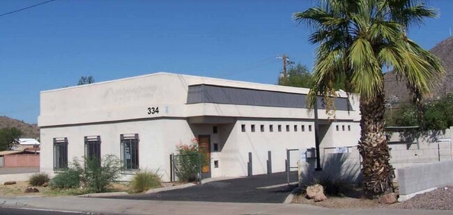
334 E Hatcher Rd, Phoenix, AZ 85020

Property Detail
334 E Hatcher Rd
159-45-095
Tengen Place Addition
Federalproperty
BEG 30 N & 130 W OF SE COR SW4 NE4 SE4 SD SEC TH N 135.31 W 75 S 135.31 & TH E 75 TO BEG .23 AC
X
Maricopa
04013C1730L
Arizona
2025
0.23 AC
2025
Piestewa Peak Corridor
104600
Phoenix
3,306 SF
Phoenix-Mesa-Chandler, AZ
NEARBY LISTINGS FOR SALE OR LEASE
DEMOGRAPHICS near 334 E Hatcher Rd
1 mile
3 mile
5 mile
2024 Total Population
18,846
119,040
375,071
2029 Population
20,484
129,148
405,609
Pop Growth 2024-2029
+ 8.69%
+ 8.49%
+ 8.14%
Average Age
40
40
39
2024 Total Households
8,251
50,668
153,144
HH Growth 2024-2029
+ 8.85%
+ 8.71%
+ 8.35%
Median Household Inc
$62,177
$63,395
$62,853
Avg Household Size
2.20
2.30
2.40
2024 Avg HH Vehicles
2.00
2.00
2.00
Median Home Value
$343,473
$451,947
$380,512
Median Year Built
1973
1976
1976
Nearby Places
Map Layers
Map Styles
 Street
 Aerial
Transit
 Traffic
 Biking
Places
Listings with unknown addresses are not visible on the map
- Restaurants
- Banks
- Shops
- Fitness
- Groceries
PUBLIC TRANSPORTATION
AIRPORT
Phoenix Sky Harbor International
Drive
Walk
Distance
Phoenix Sky Harbor International
23 min
13.3 mi
Phoenix-Mesa Gateway
Drive
Walk
Distance
Phoenix-Mesa Gateway
55 min
40.0 mi
Freight Ports
Port of San Diego
Drive
Walk
Distance
Port of San Diego
408 min
362.9 mi
SALE & LEASE HISTORY
LISTING DATE
SALE/LEASE

Oct 13, 2023
For Sale
Jul 26, 2019
For Lease
Jan 15, 2020
For Sale
Dec 02, 2025
For Lease
Nearby Properties
Address
Land Use
TOTAL SIZE
Lot Size
Zoning
Address
Land Use
TOTAL SIZE
Lot Size
Zoning
98,760 SF
6.76 AC
A-1
Address
Land Use
TOTAL SIZE
Lot Size
Zoning
63,018 SF
4.77 AC
C-T
Address
Land Use
TOTAL SIZE
Lot Size
Zoning
3.58 AC
Address
Land Use
TOTAL SIZE
Lot Size
Zoning
19,474 SF
8.43 AC
C-3
Address
Land Use
TOTAL SIZE
Lot Size
Zoning
558,361 SF
14.61 AC
C-2
Address
Land Use
TOTAL SIZE
Lot Size
Zoning
367,399 SF
14.88 AC
C-1
Address
Land Use
TOTAL SIZE
Lot Size
Zoning
515,418 SF
19.72 AC
R-3
Address
Land Use
TOTAL SIZE
Lot Size
Zoning
215,150 SF
13.24 AC
R-3
Address
Land Use
TOTAL SIZE
Lot Size
Zoning
323,288 SF
40.56 AC
R1-10
Address
Land Use
TOTAL SIZE
Lot Size
Zoning
16,284 SF
3.77 AC
M-H
Address
Land Use
TOTAL SIZE
Lot Size
Zoning
7,665 SF
1.29 AC
C-T
Address
Land Use
TOTAL SIZE
Lot Size
Zoning
452,506 SF
55.11 AC
RH
Address
Land Use
TOTAL SIZE
Lot Size
Zoning
146,867 SF
12.95 AC
CPGCP
Address
Land Use
TOTAL SIZE
Lot Size
Zoning
394,793 SF
3.60 AC
PUD
Address
Land Use
TOTAL SIZE
Lot Size
Zoning
584,674 SF
27.83 AC
R-3A
Address
Land Use
TOTAL SIZE
Lot Size
Zoning
349,252 SF
15.11 AC
Address
Land Use
TOTAL SIZE
Lot Size
Zoning
362,729 SF
21.85 AC
Address
Land Use
TOTAL SIZE
Lot Size
Zoning
99,714 SF
11.72 AC
R-6
Address
Land Use
TOTAL SIZE
Lot Size
Zoning
533,505 SF
27.69 AC
Address
Land Use
TOTAL SIZE
Lot Size
Zoning
123,370 SF
0.82 AC
C-C
Address
Land Use
TOTAL SIZE
Lot Size
Zoning
154,128 SF
9.32 AC
I-1
Address
Land Use
TOTAL SIZE
Lot Size
Zoning
302,016 SF
28.06 AC
Address
Land Use
TOTAL SIZE
Lot Size
Zoning
231,327 SF
5.46 AC
M-H
Address
Land Use
TOTAL SIZE
Lot Size
Zoning
84,738 SF
8.83 AC
R-6
Address
Land Use
TOTAL SIZE
Lot Size
Zoning
362,106 SF
15.60 AC
M-H
Address
Land Use
TOTAL SIZE
Lot Size
Zoning
81,692 SF
8.65 AC
R-10
Address
Land Use
TOTAL SIZE
Lot Size
Zoning
110,623 SF
4.39 AC
R-10
Address
Land Use
TOTAL SIZE
Lot Size
Zoning
122,646 SF
14.69 AC
I-P
Address
Land Use
TOTAL SIZE
Lot Size
Zoning
339,043 SF
5.43 AC
C-O
Address
Land Use
TOTAL SIZE
Lot Size
Zoning
210,064 SF
8.60 AC
C-T
The World's #1 Commercial Real Estate Marketplace
Connect with us
© 2026 CoStar Group
The information above has been obtained from sources believed reliable. While we do not doubt its accuracy we have not verified it and make no guarantee, warranty or representation about it. It is your responsibility to independently confirm its accuracy and completeness. Any projections, opinions, assumptions, or estimates used are for example only and do not represent the current or future performance of the property. The value of this transaction to you depends on tax and other factors which should be evaluated by your tax, financial, and legal advisors. You and your advisors should conduct a careful, independent investigation of the property to determine to your satisfaction the suitability of the property for your needs.