Property Record
334 S Mannheim Rd, Hillside, IL 60162
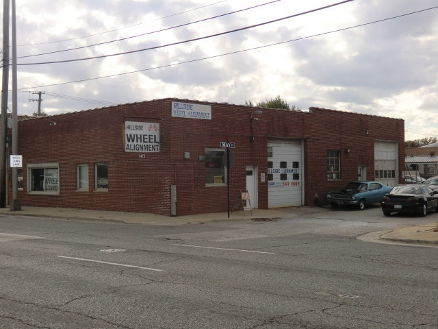


Property Detail
334 S Mannheim Rd
Chicago-Naperville-Elgin, IL-IN
(BAETHKES) SUB OF S372FT OF EH SE SEC 17-39-12
15-17-414-037-0000
Cook
Parkingstructure
Illinois
B and X Area of moderate flood hazard, usually the area between the limits of the 100-year and 500-year floods.
1
2023
0.16 AC
2025
Melrose Park Area
818401
Chicago
3,312 SF
NEARBY LISTINGS FOR SALE OR LEASE
DEMOGRAPHICS near 334 S Mannheim Rd
1 mile
3 mile
5 mile
2025 Total Population
13,897
131,877
394,212
2030 Population
13,903
132,141
397,180
Pop Growth 2025-2030
+ 0.04%
+ 0.20%
+ 0.75%
Average Age
43
41
41
2025 Total Households
5,173
46,073
145,778
HH Growth 2025-2030
(0.25%)
+ 0.06%
+ 0.71%
Median Household Inc
$91,967
$83,730
$95,997
Avg Household Size
2.60
2.80
2.60
2025 Avg HH Vehicles
2.00
2.00
2.00
Median Home Value
$272,347
$280,323
$349,381
Median Year Built
1954
1955
1955
Nearby Places
Map Layers
Map Styles
 Street
 Aerial
Layers
 Traffic
 Biking
Places
Listings with unknown addresses are not visible on the map
- Restaurants
- Banks
- Shops
- Fitness
- Groceries
PUBLIC TRANSPORTATION
COMMUTER RAIL
Bellwood Station (Union Pacific West Line - Northeast Illinois Regional Commuter Railroad (Metra))
Drive
Walk
Distance
Bellwood Station (Union Pacific West Line - Northeast Illinois Regional Commuter Railroad (Metra))
6 min
2.1 mi
Melrose Park Station (Union Pacific West Line - Northeast Illinois Regional Commuter Railroad (Metra))
Drive
Walk
Distance
Melrose Park Station (Union Pacific West Line - Northeast Illinois Regional Commuter Railroad (Metra))
7 min
3.2 mi
AIRPORT
Chicago O'Hare International
Drive
Walk
Distance
Chicago O'Hare International
20 min
10.4 mi
Chicago Midway International
Drive
Walk
Distance
Chicago Midway International
18 min
10.8 mi
SALE & LEASE HISTORY
LISTING DATE
SALE/LEASE

Oct 19, 2020
For Sale
Nearby Properties
Address
Land Use
TOTAL SIZE
Lot Size
Zoning
Address
Land Use
TOTAL SIZE
Lot Size
Zoning
221,673 SF
4.49 AC
Address
Land Use
TOTAL SIZE
Lot Size
Zoning
973,922 SF
53.84 AC
I
Address
Land Use
TOTAL SIZE
Lot Size
Zoning
221,111 SF
20.62 AC
Address
Land Use
TOTAL SIZE
Lot Size
Zoning
516,605 SF
16.29 AC
Address
Land Use
TOTAL SIZE
Lot Size
Zoning
98,990 SF
3.52 AC
C
Address
Land Use
TOTAL SIZE
Lot Size
Zoning
250,892 SF
9.04 AC
C
Address
Land Use
TOTAL SIZE
Lot Size
Zoning
6.26 AC
Address
Land Use
TOTAL SIZE
Lot Size
Zoning
8.53 AC
Address
Land Use
TOTAL SIZE
Lot Size
Zoning
218,192 SF
10.32 AC
C
Address
Land Use
TOTAL SIZE
Lot Size
Zoning
1,156,393 SF
6.55 AC
Address
Land Use
TOTAL SIZE
Lot Size
Zoning
6.11 AC
Address
Land Use
TOTAL SIZE
Lot Size
Zoning
128,536 SF
17.06 AC
C
Address
Land Use
TOTAL SIZE
Lot Size
Zoning
128,536 SF
11.24 AC
C
Address
Land Use
TOTAL SIZE
Lot Size
Zoning
7.16 AC
Address
Land Use
TOTAL SIZE
Lot Size
Zoning
8.01 AC
Address
Land Use
TOTAL SIZE
Lot Size
Zoning
1,016,817 SF
46.98 AC
C
Address
Land Use
TOTAL SIZE
Lot Size
Zoning
80,871 SF
0.59 AC
C
Address
Land Use
TOTAL SIZE
Lot Size
Zoning
389,155 SF
17.69 AC
Address
Land Use
TOTAL SIZE
Lot Size
Zoning
Address
Land Use
TOTAL SIZE
Lot Size
Zoning
137,144 SF
11.77 AC
Address
Land Use
TOTAL SIZE
Lot Size
Zoning
95,520 SF
9.55 AC
C
Address
Land Use
TOTAL SIZE
Lot Size
Zoning
165,728 SF
2.88 AC
C
Address
Land Use
TOTAL SIZE
Lot Size
Zoning
195,355 SF
8.65 AC
C
Address
Land Use
TOTAL SIZE
Lot Size
Zoning
184,970 SF
11.64 AC
Address
Land Use
TOTAL SIZE
Lot Size
Zoning
479,130 SF
15.80 AC
Address
Land Use
TOTAL SIZE
Lot Size
Zoning
108,276 SF
3.80 AC
Address
Land Use
TOTAL SIZE
Lot Size
Zoning
225,000 SF
5.82 AC
Address
Land Use
TOTAL SIZE
Lot Size
Zoning
1.65 AC
Address
Land Use
TOTAL SIZE
Lot Size
Zoning
101,146 SF
2.24 AC
Address
Land Use
TOTAL SIZE
Lot Size
Zoning
320,928 SF
13.46 AC
The World's #1 Commercial Real Estate Marketplace
Connect with us
© 2026 CoStar Group
The information above has been obtained from sources believed reliable. While we do not doubt its accuracy we have not verified it and make no guarantee, warranty or representation about it. It is your responsibility to independently confirm its accuracy and completeness. Any projections, opinions, assumptions, or estimates used are for example only and do not represent the current or future performance of the property. The value of this transaction to you depends on tax and other factors which should be evaluated by your tax, financial, and legal advisors. You and your advisors should conduct a careful, independent investigation of the property to determine to your satisfaction the suitability of the property for your needs.