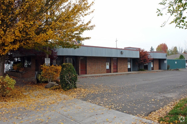
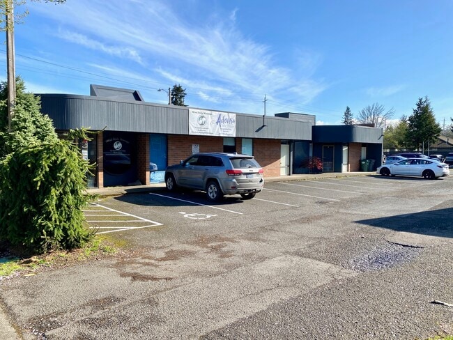
Property Record
334 Se 5Th Ave, Hillsboro, OR 97123

Current Lease Availabilities
Property Detail
334 Se 5Th Ave
Portland-Vancouver-Hillsboro, OR-WA
Humphreys Add To Hillsboro-Amended
R0326640
HUMPHREYS ADD TO HILLSBORO-AMENDED, BLOCK 1, LOT 10 & PTS 6-7, ACRES 0.18
Commercialbuilding
Washington
X
Oregon
41067C0338E
10
2024
0.18 AC
2026
Sunset Corridor/Hillsboro
032501
Portland
3,062 SF
NEARBY LISTINGS FOR SALE OR LEASE
DEMOGRAPHICS near 334 Se 5Th Ave
1 mile
3 mile
5 mile
2024 Total Population
18,122
66,333
133,757
2029 Population
18,155
66,557
134,858
Pop Growth 2024-2029
+ 0.18%
+ 0.34%
+ 0.82%
Average Age
37
38
38
2024 Total Households
5,967
22,420
48,063
HH Growth 2024-2029
+ 0.20%
+ 0.36%
+ 0.88%
Median Household Inc
$69,583
$92,764
$92,712
Avg Household Size
2.80
2.80
2.70
2024 Avg HH Vehicles
2.00
2.00
2.00
Median Home Value
$404,036
$446,821
$445,229
Median Year Built
1973
1986
1994
Nearby Places
Map Layers
Map Styles
 Street
 Aerial
Transit
 Traffic
 Biking
Places
Listings with unknown addresses are not visible on the map
- Restaurants
- Banks
- Shops
- Fitness
- Groceries
PUBLIC TRANSPORTATION
TRANSIT/SUBWAY
Hillsboro Central/SE 3rd Transit Center (MAX Blue Line - Tri-County Metropolitan Transportation District of Oregon Rail (TriMet Rail))
Drive
Walk
Distance
Hillsboro Central/SE 3rd Transit Center (MAX Blue Line - Tri-County Metropolitan Transportation District of Oregon Rail (TriMet Rail))
2 min
6 min
0.3 mi
Tuality Hospital/SE 8th Avenue (MAX Blue Line - Tri-County Metropolitan Transportation District of Oregon Rail (TriMet Rail))
Drive
Walk
Distance
Tuality Hospital/SE 8th Avenue (MAX Blue Line - Tri-County Metropolitan Transportation District of Oregon Rail (TriMet Rail))
1 min
6 min
0.3 mi
Hatfield Government Center (MAX Blue Line - Tri-County Metropolitan Transportation District of Oregon Rail (TriMet Rail))
Drive
Walk
Distance
Hatfield Government Center (MAX Blue Line - Tri-County Metropolitan Transportation District of Oregon Rail (TriMet Rail))
3 min
12 min
0.6 mi
Washington/SE 12th Avenue (MAX Blue Line - Tri-County Metropolitan Transportation District of Oregon Rail (TriMet Rail))
Drive
Walk
Distance
Washington/SE 12th Avenue (MAX Blue Line - Tri-County Metropolitan Transportation District of Oregon Rail (TriMet Rail))
3 min
14 min
0.7 mi
COMMUTER RAIL
Beaverton Transit Center (West Side Express) (Westside Express Service - Tri-County Metropolitan Transportation District of Oregon Rail (TriMet Rail))
Drive
Walk
Distance
Beaverton Transit Center (West Side Express) (Westside Express Service - Tri-County Metropolitan Transportation District of Oregon Rail (TriMet Rail))
20 min
9.7 mi
AIRPORT
Portland International
Drive
Walk
Distance
Portland International
50 min
29.9 mi
Nearby Properties
Address
Land Use
TOTAL SIZE
Lot Size
Zoning
Address
Land Use
TOTAL SIZE
Lot Size
Zoning
1,619,885 SF
115.71 AC
I-P
Address
Land Use
TOTAL SIZE
Lot Size
Zoning
9.97 AC
SCC-DT
Address
Land Use
TOTAL SIZE
Lot Size
Zoning
47.85 AC
I-P
Address
Land Use
TOTAL SIZE
Lot Size
Zoning
60.97 AC
INST
Address
Land Use
TOTAL SIZE
Lot Size
Zoning
5.83 AC
INST
Address
Land Use
TOTAL SIZE
Lot Size
Zoning
0.17 AC
I-P
Address
Land Use
TOTAL SIZE
Lot Size
Zoning
248,332 SF
4.26 AC
SCC-DT
Address
Land Use
TOTAL SIZE
Lot Size
Zoning
20.33 AC
I-S
Address
Land Use
TOTAL SIZE
Lot Size
Zoning
53.13 AC
SC-BP
Address
Land Use
TOTAL SIZE
Lot Size
Zoning
53.49 AC
SCFI
Address
Land Use
TOTAL SIZE
Lot Size
Zoning
256,652 SF
48.72 AC
SFR-7
Address
Land Use
TOTAL SIZE
Lot Size
Zoning
13,368 SF
112.70 AC
I-G
Address
Land Use
TOTAL SIZE
Lot Size
Zoning
82,297 SF
175.24 AC
I-G
Address
Land Use
TOTAL SIZE
Lot Size
Zoning
0.06 AC
I-P
Address
Land Use
TOTAL SIZE
Lot Size
Zoning
252,251 SF
2.62 AC
SCC-DT
Address
Land Use
TOTAL SIZE
Lot Size
Zoning
3,616 SF
0.85 AC
SCC-DT
Address
Land Use
TOTAL SIZE
Lot Size
Zoning
6.03 AC
SCR-MD
Address
Land Use
TOTAL SIZE
Lot Size
Zoning
24.26 AC
I-P
Address
Land Use
TOTAL SIZE
Lot Size
Zoning
43,041 SF
9.43 AC
SFR-7
Address
Land Use
TOTAL SIZE
Lot Size
Zoning
240,000 SF
39.66 AC
SFR-7
Address
Land Use
TOTAL SIZE
Lot Size
Zoning
354,705 SF
18.29 AC
C-G
Address
Land Use
TOTAL SIZE
Lot Size
Zoning
147 SF
14.87 AC
I-S
Address
Land Use
TOTAL SIZE
Lot Size
Zoning
27.36 AC
I-P
Address
Land Use
TOTAL SIZE
Lot Size
Zoning
205,467 SF
19.44 AC
C-G
Address
Land Use
TOTAL SIZE
Lot Size
Zoning
17.84 AC
SC-BP
Address
Land Use
TOTAL SIZE
Lot Size
Zoning
180,900 SF
6.33 AC
SCR-HD
Address
Land Use
TOTAL SIZE
Lot Size
Zoning
2,675 SF
16.57 AC
MFR-1
Address
Land Use
TOTAL SIZE
Lot Size
Zoning
347,362 SF
14.06 AC
C-G
Address
Land Use
TOTAL SIZE
Lot Size
Zoning
285,970 SF
1.58 AC
SCC-DT
The World's #1 Commercial Real Estate Marketplace
Connect with us
© 2026 CoStar Group
The information above has been obtained from sources believed reliable. While we do not doubt its accuracy we have not verified it and make no guarantee, warranty or representation about it. It is your responsibility to independently confirm its accuracy and completeness. Any projections, opinions, assumptions, or estimates used are for example only and do not represent the current or future performance of the property. The value of this transaction to you depends on tax and other factors which should be evaluated by your tax, financial, and legal advisors. You and your advisors should conduct a careful, independent investigation of the property to determine to your satisfaction the suitability of the property for your needs.