Property Record
3340 Mall Loop Dr, Joliet, IL 60431

Save to a Folder
{{folder.Name}}
{{folder.ListingIds.length}} Properties
{{folder.ListingIds.length}} Property
Create a New Folder
This Property Is For Sale
Property Detail
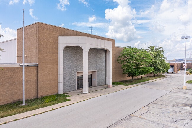
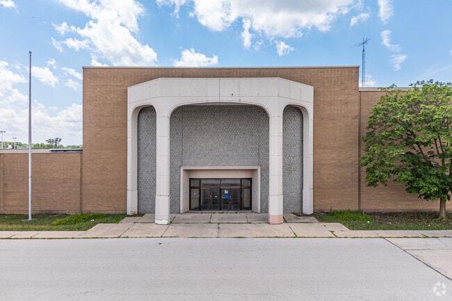
3340 Mall Loop Dr
Chicago-Naperville-Elgin, IL-IN
THAT PRT OF THE NE1/4 OF SEC. 26 PRT OF THE NW1/4 OF SEC. 25, T36N-R9E, DAF: COMM AT THE SE COR OF THE NE1/4 OF SD SEC. 26;
06-03-26-200-007
WILL
Commercialnec
Illinois
B and X Area of moderate flood hazard, usually the area between the limits of the 100-year and 500-year floods.
16.73 AC
2025
Joliet/Central Will
2024
Chicago
880427
NEARBY LISTINGS FOR SALE OR LEASE
DEMOGRAPHICS near 3340 Mall Loop Dr
1 mile
3 mile
5 mile
2025 Total Population
7,622
69,636
197,314
2030 Population
7,650
70,159
200,074
Pop Growth 2025-2030
+ 0.37%
+ 0.75%
+ 1.40%
Average Age
41
41
39
2025 Total Households
2,687
25,573
68,568
HH Growth 2025-2030
+ 0.45%
+ 0.88%
+ 1.41%
Median Household Inc
$103,043
$96,869
$95,449
Avg Household Size
2.70
2.70
2.70
2025 Avg HH Vehicles
2.00
2.00
2.00
Median Home Value
$261,556
$280,566
$280,903
Median Year Built
1992
1995
1993
Nearby Places
Map Layers
Map Styles
 Street
 Aerial
Layers
 Traffic
 Biking
Places
Listings with unknown addresses are not visible on the map
- Restaurants
- Banks
- Shops
- Fitness
- Groceries
PUBLIC TRANSPORTATION
COMMUTER RAIL
Joliet Station (Heritage Corridor Line - Northeast Illinois Regional Commuter Railroad (Metra), Rock Island District Line - Northeast Illinois Regional Commuter Railroad (Metra))
Drive
Walk
Distance
Joliet Station (Heritage Corridor Line - Northeast Illinois Regional Commuter Railroad (Metra), Rock Island District Line - Northeast Illinois Regional Commuter Railroad (Metra))
14 min
6.3 mi
Lockport Station (Heritage Corridor Line - Northeast Illinois Regional Commuter Railroad (Metra))
Drive
Walk
Distance
Lockport Station (Heritage Corridor Line - Northeast Illinois Regional Commuter Railroad (Metra))
16 min
6.9 mi
AIRPORT
Chicago Midway International
Drive
Walk
Distance
Chicago Midway International
40 min
29.2 mi
Freight Ports
Port Milwaukee
Drive
Walk
Distance
Port Milwaukee
138 min
112.3 mi
Nearby Properties
Address
Land Use
TOTAL SIZE
Lot Size
Zoning
Address
Land Use
TOTAL SIZE
Lot Size
Zoning
21.76 AC
Address
Land Use
TOTAL SIZE
Lot Size
Zoning
32.49 AC
Address
Land Use
TOTAL SIZE
Lot Size
Zoning
54.90 AC
Address
Land Use
TOTAL SIZE
Lot Size
Zoning
10.47 AC
Address
Land Use
TOTAL SIZE
Lot Size
Zoning
7.72 AC
Address
Land Use
TOTAL SIZE
Lot Size
Zoning
Address
Land Use
TOTAL SIZE
Lot Size
Zoning
26.31 AC
Address
Land Use
TOTAL SIZE
Lot Size
Zoning
18.76 AC
Address
Land Use
TOTAL SIZE
Lot Size
Zoning
Address
Land Use
TOTAL SIZE
Lot Size
Zoning
20.22 AC
Address
Land Use
TOTAL SIZE
Lot Size
Zoning
Address
Land Use
TOTAL SIZE
Lot Size
Zoning
15.59 AC
Address
Land Use
TOTAL SIZE
Lot Size
Zoning
15.72 AC
Address
Land Use
TOTAL SIZE
Lot Size
Zoning
1.66 AC
Address
Land Use
TOTAL SIZE
Lot Size
Zoning
Address
Land Use
TOTAL SIZE
Lot Size
Zoning
15.45 AC
Address
Land Use
TOTAL SIZE
Lot Size
Zoning
16,359 SF
1.26 AC
Address
Land Use
TOTAL SIZE
Lot Size
Zoning
8.46 AC
Address
Land Use
TOTAL SIZE
Lot Size
Zoning
5.75 AC
Address
Land Use
TOTAL SIZE
Lot Size
Zoning
Address
Land Use
TOTAL SIZE
Lot Size
Zoning
4.73 AC
Address
Land Use
TOTAL SIZE
Lot Size
Zoning
17.62 AC
Address
Land Use
TOTAL SIZE
Lot Size
Zoning
105,825 SF
2.62 AC
Address
Land Use
TOTAL SIZE
Lot Size
Zoning
68,154 SF
6.94 AC
Address
Land Use
TOTAL SIZE
Lot Size
Zoning
8.91 AC
Address
Land Use
TOTAL SIZE
Lot Size
Zoning
8.99 AC
Address
Land Use
TOTAL SIZE
Lot Size
Zoning
6.58 AC
Address
Land Use
TOTAL SIZE
Lot Size
Zoning
Address
Land Use
TOTAL SIZE
Lot Size
Zoning
0.82 AC
Address
Land Use
TOTAL SIZE
Lot Size
Zoning
3.33 AC
The World's #1 Commercial Real Estate Marketplace
Connect with us
© 2026 CoStar Group
The information above has been obtained from sources believed reliable. While we do not doubt its accuracy we have not verified it and make no guarantee, warranty or representation about it. It is your responsibility to independently confirm its accuracy and completeness. Any projections, opinions, assumptions, or estimates used are for example only and do not represent the current or future performance of the property. The value of this transaction to you depends on tax and other factors which should be evaluated by your tax, financial, and legal advisors. You and your advisors should conduct a careful, independent investigation of the property to determine to your satisfaction the suitability of the property for your needs.