Property Record
33411 Pinehurst Loop, Magnolia, TX 77355

Property Detail
33411 Pinehurst Loop
0361-00-00611
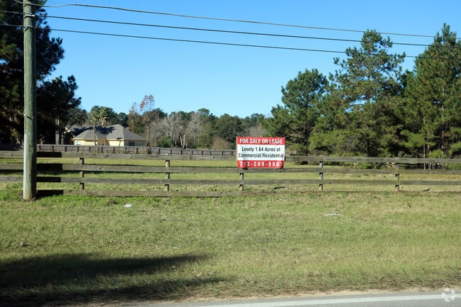
A0361 - MOORE JOHN, TRACT 6-D, ACRES 1.64
Commercialnec
Montgomery
B and X Area of moderate flood hazard, usually the area between the limits of the 100-year and 500-year floods.
Texas
2024
1.64 AC
2025
Northwest Outlier
690207
Houston
10,500 SF
Houston-Pasadena-The Woodlands, TX
NEARBY LISTINGS FOR SALE OR LEASE
DEMOGRAPHICS near 33411 Pinehurst Loop
1 mile
3 mile
5 mile
2025 Total Population
2,686
18,850
59,327
2030 Population
3,172
21,996
68,353
Pop Growth 2025-2030
+ 18.09%
+ 16.69%
+ 15.21%
Average Age
41
40
40
2025 Total Households
902
6,466
20,514
HH Growth 2025-2030
+ 18.63%
+ 17.09%
+ 15.33%
Median Household Inc
$90,813
$104,796
$92,092
Avg Household Size
2.90
2.90
2.80
2025 Avg HH Vehicles
2.00
2.00
2.00
Median Home Value
$471,241
$423,412
$389,897
Median Year Built
2010
2005
2002
Nearby Places
Map Layers
Map Styles
 Street
 Aerial
Transit
 Traffic
 Biking
Places
Listings with unknown addresses are not visible on the map
- Restaurants
- Banks
- Shops
- Fitness
- Groceries
PUBLIC TRANSPORTATION
AIRPORT
George Bush Intcntl/Houston
Drive
Walk
Distance
George Bush Intcntl/Houston
42 min
32.0 mi
William P Hobby
Drive
Walk
Distance
William P Hobby
70 min
47.1 mi
Freight Ports
Port of Houston
Drive
Walk
Distance
Port of Houston
62 min
42.7 mi
SALE & LEASE HISTORY
LISTING DATE
SALE/LEASE

Dec 11, 2018
For Sale
Nearby Properties
Address
Land Use
TOTAL SIZE
Lot Size
Zoning
Address
Land Use
TOTAL SIZE
Lot Size
Zoning
14,865 SF
1.98 AC
2
Address
Land Use
TOTAL SIZE
Lot Size
Zoning
90,311 SF
10 AC
Address
Land Use
TOTAL SIZE
Lot Size
Zoning
100,389 SF
5.47 AC
2
Address
Land Use
TOTAL SIZE
Lot Size
Zoning
1,184 SF
27.54 AC
Address
Land Use
TOTAL SIZE
Lot Size
Zoning
68,950 SF
18.57 AC
2
Address
Land Use
TOTAL SIZE
Lot Size
Zoning
55,656 SF
5.09 AC
2
Address
Land Use
TOTAL SIZE
Lot Size
Zoning
1,722 SF
31.19 AC
2
Address
Land Use
TOTAL SIZE
Lot Size
Zoning
25,050 SF
2.16 AC
Address
Land Use
TOTAL SIZE
Lot Size
Zoning
43,400 SF
6.05 AC
2
Address
Land Use
TOTAL SIZE
Lot Size
Zoning
5,353 SF
37.56 AC
Address
Land Use
TOTAL SIZE
Lot Size
Zoning
4,365 SF
0.99 AC
Address
Land Use
TOTAL SIZE
Lot Size
Zoning
29,682 SF
2.41 AC
Address
Land Use
TOTAL SIZE
Lot Size
Zoning
13,545 SF
4.56 AC
2
Address
Land Use
TOTAL SIZE
Lot Size
Zoning
52,800 SF
3.81 AC
2
Address
Land Use
TOTAL SIZE
Lot Size
Zoning
8,958 SF
40.19 AC
2
Address
Land Use
TOTAL SIZE
Lot Size
Zoning
11,723 SF
2.50 AC
2
Address
Land Use
TOTAL SIZE
Lot Size
Zoning
37,512 SF
9.91 AC
2
Address
Land Use
TOTAL SIZE
Lot Size
Zoning
13,871 SF
1.68 AC
2
Address
Land Use
TOTAL SIZE
Lot Size
Zoning
27,450 SF
2.08 AC
Address
Land Use
TOTAL SIZE
Lot Size
Zoning
31,627 SF
11.46 AC
Address
Land Use
TOTAL SIZE
Lot Size
Zoning
15,200 SF
24.21 AC
Address
Land Use
TOTAL SIZE
Lot Size
Zoning
24,000 SF
1 AC
Address
Land Use
TOTAL SIZE
Lot Size
Zoning
8,650 SF
1.19 AC
Address
Land Use
TOTAL SIZE
Lot Size
Zoning
36,248 SF
4.22 AC
Address
Land Use
TOTAL SIZE
Lot Size
Zoning
573 SF
10.37 AC
2
Address
Land Use
TOTAL SIZE
Lot Size
Zoning
23,436 SF
4.03 AC
2
Address
Land Use
TOTAL SIZE
Lot Size
Zoning
3,111 SF
15.91 AC
Address
Land Use
TOTAL SIZE
Lot Size
Zoning
17,028 SF
5.08 AC
Address
Land Use
TOTAL SIZE
Lot Size
Zoning
11,523 SF
8.87 AC
2
The World's #1 Commercial Real Estate Marketplace
Connect with us
© 2026 CoStar Group
The information above has been obtained from sources believed reliable. While we do not doubt its accuracy we have not verified it and make no guarantee, warranty or representation about it. It is your responsibility to independently confirm its accuracy and completeness. Any projections, opinions, assumptions, or estimates used are for example only and do not represent the current or future performance of the property. The value of this transaction to you depends on tax and other factors which should be evaluated by your tax, financial, and legal advisors. You and your advisors should conduct a careful, independent investigation of the property to determine to your satisfaction the suitability of the property for your needs.