Property Record
3345 Kirby Whitten Rd, Bartlett, TN 38134

NEARBY LISTINGS FOR SALE OR LEASE
-
-
-
-
-
No Photo
-
-
-
View all Bartlett listings for sale on LoopNet.com
Property Detail
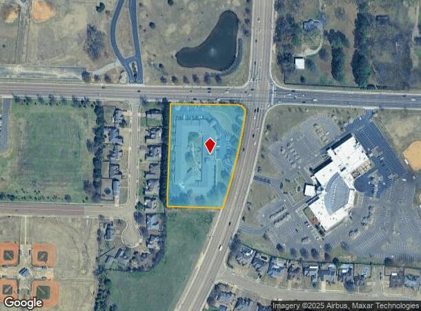
3345 Kirby Whitten Rd
Memphis, TN-MS-AR
Hearthstone Assisted Living Center
B0-157-0-0887
WS KIRBY WHITTEN RD COR YALE RD (SW) SEE MAP D1-57
Hospitalprivate
Shelby
X
Tennessee
47157C0304G
1
2024
3.94 AC
2025
North
020634
Memphis
42,706 SF
DEMOGRAPHICS near 3345 Kirby Whitten Rd
1 Mile
3 Mile
5 Mile
2024 Total Population
7,206
58,262
144,833
2029 Population
6,942
56,405
140,653
Pop Growth 2024-2029
(3.66%)
(3.19%)
(2.89%)
Average Age
43
40
38
2024 Total Households
2,832
21,608
55,637
HH Growth 2024-2029
(3.81%)
(3.30%)
(2.95%)
Median Household Inc
$81,095
$71,962
$65,705
Avg Household Size
2.50
2.60
2.50
2024 Avg HH Vehicles
2.00
2.00
2.00
Median Home Value
$214,220
$199,216
$202,799
Median Year Built
1989
1985
1988
Nearby Places
Map Layers
Map Styles
 Street
 Aerial
- Restaurants
- Banks
- Shops
- Fitness
- Groceries
PUBLIC TRANSPORTATION
AIRPORT
Memphis International
DRIVE
WALK
Distance
Memphis International
29 min
19.1 mi
Freight Ports
Port of Shreveport
DRIVE
WALK
Distance
Port of Shreveport
419 min
383.8 mi
Nearby Properties
Address
Land Use
TOTAL SIZE
Lot Size
Zoning
Address
Land Use
TOTAL SIZE
Lot Size
Zoning
270,045 SF
28.34 AC
CA
Address
Land Use
TOTAL SIZE
Lot Size
Zoning
1,153,892 SF
50.47 AC
I-P
Address
Land Use
TOTAL SIZE
Lot Size
Zoning
231,038 SF
24.97 AC
RU-2
Address
Land Use
TOTAL SIZE
Lot Size
Zoning
207,537 SF
21.73 AC
C-G
Address
Land Use
TOTAL SIZE
Lot Size
Zoning
134,272 SF
28.85 AC
CMP-1
Address
Land Use
TOTAL SIZE
Lot Size
Zoning
591,149 SF
45.48 AC
CMU-3
Address
Land Use
TOTAL SIZE
Lot Size
Zoning
338,215 SF
33.08 AC
CA
Address
Land Use
TOTAL SIZE
Lot Size
Zoning
498,680 SF
46.61 AC
I-P
Address
Land Use
TOTAL SIZE
Lot Size
Zoning
75,099 SF
12.22 AC
EMP
Address
Land Use
TOTAL SIZE
Lot Size
Zoning
62,852 SF
10.15 AC
RS-12
Address
Land Use
TOTAL SIZE
Lot Size
Zoning
108,678 SF
8.99 AC
R-E
Address
Land Use
TOTAL SIZE
Lot Size
Zoning
56,431 SF
1.24 AC
C-G
Address
Land Use
TOTAL SIZE
Lot Size
Zoning
133,020 SF
11.73 AC
SC-1
Address
Land Use
TOTAL SIZE
Lot Size
Zoning
198,103 SF
17.75 AC
CG-MS
Address
Land Use
TOTAL SIZE
Lot Size
Zoning
449,267 SF
20.03 AC
RU-3
Address
Land Use
TOTAL SIZE
Lot Size
Zoning
191,316 SF
21.71 AC
CMU-3
Address
Land Use
TOTAL SIZE
Lot Size
Zoning
199,320 SF
9.05 AC
CA
Address
Land Use
TOTAL SIZE
Lot Size
Zoning
134,599 SF
6.43 AC
I-P
Address
Land Use
TOTAL SIZE
Lot Size
Zoning
256,617 SF
10.54 AC
I-P
Address
Land Use
TOTAL SIZE
Lot Size
Zoning
86,875 SF
7.09 AC
I-P
Address
Land Use
TOTAL SIZE
Lot Size
Zoning
253,831 SF
16.74 AC
EMP
Address
Land Use
TOTAL SIZE
Lot Size
Zoning
142,703 SF
18.62 AC
CMU-3
Address
Land Use
TOTAL SIZE
Lot Size
Zoning
146,182 SF
14.45 AC
OG
Address
Land Use
TOTAL SIZE
Lot Size
Zoning
50,818 SF
13.30 AC
RU-3
Address
Land Use
TOTAL SIZE
Lot Size
Zoning
217,564 SF
20.41 AC
AG
Address
Land Use
TOTAL SIZE
Lot Size
Zoning
67,961 SF
19.02 AC
RU-3
Address
Land Use
TOTAL SIZE
Lot Size
Zoning
67,640 SF
20.28 AC
R-M
Address
Land Use
TOTAL SIZE
Lot Size
Zoning
76,169 SF
5.39 AC
I-P
Address
Land Use
TOTAL SIZE
Lot Size
Zoning
67,355 SF
12.06 AC
R-8
Address
Land Use
TOTAL SIZE
Lot Size
Zoning
120,000 SF
9.64 AC
I-P
The World's #1 Commercial Real Estate Marketplace
Connect with us
© 2026 CoStar Group
The information above has been obtained from sources believed reliable. While we do not doubt its accuracy we have not verified it and make no guarantee, warranty or representation about it. It is your responsibility to independently confirm its accuracy and completeness. Any projections, opinions, assumptions, or estimates used are for example only and do not represent the current or future performance of the property. The value of this transaction to you depends on tax and other factors which should be evaluated by your tax, financial, and legal advisors. You and your advisors should conduct a careful, independent investigation of the property to determine to your satisfaction the suitability of the property for your needs.