Property Record
3340 Highway 51, Fort Mill, SC 29715
NEARBY LISTINGS FOR SALE OR LEASE
Property Detail
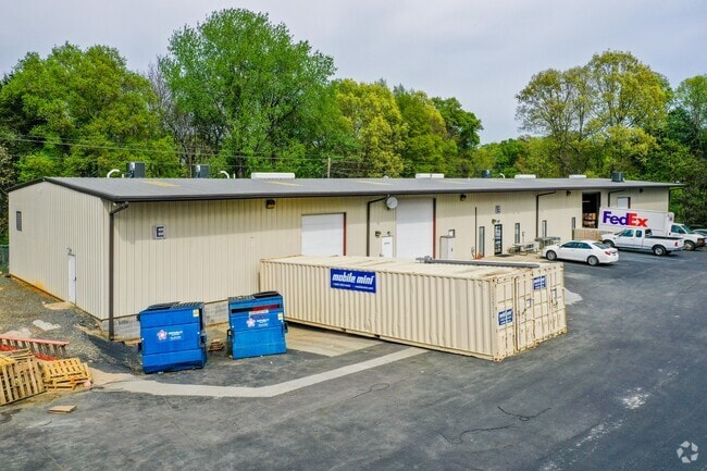
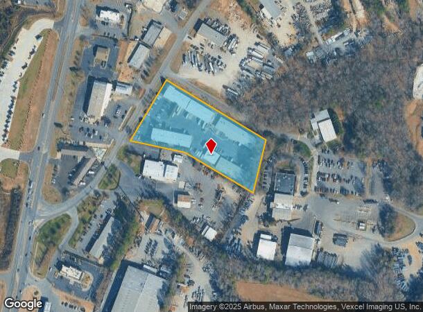
3340 Highway 51
7210000020
Sg
Commercialnec
HWY 21 (3.41 AC)
X
York
45057C0008E
South Carolina
2025
3.41 AC
2025
York County
061007
Charlotte
12,000 SF
Charlotte-Concord-Gastonia, NC-SC
DEMOGRAPHICS near 3340 Highway 51
1 Mile
3 Mile
5 Mile
2024 Total Population
4,617
42,661
165,699
2029 Population
5,197
47,162
179,691
Pop Growth 2024-2029
+ 12.56%
+ 10.55%
+ 8.44%
Average Age
36
38
37
2024 Total Households
1,622
16,610
65,927
HH Growth 2024-2029
+ 12.82%
+ 10.51%
+ 8.32%
Median Household Inc
$70,246
$85,136
$78,644
Avg Household Size
2.80
2.50
2.50
2024 Avg HH Vehicles
2.00
2.00
2.00
Median Home Value
$311,041
$340,788
$323,538
Median Year Built
2004
2004
2000
Nearby Places
Map Layers
Map Styles
 Street
 Aerial
- Restaurants
- Banks
- Shops
- Fitness
- Groceries
PUBLIC TRANSPORTATION
AIRPORT
Charlotte/Douglas International
DRIVE
WALK
Distance
Charlotte/Douglas International
22 min
10.9 mi
Concord-Padgett Regional
DRIVE
WALK
Distance
Concord-Padgett Regional
40 min
28.0 mi
Freight Ports
North Charleston Terminal
DRIVE
WALK
Distance
North Charleston Terminal
212 min
187.8 mi
SALE & LEASE HISTORY
LISTING DATE
SALE/LEASE

Jun 03, 2025
For Lease
Nearby Properties
Address
Land Use
TOTAL SIZE
Lot Size
Zoning
Address
Land Use
TOTAL SIZE
Lot Size
Zoning
1,007,888 SF
55.04 AC
G-I
Address
Land Use
TOTAL SIZE
Lot Size
Zoning
857,532 SF
73.57 AC
I1
Address
Land Use
TOTAL SIZE
Lot Size
Zoning
245,573 SF
23.62 AC
R12MFCD
Address
Land Use
TOTAL SIZE
Lot Size
Zoning
873,356 SF
52.31 AC
I2
Address
Land Use
TOTAL SIZE
Lot Size
Zoning
216,222 SF
21.81 AC
RMF
Address
Land Use
TOTAL SIZE
Lot Size
Zoning
227,264 SF
21.77 AC
RMF
Address
Land Use
TOTAL SIZE
Lot Size
Zoning
524,365 SF
33.52 AC
G-I
Address
Land Use
TOTAL SIZE
Lot Size
Zoning
151,844 SF
11.65 AC
Address
Land Use
TOTAL SIZE
Lot Size
Zoning
182,235 SF
18.29 AC
R17MF
Address
Land Use
TOTAL SIZE
Lot Size
Zoning
363,238 SF
153.46 AC
Address
Land Use
TOTAL SIZE
Lot Size
Zoning
523,480 SF
45.04 AC
G-I
Address
Land Use
TOTAL SIZE
Lot Size
Zoning
Address
Land Use
TOTAL SIZE
Lot Size
Zoning
371,345 SF
26.37 AC
R-7
Address
Land Use
TOTAL SIZE
Lot Size
Zoning
596,863 SF
41.28 AC
I-2
Address
Land Use
TOTAL SIZE
Lot Size
Zoning
491,258 SF
27.86 AC
I1
Address
Land Use
TOTAL SIZE
Lot Size
Zoning
271,500 SF
31.78 AC
I-2
Address
Land Use
TOTAL SIZE
Lot Size
Zoning
36.84 AC
UD
Address
Land Use
TOTAL SIZE
Lot Size
Zoning
432,645 SF
30.18 AC
I1
Address
Land Use
TOTAL SIZE
Lot Size
Zoning
198,138 SF
13.98 AC
B3
Address
Land Use
TOTAL SIZE
Lot Size
Zoning
422,240 SF
40.71 AC
R-44
Address
Land Use
TOTAL SIZE
Lot Size
Zoning
370,000 SF
59.74 AC
LI
Address
Land Use
TOTAL SIZE
Lot Size
Zoning
354,545 SF
36.49 AC
I-2
Address
Land Use
TOTAL SIZE
Lot Size
Zoning
402,376 SF
25.97 AC
I-2
Address
Land Use
TOTAL SIZE
Lot Size
Zoning
279,352 SF
19.73 AC
GI
Address
Land Use
TOTAL SIZE
Lot Size
Zoning
212,180 SF
17.08 AC
I-2
Address
Land Use
TOTAL SIZE
Lot Size
Zoning
312,000 SF
18.63 AC
I-2
Address
Land Use
TOTAL SIZE
Lot Size
Zoning
70,607 SF
11.43 AC
B-3
Address
Land Use
TOTAL SIZE
Lot Size
Zoning
300,000 SF
24.25 AC
I-2
Address
Land Use
TOTAL SIZE
Lot Size
Zoning
86,604 SF
17.85 AC
B-3
Address
Land Use
TOTAL SIZE
Lot Size
Zoning
288,420 SF
16.17 AC
I-2
The World's #1 Commercial Real Estate Marketplace
Connect with us
© 2026 CoStar Group
The information above has been obtained from sources believed reliable. While we do not doubt its accuracy we have not verified it and make no guarantee, warranty or representation about it. It is your responsibility to independently confirm its accuracy and completeness. Any projections, opinions, assumptions, or estimates used are for example only and do not represent the current or future performance of the property. The value of this transaction to you depends on tax and other factors which should be evaluated by your tax, financial, and legal advisors. You and your advisors should conduct a careful, independent investigation of the property to determine to your satisfaction the suitability of the property for your needs.