Property Record
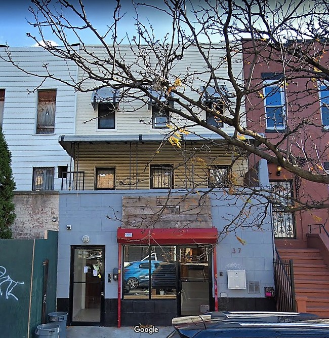
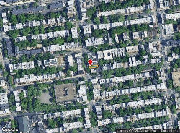
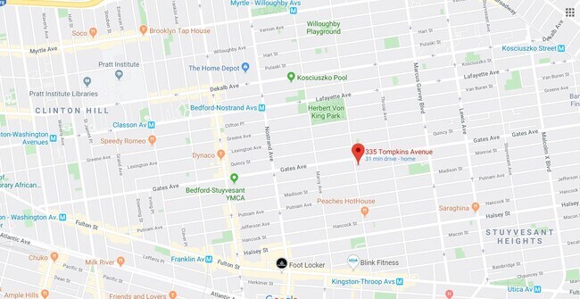
335 Tompkins Ave, Brooklyn, NY 11216
NEARBY LISTINGS FOR SALE OR LEASE
Property Detail
335 Tompkins Ave
New York-Jersey City-White Plains, NY-NJ
Kings
01815-0004
New York
Duplex
0.04 AC
X
North Brooklyn
3604970212F
Long Island (New York)
1,508 SF
DEMOGRAPHICS near 335 Tompkins Ave
1 Mile
3 Mile
5 Mile
2024 Total Population
187,682
1,318,061
2,855,194
2029 Population
177,123
1,246,931
2,671,060
Pop Growth 2024-2029
(5.63%)
(5.40%)
(6.45%)
Average Age
36
38
38
2024 Total Households
72,422
517,411
1,128,683
HH Growth 2024-2029
(6.34%)
(5.82%)
(6.70%)
Median Household Inc
$69,413
$74,757
$79,428
Avg Household Size
2.50
2.40
2.40
2024 Avg HH Vehicles
.00
.00
.00
Median Home Value
$1,032,938
$945,538
$853,282
Median Year Built
1947
1948
1949
Nearby Places
Map Layers
Map Styles
 Street
 Aerial
- Restaurants
- Banks
- Shops
- Fitness
- Groceries
PUBLIC TRANSPORTATION
TRANSIT/SUBWAY
Kingston-Throop Avenues (A - New York MTA Subway (The Subway), C - New York MTA Subway (The Subway))
DRIVE
WALK
Distance
Kingston-Throop Avenues (A - New York MTA Subway (The Subway), C - New York MTA Subway (The Subway))
2 min
11 min
0.6 mi
Bedford-Nostrand Avenues (G - New York MTA Subway (The Subway))
DRIVE
WALK
Distance
Bedford-Nostrand Avenues (G - New York MTA Subway (The Subway))
3 min
14 min
0.7 mi
Nostrand Avenue (A,C Line) (A - New York MTA Subway (The Subway), C - New York MTA Subway (The Subway))
DRIVE
WALK
Distance
Nostrand Avenue (A,C Line) (A - New York MTA Subway (The Subway), C - New York MTA Subway (The Subway))
2 min
14 min
0.7 mi
Myrtle-Willoughby Avenues (G - New York MTA Subway (The Subway))
DRIVE
WALK
Distance
Myrtle-Willoughby Avenues (G - New York MTA Subway (The Subway))
3 min
14 min
0.7 mi
Nostrand Avenue Station (Far Rockaway Branch - Long Island Rail Road, Hempstead Branch - Long Island Rail Road, Long Beach Branch - Long Island Rail Road, West Hempstead Branch - Long Island Rail Road)
DRIVE
WALK
Distance
Nostrand Avenue Station (Far Rockaway Branch - Long Island Rail Road, Hempstead Branch - Long Island Rail Road, Long Beach Branch - Long Island Rail Road, West Hempstead Branch - Long Island Rail Road)
3 min
15 min
0.8 mi
COMMUTER RAIL
Nostrand Avenue Station (Far Rockaway Branch - Long Island Rail Road, Hempstead Branch - Long Island Rail Road, Long Beach Branch - Long Island Rail Road, West Hempstead Branch - Long Island Rail Road)
DRIVE
WALK
Distance
Nostrand Avenue Station (Far Rockaway Branch - Long Island Rail Road, Hempstead Branch - Long Island Rail Road, Long Beach Branch - Long Island Rail Road, West Hempstead Branch - Long Island Rail Road)
3 min
15 min
0.8 mi
DRIVE
WALK
Distance
7 min
2.4 mi
AIRPORT
LaGuardia
DRIVE
WALK
Distance
LaGuardia
21 min
9.8 mi
John F Kennedy International
DRIVE
WALK
Distance
John F Kennedy International
25 min
11.0 mi
Newark Liberty International
DRIVE
WALK
Distance
Newark Liberty International
32 min
16.5 mi
Freight Ports
NY - Red Hook Container Terminal
DRIVE
WALK
Distance
NY - Red Hook Container Terminal
12 min
5.2 mi
SALE & LEASE HISTORY
LISTING DATE
SALE/LEASE

Nov 26, 2018
For Sale
Nov 22, 2019
For Sale
May 18, 2018
For Sale
Jan 14, 2020
For Sale
Dec 27, 2018
For Sale
Dec 03, 2019
For Sale
Aug 24, 2018
For Sale
Nearby Properties
Address
Land Use
TOTAL SIZE
Lot Size
Zoning
Address
Land Use
TOTAL SIZE
Lot Size
Zoning
2,812,739 SF
2.10 AC
C5-3
Address
Land Use
TOTAL SIZE
Lot Size
Zoning
7,058,736 SF
147.61 AC
M3-1
Address
Land Use
TOTAL SIZE
Lot Size
Zoning
869,038 SF
1.53 AC
M1-1
Address
Land Use
TOTAL SIZE
Lot Size
Zoning
1,503,150 SF
20.47 AC
R5
Address
Land Use
TOTAL SIZE
Lot Size
Zoning
393.54 AC
PARK
Address
Land Use
TOTAL SIZE
Lot Size
Zoning
2,948,300 SF
27.71 AC
R7-2
Address
Land Use
TOTAL SIZE
Lot Size
Zoning
577,381 SF
3.19 AC
R6
Address
Land Use
TOTAL SIZE
Lot Size
Zoning
890,142 SF
2.22 AC
R7-1
Address
Land Use
TOTAL SIZE
Lot Size
Zoning
1,258,851 SF
2.20 AC
C6-4
Address
Land Use
TOTAL SIZE
Lot Size
Zoning
1,658,649 SF
15.93 AC
R7-2
Address
Land Use
TOTAL SIZE
Lot Size
Zoning
830,879 SF
1 AC
C5-4
Address
Land Use
TOTAL SIZE
Lot Size
Zoning
835,231 SF
11.32 AC
R6
Address
Land Use
TOTAL SIZE
Lot Size
Zoning
1,061,228 SF
8.86 AC
R5
Address
Land Use
TOTAL SIZE
Lot Size
Zoning
579,404 SF
4.80 AC
R6
Address
Land Use
TOTAL SIZE
Lot Size
Zoning
512,755 SF
1.19 AC
R6
Address
Land Use
TOTAL SIZE
Lot Size
Zoning
879,916 SF
1.35 AC
C6-4
Address
Land Use
TOTAL SIZE
Lot Size
Zoning
627,018 SF
1.21 AC
C6-4
Address
Land Use
TOTAL SIZE
Lot Size
Zoning
550,232 SF
1.68 AC
R7-2
Address
Land Use
TOTAL SIZE
Lot Size
Zoning
561,945 SF
11.58 AC
R6
Address
Land Use
TOTAL SIZE
Lot Size
Zoning
905,298 SF
1.60 AC
C61A
Address
Land Use
TOTAL SIZE
Lot Size
Zoning
296,915 SF
0.31 AC
C5-3
Address
Land Use
TOTAL SIZE
Lot Size
Zoning
392,162 SF
1.86 AC
M3-1
Address
Land Use
TOTAL SIZE
Lot Size
Zoning
503,608 SF
1.64 AC
R8
Address
Land Use
TOTAL SIZE
Lot Size
Zoning
582,359 SF
0.99 AC
C6-4
Address
Land Use
TOTAL SIZE
Lot Size
Zoning
450,516 SF
2.32 AC
C6-4
Address
Land Use
TOTAL SIZE
Lot Size
Zoning
566,000 SF
12.33 AC
R6
Address
Land Use
TOTAL SIZE
Lot Size
Zoning
600,000 SF
2.51 AC
R6B
Address
Land Use
TOTAL SIZE
Lot Size
Zoning
582,700 SF
1.20 AC
R8
Address
Land Use
TOTAL SIZE
Lot Size
Zoning
493,889 SF
1.84 AC
R7-3
Address
Land Use
TOTAL SIZE
Lot Size
Zoning
389,125 SF
3.48 AC
C6-4
The World's #1 Commercial Real Estate Marketplace
Connect with us
© 2025 CoStar Group
The information above has been obtained from sources believed reliable. While we do not doubt its accuracy we have not verified it and make no guarantee, warranty or representation about it. It is your responsibility to independently confirm its accuracy and completeness. Any projections, opinions, assumptions, or estimates used are for example only and do not represent the current or future performance of the property. The value of this transaction to you depends on tax and other factors which should be evaluated by your tax, financial, and legal advisors. You and your advisors should conduct a careful, independent investigation of the property to determine to your satisfaction the suitability of the property for your needs.