Property Record
3350 Stoner Bnd, Hermitage, TN 37076


Property Detail
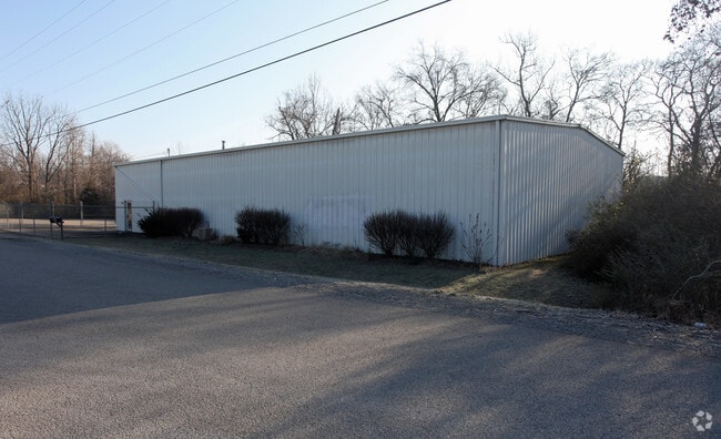
3350 Stoner Bnd
086-00-0-321
LOT 1 STONERS BEND BUSINESS PARK RE-SUB LOT 6
Publicstorage
Davidson
IWD
Tennessee
AE The base floodplain where base flood elevations are provided. AE Zones are now used on new format FIRMs instead of A1-A30 Zones.
1,6
2025
2.33 AC
2025
East
015404
Nashville
5,000 SF
Nashville-Davidson--Murfreesboro--Franklin, TN
NEARBY LISTINGS FOR SALE OR LEASE
DEMOGRAPHICS near 3350 Stoner Bnd
1 mile
3 mile
5 mile
2025 Total Population
5,275
50,447
108,123
2030 Population
5,513
52,480
113,667
Pop Growth 2025-2030
+ 4.51%
+ 4.03%
+ 5.13%
Average Age
39
39
40
2025 Total Households
2,268
22,453
45,835
HH Growth 2025-2030
+ 5.07%
+ 4.42%
+ 5.26%
Median Household Inc
$77,383
$79,891
$87,602
Avg Household Size
2.30
2.20
2.30
2025 Avg HH Vehicles
2.00
2.00
2.00
Median Home Value
$398,140
$378,467
$408,914
Median Year Built
1978
1989
1988
Nearby Places
Map Layers
Map Styles
 Street
 Aerial
Layers
 Traffic
 Biking
Places
Listings with unknown addresses are not visible on the map
- Restaurants
- Banks
- Shops
- Fitness
- Groceries
PUBLIC TRANSPORTATION
COMMUTER RAIL
Hermitage (East Corridor Line - Tennessee Regional Transportation Authority Music City Star (Music City Star))
Drive
Walk
Distance
Hermitage (East Corridor Line - Tennessee Regional Transportation Authority Music City Star (Music City Star))
7 min
2.2 mi
Donelson (East Corridor Line - Tennessee Regional Transportation Authority Music City Star (Music City Star))
Drive
Walk
Distance
Donelson (East Corridor Line - Tennessee Regional Transportation Authority Music City Star (Music City Star))
6 min
3.1 mi
AIRPORT
Nashville International
Drive
Walk
Distance
Nashville International
13 min
6.9 mi
Nearby Properties
Address
Land Use
TOTAL SIZE
Lot Size
Zoning
Address
Land Use
TOTAL SIZE
Lot Size
Zoning
32,891 SF
10.65 AC
MUL
Address
Land Use
TOTAL SIZE
Lot Size
Zoning
503,878 SF
47.85 AC
OG
Address
Land Use
TOTAL SIZE
Lot Size
Zoning
25,068 SF
42.36 AC
MULTI-ZONE
Address
Land Use
TOTAL SIZE
Lot Size
Zoning
9,956 SF
81.09 AC
RM9
Address
Land Use
TOTAL SIZE
Lot Size
Zoning
102,162 SF
25.71 AC
RM9
Address
Land Use
TOTAL SIZE
Lot Size
Zoning
75,873 SF
8.88 AC
OR20
Address
Land Use
TOTAL SIZE
Lot Size
Zoning
21,061 SF
31.15 AC
RM9
Address
Land Use
TOTAL SIZE
Lot Size
Zoning
12,312 SF
21.51 AC
OR20
Address
Land Use
TOTAL SIZE
Lot Size
Zoning
49,660 SF
16.96 AC
MULTIZONE
Address
Land Use
TOTAL SIZE
Lot Size
Zoning
7,940 SF
28.01 AC
RM15
Address
Land Use
TOTAL SIZE
Lot Size
Zoning
10,280 SF
32.07 AC
RM15
Address
Land Use
TOTAL SIZE
Lot Size
Zoning
144,730 SF
13.13 AC
Address
Land Use
TOTAL SIZE
Lot Size
Zoning
18,522 SF
22.42 AC
MULTI-ZONE
Address
Land Use
TOTAL SIZE
Lot Size
Zoning
52,305 SF
25.71 AC
MULTI-ZONE
Address
Land Use
TOTAL SIZE
Lot Size
Zoning
15,750 SF
19.47 AC
RM15
Address
Land Use
TOTAL SIZE
Lot Size
Zoning
49,140 SF
17.93 AC
OL
Address
Land Use
TOTAL SIZE
Lot Size
Zoning
23,328 SF
13.48 AC
RM20
Address
Land Use
TOTAL SIZE
Lot Size
Zoning
248,573 SF
25.36 AC
OL
Address
Land Use
TOTAL SIZE
Lot Size
Zoning
64,560 SF
8.57 AC
MULTIZONE
Address
Land Use
TOTAL SIZE
Lot Size
Zoning
51,846 SF
6.37 AC
MULTIZONE
Address
Land Use
TOTAL SIZE
Lot Size
Zoning
15,044 SF
20.63 AC
RM20
Address
Land Use
TOTAL SIZE
Lot Size
Zoning
81,811 SF
8.95 AC
MULTI-ZONE
Address
Land Use
TOTAL SIZE
Lot Size
Zoning
21,580 SF
20.29 AC
RM9
Address
Land Use
TOTAL SIZE
Lot Size
Zoning
19,120 SF
22.25 AC
RM15
Address
Land Use
TOTAL SIZE
Lot Size
Zoning
37,050 SF
8.78 AC
OR20
Address
Land Use
TOTAL SIZE
Lot Size
Zoning
16,890 SF
8.28 AC
CS
Address
Land Use
TOTAL SIZE
Lot Size
Zoning
14,374 SF
19.16 AC
RM15
Address
Land Use
TOTAL SIZE
Lot Size
Zoning
13,616 SF
14.96 AC
MULTI-ZONE
Address
Land Use
TOTAL SIZE
Lot Size
Zoning
43,030 SF
7 AC
CL
Address
Land Use
TOTAL SIZE
Lot Size
Zoning
294,923 SF
17.91 AC
MULTI-ZONE
The World's #1 Commercial Real Estate Marketplace
Connect with us
© 2026 CoStar Group
The information above has been obtained from sources believed reliable. While we do not doubt its accuracy we have not verified it and make no guarantee, warranty or representation about it. It is your responsibility to independently confirm its accuracy and completeness. Any projections, opinions, assumptions, or estimates used are for example only and do not represent the current or future performance of the property. The value of this transaction to you depends on tax and other factors which should be evaluated by your tax, financial, and legal advisors. You and your advisors should conduct a careful, independent investigation of the property to determine to your satisfaction the suitability of the property for your needs.