Property Record
3351 W Laskey Rd, Toledo, OH 43623


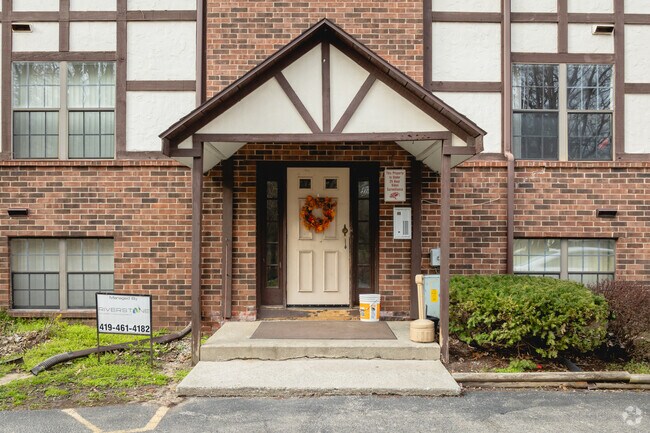
Property Detail
3351 W Laskey Rd
22-15537
7 9 18 NE 1/4 N 165 FT ON E LINE BY 112.40 FT ON W LINE E 1/
Apartment
LUCAS
10-RM36
Ohio
AE The base floodplain where base flood elevations are provided. AE Zones are now used on new format FIRMs instead of A1-A30 Zones.
1.37 AC
0
Franklin Park
2025
Toledo
008303
Toledo, OH
24,252 SF
NEARBY LISTINGS FOR SALE OR LEASE
-
-
View all Toledo listings for sale on LoopNet.com
DEMOGRAPHICS near 3351 W Laskey Rd
1 mile
3 mile
5 mile
2025 Total Population
13,128
87,599
199,917
2030 Population
12,791
85,969
198,372
Pop Growth 2025-2030
(2.57%)
(1.86%)
(0.77%)
Average Age
42
40
40
2025 Total Households
6,041
38,163
85,760
HH Growth 2025-2030
(2.58%)
(1.86%)
(0.74%)
Median Household Inc
$61,183
$67,337
$60,052
Avg Household Size
2.10
2.20
2.20
2025 Avg HH Vehicles
2.00
2.00
2.00
Median Home Value
$148,518
$164,087
$159,459
Median Year Built
1961
1957
1959
Nearby Places
Map Layers
Map Styles
 Street
 Aerial
Layers
 Traffic
 Biking
Places
Listings with unknown addresses are not visible on the map
- Restaurants
- Banks
- Shops
- Fitness
- Groceries
PUBLIC TRANSPORTATION
COMMUTER RAIL
Toledo (Capitol Limited - Amtrak, Lake Shore Limited - Amtrak)
Drive
Walk
Distance
Toledo (Capitol Limited - Amtrak, Lake Shore Limited - Amtrak)
13 min
7.5 mi
AIRPORT
Eugene F Kranz Toledo Express
Drive
Walk
Distance
Eugene F Kranz Toledo Express
36 min
21.1 mi
Freight Ports
Port of Toledo
Drive
Walk
Distance
Port of Toledo
25 min
12.6 mi
SALE & LEASE HISTORY
LISTING DATE
SALE/LEASE

Sep 24, 2016
For Sale
Dec 04, 2023
For Sale
Nearby Properties
Address
Land Use
TOTAL SIZE
Lot Size
Zoning
Address
Land Use
TOTAL SIZE
Lot Size
Zoning
3,101,694 SF
35.64 AC
10-IC
Address
Land Use
TOTAL SIZE
Lot Size
Zoning
1,972,579 SF
76.32 AC
10-IG
Address
Land Use
TOTAL SIZE
Lot Size
Zoning
304,593 SF
24.13 AC
10-IC
Address
Land Use
TOTAL SIZE
Lot Size
Zoning
693,900 SF
76.32 AC
10-IG
Address
Land Use
TOTAL SIZE
Lot Size
Zoning
448,269 SF
29.52 AC
10-IC
Address
Land Use
TOTAL SIZE
Lot Size
Zoning
253,662 SF
16.59 AC
10-MX
Address
Land Use
TOTAL SIZE
Lot Size
Zoning
15.79 AC
31-B4
Address
Land Use
TOTAL SIZE
Lot Size
Zoning
76.32 AC
10-IG
Address
Land Use
TOTAL SIZE
Lot Size
Zoning
72,306 SF
0.09 AC
10-IC
Address
Land Use
TOTAL SIZE
Lot Size
Zoning
317,139 SF
25.80 AC
10-IC
Address
Land Use
TOTAL SIZE
Lot Size
Zoning
7.71 AC
10-CRSO
Address
Land Use
TOTAL SIZE
Lot Size
Zoning
12.52 AC
10-CRSO
Address
Land Use
TOTAL SIZE
Lot Size
Zoning
293,770 SF
13.95 AC
10-RS6
Address
Land Use
TOTAL SIZE
Lot Size
Zoning
90,113 SF
11.83 AC
10-RS6
Address
Land Use
TOTAL SIZE
Lot Size
Zoning
166,837 SF
23.82 AC
10-MX
Address
Land Use
TOTAL SIZE
Lot Size
Zoning
208,092 SF
12.49 AC
10-CR
Address
Land Use
TOTAL SIZE
Lot Size
Zoning
87,071 SF
8.10 AC
10-CRSO
Address
Land Use
TOTAL SIZE
Lot Size
Zoning
141,643 SF
14.31 AC
10-RS9
Address
Land Use
TOTAL SIZE
Lot Size
Zoning
222,493 SF
29.88 AC
10-IC
Address
Land Use
TOTAL SIZE
Lot Size
Zoning
49,960 SF
8.33 AC
10-CO
Address
Land Use
TOTAL SIZE
Lot Size
Zoning
51,129 SF
460.05 AC
20-S1
Address
Land Use
TOTAL SIZE
Lot Size
Zoning
154,003 SF
14 AC
10-MX
Address
Land Use
TOTAL SIZE
Lot Size
Zoning
61,718 SF
7 AC
Address
Land Use
TOTAL SIZE
Lot Size
Zoning
203,129 SF
10 AC
10-RS9
Address
Land Use
TOTAL SIZE
Lot Size
Zoning
157,086 SF
13.24 AC
10-CRSO
Address
Land Use
TOTAL SIZE
Lot Size
Zoning
52,429 SF
3.79 AC
10-CO
Address
Land Use
TOTAL SIZE
Lot Size
Zoning
161,884 SF
3.09 AC
10-RM36
Address
Land Use
TOTAL SIZE
Lot Size
Zoning
135,978 SF
14.01 AC
31-B2
Address
Land Use
TOTAL SIZE
Lot Size
Zoning
123,985 SF
9.74 AC
10-MX
Address
Land Use
TOTAL SIZE
Lot Size
Zoning
84,485 SF
8.41 AC
20-C2
The World's #1 Commercial Real Estate Marketplace
Connect with us
© 2026 CoStar Group
The information above has been obtained from sources believed reliable. While we do not doubt its accuracy we have not verified it and make no guarantee, warranty or representation about it. It is your responsibility to independently confirm its accuracy and completeness. Any projections, opinions, assumptions, or estimates used are for example only and do not represent the current or future performance of the property. The value of this transaction to you depends on tax and other factors which should be evaluated by your tax, financial, and legal advisors. You and your advisors should conduct a careful, independent investigation of the property to determine to your satisfaction the suitability of the property for your needs.