Property Record
3352 W South Jordan Pkwy, South Jordan, UT 84095
NEARBY LISTINGS FOR SALE OR LEASE
Property Detail
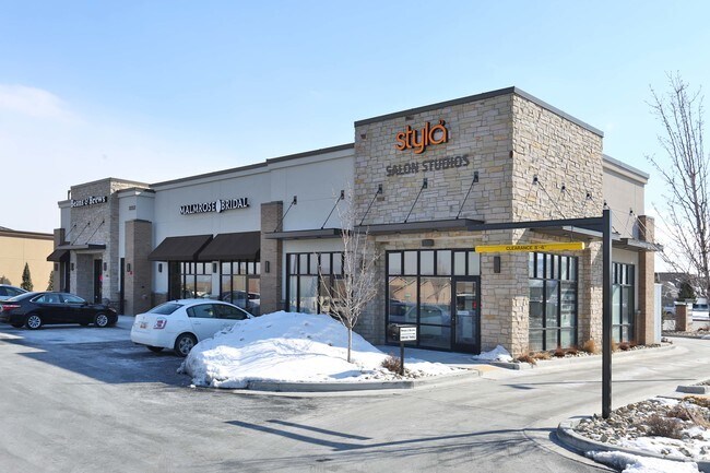
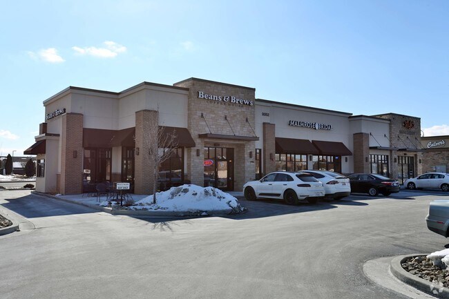
3352 W South Jordan Pkwy
Salt Lake City, UT
Harvest Village
27-17-231-008-0000
LOT 7, HARVEST VILLAGE AT SOUTH JORDAN PH 4 AMD.
Stripcommercialcenter
Salt Lake
X
Utah
49035C0430G
7
2024
0.83 AC
2025
Southwest Valley
113024
Salt Lake City
4,585 SF
DEMOGRAPHICS near 3352 W South Jordan Pkwy
1 Mile
3 Mile
5 Mile
2024 Total Population
14,932
118,096
289,135
2029 Population
15,038
119,706
294,340
Pop Growth 2024-2029
+ 0.71%
+ 1.36%
+ 1.80%
Average Age
35
36
35
2024 Total Households
4,155
35,125
89,602
HH Growth 2024-2029
+ 0.67%
+ 1.33%
+ 1.80%
Median Household Inc
$116,636
$108,761
$95,471
Avg Household Size
3.50
3.30
3.20
2024 Avg HH Vehicles
3.00
2.00
2.00
Median Home Value
$596,066
$520,750
$466,884
Median Year Built
2004
2001
2002
Nearby Places
Map Layers
Map Styles
 Street
 Aerial
- Restaurants
- Banks
- Shops
- Fitness
- Groceries
PUBLIC TRANSPORTATION
COMMUTER RAIL
South Jordan Station (FrontRunner - Utah Transit Authority (UTA))
DRIVE
WALK
Distance
South Jordan Station (FrontRunner - Utah Transit Authority (UTA))
9 min
4.2 mi
Draper Station (FrontRunner - Utah Transit Authority (UTA))
DRIVE
WALK
Distance
Draper Station (FrontRunner - Utah Transit Authority (UTA))
15 min
7.4 mi
AIRPORT
Salt Lake City International
DRIVE
WALK
Distance
Salt Lake City International
24 min
16.0 mi
Provo Municipal
DRIVE
WALK
Distance
Provo Municipal
48 min
35.2 mi
Freight Ports
Port of Stockton
DRIVE
WALK
Distance
Port of Stockton
724 min
700.6 mi
Nearby Properties
Address
Land Use
TOTAL SIZE
Lot Size
Zoning
Address
Land Use
TOTAL SIZE
Lot Size
Zoning
540,554 SF
63.03 AC
C-R
Address
Land Use
TOTAL SIZE
Lot Size
Zoning
733,215 SF
58.65 AC
M-1
Address
Land Use
TOTAL SIZE
Lot Size
Zoning
198,801 SF
8.36 AC
R-3-20
Address
Land Use
TOTAL SIZE
Lot Size
Zoning
469,074 SF
5.14 AC
C-P
Address
Land Use
TOTAL SIZE
Lot Size
Zoning
702,100 SF
13.83 AC
P-C
Address
Land Use
TOTAL SIZE
Lot Size
Zoning
73,318 SF
1.36 AC
PC
Address
Land Use
TOTAL SIZE
Lot Size
Zoning
410,435 SF
2.43 AC
P-C
Address
Land Use
TOTAL SIZE
Lot Size
Zoning
256,933 SF
19.68 AC
P-C
Address
Land Use
TOTAL SIZE
Lot Size
Zoning
77,525 SF
2.35 AC
P-C
Address
Land Use
TOTAL SIZE
Lot Size
Zoning
143,314 SF
2.30 AC
P-C
Address
Land Use
TOTAL SIZE
Lot Size
Zoning
425,753 SF
2.28 AC
PC
Address
Land Use
TOTAL SIZE
Lot Size
Zoning
398,447 SF
11.04 AC
BMHU
Address
Land Use
TOTAL SIZE
Lot Size
Zoning
348,043 SF
5.35 AC
PC
Address
Land Use
TOTAL SIZE
Lot Size
Zoning
348,917 SF
6.23 AC
PC
Address
Land Use
TOTAL SIZE
Lot Size
Zoning
203,064 SF
5.91 AC
PC
Address
Land Use
TOTAL SIZE
Lot Size
Zoning
120,929 SF
7.23 AC
PC
Address
Land Use
TOTAL SIZE
Lot Size
Zoning
554,777 SF
168.76 AC
M-1
Address
Land Use
TOTAL SIZE
Lot Size
Zoning
4.76 AC
PC
Address
Land Use
TOTAL SIZE
Lot Size
Zoning
268,200 SF
44.38 AC
PF
Address
Land Use
TOTAL SIZE
Lot Size
Zoning
36,708 SF
12.83 AC
R-3-16
Address
Land Use
TOTAL SIZE
Lot Size
Zoning
105,956 SF
37.60 AC
4180
Address
Land Use
TOTAL SIZE
Lot Size
Zoning
341,646 SF
19.70 AC
M-1
Address
Land Use
TOTAL SIZE
Lot Size
Zoning
118.74 AC
4180
Address
Land Use
TOTAL SIZE
Lot Size
Zoning
292,006 SF
29.40 AC
1122
Address
Land Use
TOTAL SIZE
Lot Size
Zoning
111,048 SF
39.95 AC
1308
Address
Land Use
TOTAL SIZE
Lot Size
Zoning
52,320 SF
4.97 AC
MU-TC
Address
Land Use
TOTAL SIZE
Lot Size
Zoning
276,657 SF
36.86 AC
1114
Address
Land Use
TOTAL SIZE
Lot Size
Zoning
182,656 SF
2.30 AC
OS
Address
Land Use
TOTAL SIZE
Lot Size
Zoning
87,392 SF
12.15 AC
BHMU
Address
Land Use
TOTAL SIZE
Lot Size
Zoning
234,002 SF
5.95 AC
P-C
The World's #1 Commercial Real Estate Marketplace
Connect with us
© 2025 CoStar Group
The information above has been obtained from sources believed reliable. While we do not doubt its accuracy we have not verified it and make no guarantee, warranty or representation about it. It is your responsibility to independently confirm its accuracy and completeness. Any projections, opinions, assumptions, or estimates used are for example only and do not represent the current or future performance of the property. The value of this transaction to you depends on tax and other factors which should be evaluated by your tax, financial, and legal advisors. You and your advisors should conduct a careful, independent investigation of the property to determine to your satisfaction the suitability of the property for your needs.