Property Record
3353 N Central Ave, Chicago, IL 60634


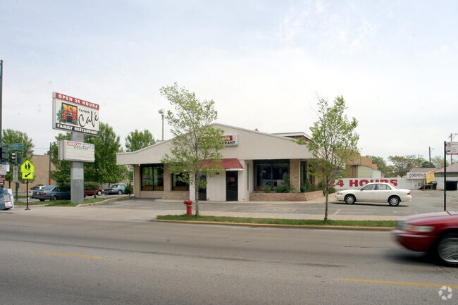

This Property Is For Sale
NEARBY LISTINGS FOR SALE OR LEASE
Property Detail
3353 N Central Ave
Chicago-Naperville-Elgin, IL-IN-WI
Stoltzners Central
13-21-315-040-0000
(STOLTZNERS) (CENTRAL) AVE SUB OF BLK4 IN SUB-LTS D-F OF PARTN OF WH SW SEC 21-40-13
Commercialbuilding
Cook
X
Illinois
17031C0385J
d
2023
0.35 AC
2024
Northwest City
151100
Chicago
4,255 SF
DEMOGRAPHICS near 3353 N Central Ave
1 Mile
3 Mile
5 Mile
2024 Total Population
48,718
363,548
870,183
2029 Population
45,315
340,253
823,940
Pop Growth 2024-2029
(6.99%)
(6.41%)
(5.31%)
Average Age
39
39
39
2024 Total Households
15,821
129,441
335,532
HH Growth 2024-2029
(7.41%)
(6.72%)
(5.55%)
Median Household Inc
$76,590
$71,148
$75,814
Avg Household Size
2.90
2.70
2.50
2024 Avg HH Vehicles
2.00
2.00
1.00
Median Home Value
$319,986
$320,838
$358,773
Median Year Built
1946
1947
1948
Nearby Places
Map Layers
Map Styles
 Street
 Aerial
- Restaurants
- Banks
- Shops
- Fitness
- Groceries
PUBLIC TRANSPORTATION
COMMUTER RAIL
Grayland Station (Milwaukee District North Line - Northeast Illinois Regional Commuter Railroad (Metra))
DRIVE
WALK
Distance
Grayland Station (Milwaukee District North Line - Northeast Illinois Regional Commuter Railroad (Metra))
5 min
1.9 mi
Mayfair Station (Milwaukee District North Line - Northeast Illinois Regional Commuter Railroad (Metra))
DRIVE
WALK
Distance
Mayfair Station (Milwaukee District North Line - Northeast Illinois Regional Commuter Railroad (Metra))
5 min
2.5 mi
AIRPORT
Chicago O'Hare International
DRIVE
WALK
Distance
Chicago O'Hare International
17 min
10.0 mi
Chicago Midway International
DRIVE
WALK
Distance
Chicago Midway International
21 min
11.8 mi
Freight Ports
Port Milwaukee
DRIVE
WALK
Distance
Port Milwaukee
98 min
79.9 mi
Nearby Properties
Address
Land Use
TOTAL SIZE
Lot Size
Zoning
Address
Land Use
TOTAL SIZE
Lot Size
Zoning
192,365 SF
21.34 AC
PD 127
Address
Land Use
TOTAL SIZE
Lot Size
Zoning
237,832 SF
14.04 AC
PD 418
Address
Land Use
TOTAL SIZE
Lot Size
Zoning
9.90 AC
Address
Land Use
TOTAL SIZE
Lot Size
Zoning
1.04 AC
PD 130
Address
Land Use
TOTAL SIZE
Lot Size
Zoning
6.31 AC
PD 1013
Address
Land Use
TOTAL SIZE
Lot Size
Zoning
15,600 SF
0.77 AC
M1-1
Address
Land Use
TOTAL SIZE
Lot Size
Zoning
3.33 AC
PD 1013
Address
Land Use
TOTAL SIZE
Lot Size
Zoning
100,900 SF
4.85 AC
PD 1415
Address
Land Use
TOTAL SIZE
Lot Size
Zoning
194,582 SF
12.68 AC
PD 699
Address
Land Use
TOTAL SIZE
Lot Size
Zoning
382,635 SF
5.90 AC
M1-1
Address
Land Use
TOTAL SIZE
Lot Size
Zoning
13.33 AC
PD 127
Address
Land Use
TOTAL SIZE
Lot Size
Zoning
226,155 SF
5.86 AC
PMD 9
Address
Land Use
TOTAL SIZE
Lot Size
Zoning
78,410 SF
4.87 AC
PD 171
Address
Land Use
TOTAL SIZE
Lot Size
Zoning
0.43 AC
RS-2
Address
Land Use
TOTAL SIZE
Lot Size
Zoning
389,400 SF
28.83 AC
PMD 9
Address
Land Use
TOTAL SIZE
Lot Size
Zoning
277,819 SF
10.58 AC
PD 127
Address
Land Use
TOTAL SIZE
Lot Size
Zoning
897,723 SF
23.04 AC
PMD 15
Address
Land Use
TOTAL SIZE
Lot Size
Zoning
141,095 SF
9.15 AC
PD 127
Address
Land Use
TOTAL SIZE
Lot Size
Zoning
83,288 SF
13.43 AC
RT-4
Address
Land Use
TOTAL SIZE
Lot Size
Zoning
Address
Land Use
TOTAL SIZE
Lot Size
Zoning
179,150 SF
15.56 AC
PD 903
Address
Land Use
TOTAL SIZE
Lot Size
Zoning
36,800 SF
1.01 AC
C2-1
Address
Land Use
TOTAL SIZE
Lot Size
Zoning
0.70 AC
PD 9
Address
Land Use
TOTAL SIZE
Lot Size
Zoning
126,955 SF
13.70 AC
PD 541
Address
Land Use
TOTAL SIZE
Lot Size
Zoning
71,133 SF
7.28 AC
PD 441
Address
Land Use
TOTAL SIZE
Lot Size
Zoning
63,344 SF
5.01 AC
PD 1069,M1
Address
Land Use
TOTAL SIZE
Lot Size
Zoning
95,614 SF
4.20 AC
Address
Land Use
TOTAL SIZE
Lot Size
Zoning
65,243 SF
3.70 AC
Address
Land Use
TOTAL SIZE
Lot Size
Zoning
138,042 SF
11.74 AC
PD 127
Address
Land Use
TOTAL SIZE
Lot Size
Zoning
306,872 SF
3.61 AC
PD 617
The World's #1 Commercial Real Estate Marketplace
Connect with us
© 2025 CoStar Group
The information above has been obtained from sources believed reliable. While we do not doubt its accuracy we have not verified it and make no guarantee, warranty or representation about it. It is your responsibility to independently confirm its accuracy and completeness. Any projections, opinions, assumptions, or estimates used are for example only and do not represent the current or future performance of the property. The value of this transaction to you depends on tax and other factors which should be evaluated by your tax, financial, and legal advisors. You and your advisors should conduct a careful, independent investigation of the property to determine to your satisfaction the suitability of the property for your needs.