Property Record
3353 Southside Ave, Cincinnati, OH 45204
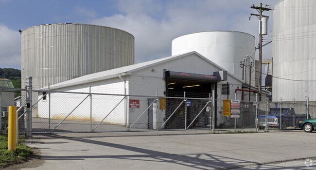

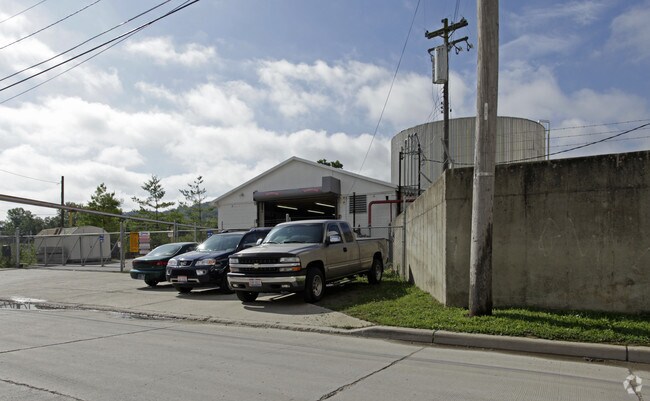

Property Detail
3353 Southside Ave
Cincinnati, OH-KY-IN
SOUTHSIDE AVE 25.3663 ACS R1 T3 S4
156-0055-0051
HAMILTON
Industrialacreage
Ohio
RFM
1
AE The base floodplain where base flood elevations are provided. AE Zones are now used on new format FIRMs instead of A1-A30 Zones.
25.37 AC
2025
Central/Midtown
2025
Cincinnati/Dayton
010300
NEARBY LISTINGS FOR SALE OR LEASE
DEMOGRAPHICS near 3353 Southside Ave
1 mile
3 mile
5 mile
2025 Total Population
4,706
85,458
257,660
2030 Population
4,935
87,232
264,535
Pop Growth 2025-2030
+ 4.87%
+ 2.08%
+ 2.67%
Average Age
39
39
38
2025 Total Households
1,679
34,167
109,933
HH Growth 2025-2030
+ 5.00%
+ 2.10%
+ 2.89%
Median Household Inc
$79,696
$68,405
$61,180
Avg Household Size
2.70
2.40
2.20
2025 Avg HH Vehicles
2.00
2.00
1.00
Median Home Value
$223,118
$215,885
$224,944
Median Year Built
1967
1960
1960
Nearby Places
Map Layers
Map Styles
 Street
 Aerial
Layers
 Traffic
 Biking
Places
Listings with unknown addresses are not visible on the map
- Restaurants
- Banks
- Shops
- Fitness
- Groceries
PUBLIC TRANSPORTATION
COMMUTER RAIL
Cincinnati Union Terminal (Cardinal - Amtrak)
Drive
Walk
Distance
Cincinnati Union Terminal (Cardinal - Amtrak)
10 min
4.8 mi
AIRPORT
Cincinnati/Northern Kentucky International
Drive
Walk
Distance
Cincinnati/Northern Kentucky International
32 min
17.7 mi
Freight Ports
Port of Toledo
Drive
Walk
Distance
Port of Toledo
248 min
209.6 mi
Nearby Properties
Address
Land Use
TOTAL SIZE
Lot Size
Zoning
Address
Land Use
TOTAL SIZE
Lot Size
Zoning
157.77 AC
Address
Land Use
TOTAL SIZE
Lot Size
Zoning
46.68 AC
Address
Land Use
TOTAL SIZE
Lot Size
Zoning
12.85 AC
Address
Land Use
TOTAL SIZE
Lot Size
Zoning
21.55 AC
Address
Land Use
TOTAL SIZE
Lot Size
Zoning
12.13 AC
Address
Land Use
TOTAL SIZE
Lot Size
Zoning
30.11 AC
Address
Land Use
TOTAL SIZE
Lot Size
Zoning
177,200 SF
16.27 AC
Address
Land Use
TOTAL SIZE
Lot Size
Zoning
99.35 AC
Address
Land Use
TOTAL SIZE
Lot Size
Zoning
85,726 SF
15.07 AC
Address
Land Use
TOTAL SIZE
Lot Size
Zoning
Address
Land Use
TOTAL SIZE
Lot Size
Zoning
194,304 SF
15.77 AC
Address
Land Use
TOTAL SIZE
Lot Size
Zoning
61,013 SF
6.73 AC
Address
Land Use
TOTAL SIZE
Lot Size
Zoning
126,326 SF
8.87 AC
Address
Land Use
TOTAL SIZE
Lot Size
Zoning
5.89 AC
Address
Land Use
TOTAL SIZE
Lot Size
Zoning
45,000 SF
0.64 AC
Address
Land Use
TOTAL SIZE
Lot Size
Zoning
19.03 AC
Address
Land Use
TOTAL SIZE
Lot Size
Zoning
1,132,632 SF
7.11 AC
Address
Land Use
TOTAL SIZE
Lot Size
Zoning
122,028 SF
15.95 AC
Address
Land Use
TOTAL SIZE
Lot Size
Zoning
101,989 SF
7.83 AC
Address
Land Use
TOTAL SIZE
Lot Size
Zoning
225,000 SF
12.05 AC
Address
Land Use
TOTAL SIZE
Lot Size
Zoning
11.58 AC
Address
Land Use
TOTAL SIZE
Lot Size
Zoning
16.34 AC
Address
Land Use
TOTAL SIZE
Lot Size
Zoning
13.52 AC
Address
Land Use
TOTAL SIZE
Lot Size
Zoning
55,074 SF
4.24 AC
Address
Land Use
TOTAL SIZE
Lot Size
Zoning
47,502 SF
4.80 AC
Address
Land Use
TOTAL SIZE
Lot Size
Zoning
23.05 AC
Address
Land Use
TOTAL SIZE
Lot Size
Zoning
67,750 SF
5.69 AC
Address
Land Use
TOTAL SIZE
Lot Size
Zoning
11.34 AC
Address
Land Use
TOTAL SIZE
Lot Size
Zoning
Address
Land Use
TOTAL SIZE
Lot Size
Zoning
6.10 AC
The World's #1 Commercial Real Estate Marketplace
Connect with us
© 2026 CoStar Group
The information above has been obtained from sources believed reliable. While we do not doubt its accuracy we have not verified it and make no guarantee, warranty or representation about it. It is your responsibility to independently confirm its accuracy and completeness. Any projections, opinions, assumptions, or estimates used are for example only and do not represent the current or future performance of the property. The value of this transaction to you depends on tax and other factors which should be evaluated by your tax, financial, and legal advisors. You and your advisors should conduct a careful, independent investigation of the property to determine to your satisfaction the suitability of the property for your needs.