Property Record
3354 State Route 132, Amelia, OH 45102


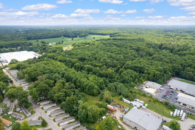

This Property Is For Sale
NEARBY LISTINGS FOR SALE OR LEASE
-
-
View all Amelia listings for sale on LoopNet.com
Property Detail
3354 State Route 132
28-28-06A-051
Catletts Military Survey #506
Industrialacreage
05TY .07 TO 136.
X
Clermont
39025C0240G
Ohio
2024
15.54 AC
2024
Outlying Cincinnati East
041503
Cincinnati/Dayton
13,134 SF
Cincinnati, OH-KY-IN
DEMOGRAPHICS near 3354 State Route 132
1 Mile
3 Mile
5 Mile
2024 Total Population
5,003
25,224
49,178
2029 Population
5,181
26,079
50,811
Pop Growth 2024-2029
+ 3.56%
+ 3.39%
+ 3.32%
Average Age
37
39
40
2024 Total Households
1,910
9,603
19,069
HH Growth 2024-2029
+ 3.51%
+ 3.41%
+ 3.36%
Median Household Inc
$62,386
$65,564
$66,461
Avg Household Size
2.60
2.60
2.50
2024 Avg HH Vehicles
2.00
2.00
2.00
Median Home Value
$168,797
$202,043
$221,973
Median Year Built
1995
1992
1990
Nearby Places
Map Layers
Map Styles
 Street
 Aerial
- Restaurants
- Banks
- Shops
- Fitness
- Groceries
PUBLIC TRANSPORTATION
AIRPORT
Cincinnati/Northern Kentucky International
DRIVE
WALK
Distance
Cincinnati/Northern Kentucky International
47 min
30.2 mi
Freight Ports
Port of Toledo
DRIVE
WALK
Distance
Port of Toledo
256 min
218.5 mi
Nearby Properties
Address
Land Use
TOTAL SIZE
Lot Size
Zoning
Address
Land Use
TOTAL SIZE
Lot Size
Zoning
16.02 AC
Address
Land Use
TOTAL SIZE
Lot Size
Zoning
1,380 SF
8.78 AC
Address
Land Use
TOTAL SIZE
Lot Size
Zoning
65,720 SF
7.49 AC
Address
Land Use
TOTAL SIZE
Lot Size
Zoning
216,760 SF
26.34 AC
Address
Land Use
TOTAL SIZE
Lot Size
Zoning
7,822 SF
8.47 AC
Address
Land Use
TOTAL SIZE
Lot Size
Zoning
67,894 SF
6.02 AC
Address
Land Use
TOTAL SIZE
Lot Size
Zoning
65,720 SF
7.49 AC
Address
Land Use
TOTAL SIZE
Lot Size
Zoning
19,654 SF
11.57 AC
Address
Land Use
TOTAL SIZE
Lot Size
Zoning
44.65 AC
Address
Land Use
TOTAL SIZE
Lot Size
Zoning
7,200 SF
58.94 AC
Address
Land Use
TOTAL SIZE
Lot Size
Zoning
10,728 SF
13.40 AC
Address
Land Use
TOTAL SIZE
Lot Size
Zoning
2,050 SF
14.01 AC
Address
Land Use
TOTAL SIZE
Lot Size
Zoning
1,032 SF
8.41 AC
Address
Land Use
TOTAL SIZE
Lot Size
Zoning
23,674 SF
3.95 AC
Address
Land Use
TOTAL SIZE
Lot Size
Zoning
10,731 SF
6.92 AC
Address
Land Use
TOTAL SIZE
Lot Size
Zoning
24,168 SF
6.90 AC
Address
Land Use
TOTAL SIZE
Lot Size
Zoning
16.85 AC
Address
Land Use
TOTAL SIZE
Lot Size
Zoning
23.04 AC
Address
Land Use
TOTAL SIZE
Lot Size
Zoning
16,100 SF
2.80 AC
Address
Land Use
TOTAL SIZE
Lot Size
Zoning
22,536 SF
2.98 AC
Address
Land Use
TOTAL SIZE
Lot Size
Zoning
15,400 SF
5.03 AC
Address
Land Use
TOTAL SIZE
Lot Size
Zoning
3,764 SF
1 AC
Address
Land Use
TOTAL SIZE
Lot Size
Zoning
45,684 SF
6.07 AC
Address
Land Use
TOTAL SIZE
Lot Size
Zoning
10,640 SF
1.27 AC
Address
Land Use
TOTAL SIZE
Lot Size
Zoning
13,318 SF
5 AC
Address
Land Use
TOTAL SIZE
Lot Size
Zoning
2,540 SF
33.14 AC
Address
Land Use
TOTAL SIZE
Lot Size
Zoning
14,476 SF
2.60 AC
Address
Land Use
TOTAL SIZE
Lot Size
Zoning
14,386 SF
1.65 AC
Address
Land Use
TOTAL SIZE
Lot Size
Zoning
1,600 SF
5.87 AC
Address
Land Use
TOTAL SIZE
Lot Size
Zoning
12,150 SF
3.72 AC
The World's #1 Commercial Real Estate Marketplace
Connect with us
© 2026 CoStar Group
The information above has been obtained from sources believed reliable. While we do not doubt its accuracy we have not verified it and make no guarantee, warranty or representation about it. It is your responsibility to independently confirm its accuracy and completeness. Any projections, opinions, assumptions, or estimates used are for example only and do not represent the current or future performance of the property. The value of this transaction to you depends on tax and other factors which should be evaluated by your tax, financial, and legal advisors. You and your advisors should conduct a careful, independent investigation of the property to determine to your satisfaction the suitability of the property for your needs.