Property Record
3355 Riverbend Dr, Springfield, OR 97477
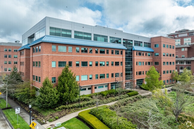


Property Detail
3355 Riverbend Dr
1839438
TL 04101-901
Commercialbuilding
Lane
MD
Oregon
B and X Area of moderate flood hazard, usually the area between the limits of the 100-year and 500-year floods.
4101
2025
Lane County
2025
Portland
002101
Eugene-Springfield, OR
NEARBY LISTINGS FOR SALE OR LEASE
DEMOGRAPHICS near 3355 Riverbend Dr
1 mile
3 mile
5 mile
2025 Total Population
6,551
64,881
151,106
2030 Population
6,453
64,148
150,448
Pop Growth 2025-2030
(1.50%)
(1.13%)
(0.44%)
Average Age
39
41
39
2025 Total Households
2,820
27,873
63,908
HH Growth 2025-2030
(1.60%)
(1.18%)
(0.56%)
Median Household Inc
$57,634
$69,190
$63,118
Avg Household Size
2.30
2.30
2.20
2025 Avg HH Vehicles
1.00
2.00
2.00
Median Home Value
$363,062
$432,636
$457,086
Median Year Built
1974
1976
1976
Nearby Places
Map Layers
Map Styles
 Street
 Aerial
Transit
 Traffic
 Biking
Places
Listings with unknown addresses are not visible on the map
- Restaurants
- Banks
- Shops
- Fitness
- Groceries
PUBLIC TRANSPORTATION
COMMUTER RAIL
Drive
Walk
Distance
10 min
5.4 mi
AIRPORT
Mahlon Sweet Field
Drive
Walk
Distance
Mahlon Sweet Field
20 min
11.0 mi
SALE & LEASE HISTORY
LISTING DATE
SALE/LEASE

Sep 25, 2016
For Lease
Jul 01, 2021
For Lease
Feb 26, 2020
For Lease
Apr 04, 2024
For Lease
Nearby Properties
Address
Land Use
TOTAL SIZE
Lot Size
Zoning
Address
Land Use
TOTAL SIZE
Lot Size
Zoning
71.87 AC
PL
Address
Land Use
TOTAL SIZE
Lot Size
Zoning
9.57 AC
LD
Address
Land Use
TOTAL SIZE
Lot Size
Zoning
22.52 AC
LD
Address
Land Use
TOTAL SIZE
Lot Size
Zoning
16.80 AC
PL
Address
Land Use
TOTAL SIZE
Lot Size
Zoning
14.39 AC
E-1
Address
Land Use
TOTAL SIZE
Lot Size
Zoning
9.59 AC
R-1
Address
Land Use
TOTAL SIZE
Lot Size
Zoning
14.54 AC
C-2
Address
Land Use
TOTAL SIZE
Lot Size
Zoning
17.37 AC
AG
Address
Land Use
TOTAL SIZE
Lot Size
Zoning
13.55 AC
CI
Address
Land Use
TOTAL SIZE
Lot Size
Zoning
11.23 AC
Address
Land Use
TOTAL SIZE
Lot Size
Zoning
Address
Land Use
TOTAL SIZE
Lot Size
Zoning
Address
Land Use
TOTAL SIZE
Lot Size
Zoning
14.09 AC
CI
Address
Land Use
TOTAL SIZE
Lot Size
Zoning
Address
Land Use
TOTAL SIZE
Lot Size
Zoning
50.28 AC
LD
Address
Land Use
TOTAL SIZE
Lot Size
Zoning
28.66 AC
LMI
Address
Land Use
TOTAL SIZE
Lot Size
Zoning
19.48 AC
LD
Address
Land Use
TOTAL SIZE
Lot Size
Zoning
11.77 AC
R-3
Address
Land Use
TOTAL SIZE
Lot Size
Zoning
31.28 AC
R-1
Address
Land Use
TOTAL SIZE
Lot Size
Zoning
7.27 AC
PL
Address
Land Use
TOTAL SIZE
Lot Size
Zoning
14.80 AC
CI
Address
Land Use
TOTAL SIZE
Lot Size
Zoning
12.37 AC
R-1
Address
Land Use
TOTAL SIZE
Lot Size
Zoning
12.58 AC
R-4
Address
Land Use
TOTAL SIZE
Lot Size
Zoning
Address
Land Use
TOTAL SIZE
Lot Size
Zoning
16.42 AC
CC
Address
Land Use
TOTAL SIZE
Lot Size
Zoning
15.54 AC
HI
Address
Land Use
TOTAL SIZE
Lot Size
Zoning
21.88 AC
PL
Address
Land Use
TOTAL SIZE
Lot Size
Zoning
15.15 AC
LD
Address
Land Use
TOTAL SIZE
Lot Size
Zoning
10.38 AC
E-1
The World's #1 Commercial Real Estate Marketplace
Connect with us
© 2026 CoStar Group
The information above has been obtained from sources believed reliable. While we do not doubt its accuracy we have not verified it and make no guarantee, warranty or representation about it. It is your responsibility to independently confirm its accuracy and completeness. Any projections, opinions, assumptions, or estimates used are for example only and do not represent the current or future performance of the property. The value of this transaction to you depends on tax and other factors which should be evaluated by your tax, financial, and legal advisors. You and your advisors should conduct a careful, independent investigation of the property to determine to your satisfaction the suitability of the property for your needs.