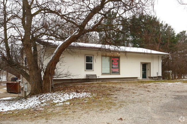
Property Record
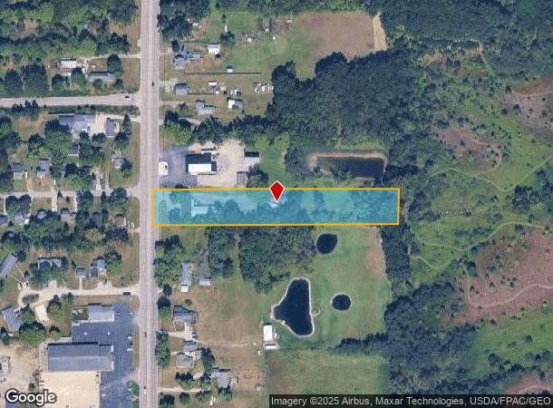
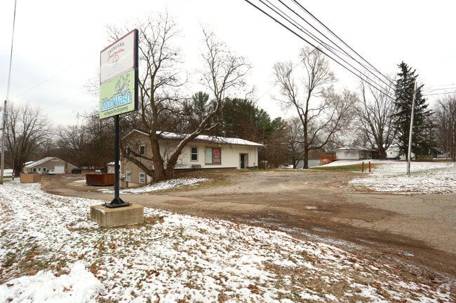
3359 N Adrian Hwy, Adrian, MI 49221
NEARBY LISTINGS FOR SALE OR LEASE
Property Detail
3359 N Adrian Hwy
RA0-119-3630-00
LD BEG 753.49 FT N FROM SW COR OF SEC 19 RUNN TH N 113.10 FT TH S 89 DEG 39'E 792 FT TH S 1 DEG 03'W 113.11 FT TH N 89 DEG
Commercialnec
Lenawee
X
Michigan
26091C0192D
2.05 AC
2024
Lenawee County
2025
Toledo
060701
Adrian, MI
7,139 SF
DEMOGRAPHICS near 3359 N Adrian Hwy
1 Mile
3 Mile
5 Mile
2024 Total Population
1,382
13,223
39,337
2029 Population
1,356
13,067
38,903
Pop Growth 2024-2029
(1.88%)
(1.18%)
(1.10%)
Average Age
43
41
40
2024 Total Households
535
5,024
14,598
HH Growth 2024-2029
(1.87%)
(1.27%)
(1.19%)
Median Household Inc
$80,357
$55,430
$51,949
Avg Household Size
2.60
2.40
2.40
2024 Avg HH Vehicles
2.00
2.00
2.00
Median Home Value
$205,502
$165,150
$147,237
Median Year Built
1984
1969
1971
Nearby Places
Map Layers
Map Styles
 Street
 Aerial
- Restaurants
- Banks
- Shops
- Fitness
- Groceries
PUBLIC TRANSPORTATION
AIRPORT
Eugene F Kranz Toledo Express
DRIVE
WALK
Distance
Eugene F Kranz Toledo Express
66 min
37.8 mi
Freight Ports
Port of Toledo
DRIVE
WALK
Distance
Port of Toledo
68 min
46.2 mi
SALE & LEASE HISTORY
LISTING DATE
SALE/LEASE

Mar 23, 2020
For Lease
Nearby Properties
Address
Land Use
TOTAL SIZE
Lot Size
Zoning
Address
Land Use
TOTAL SIZE
Lot Size
Zoning
491,035 SF
239.55 AC
I-1
Address
Land Use
TOTAL SIZE
Lot Size
Zoning
10 AC
I-1
Address
Land Use
TOTAL SIZE
Lot Size
Zoning
83,180 SF
3.14 AC
ERO
Address
Land Use
TOTAL SIZE
Lot Size
Zoning
30,451 SF
7.99 AC
Address
Land Use
TOTAL SIZE
Lot Size
Zoning
32,137 SF
2.19 AC
OS-1
Address
Land Use
TOTAL SIZE
Lot Size
Zoning
4.37 AC
OS-1
Address
Land Use
TOTAL SIZE
Lot Size
Zoning
55,698 SF
3.42 AC
RM-1
Address
Land Use
TOTAL SIZE
Lot Size
Zoning
311,536 SF
46.21 AC
AG-1
Address
Land Use
TOTAL SIZE
Lot Size
Zoning
70,467 SF
1.68 AC
I-2
Address
Land Use
TOTAL SIZE
Lot Size
Zoning
40,820 SF
12.89 AC
Address
Land Use
TOTAL SIZE
Lot Size
Zoning
34,462 SF
11.80 AC
CI
Address
Land Use
TOTAL SIZE
Lot Size
Zoning
25,485 SF
1.70 AC
B-3
Address
Land Use
TOTAL SIZE
Lot Size
Zoning
25,978 SF
11.41 AC
B-2
Address
Land Use
TOTAL SIZE
Lot Size
Zoning
6,935 SF
1.99 AC
CI
Address
Land Use
TOTAL SIZE
Lot Size
Zoning
15,241 SF
0.90 AC
OS-1
Address
Land Use
TOTAL SIZE
Lot Size
Zoning
11,671 SF
1.26 AC
B-2
Address
Land Use
TOTAL SIZE
Lot Size
Zoning
13,205 SF
2.18 AC
B-2
Address
Land Use
TOTAL SIZE
Lot Size
Zoning
8,304 SF
10.41 AC
C-2
Address
Land Use
TOTAL SIZE
Lot Size
Zoning
41,003 SF
1.72 AC
I-2
Address
Land Use
TOTAL SIZE
Lot Size
Zoning
18,048 SF
1.32 AC
OS-1
Address
Land Use
TOTAL SIZE
Lot Size
Zoning
10,485 SF
1.19 AC
OS-1
Address
Land Use
TOTAL SIZE
Lot Size
Zoning
188.73 AC
AG-1
Address
Land Use
TOTAL SIZE
Lot Size
Zoning
13,371 SF
3.29 AC
CI
Address
Land Use
TOTAL SIZE
Lot Size
Zoning
3,890 SF
1.14 AC
B-2
Address
Land Use
TOTAL SIZE
Lot Size
Zoning
28,292 SF
2.76 AC
CI
Address
Land Use
TOTAL SIZE
Lot Size
Zoning
Address
Land Use
TOTAL SIZE
Lot Size
Zoning
41.51 AC
AG-1
Address
Land Use
TOTAL SIZE
Lot Size
Zoning
103,356 SF
3.61 AC
I-2
Address
Land Use
TOTAL SIZE
Lot Size
Zoning
10,080 SF
67.71 AC
Address
Land Use
TOTAL SIZE
Lot Size
Zoning
2,990 SF
0.70 AC
B-3
The World's #1 Commercial Real Estate Marketplace
Connect with us
© 2025 CoStar Group
The information above has been obtained from sources believed reliable. While we do not doubt its accuracy we have not verified it and make no guarantee, warranty or representation about it. It is your responsibility to independently confirm its accuracy and completeness. Any projections, opinions, assumptions, or estimates used are for example only and do not represent the current or future performance of the property. The value of this transaction to you depends on tax and other factors which should be evaluated by your tax, financial, and legal advisors. You and your advisors should conduct a careful, independent investigation of the property to determine to your satisfaction the suitability of the property for your needs.